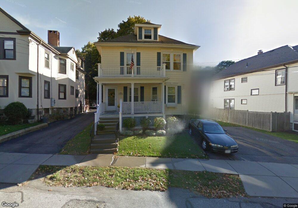
56 Burnham St Watertown, MA 02472
West Watertown NeighborhoodEstimated Value: $1,164,000 - $1,274,814
5
Beds
2
Baths
2,707
Sq Ft
$450/Sq Ft
Est. Value
About This Home
This home is located at 56 Burnham St, Watertown, MA 02472 and is currently estimated at $1,217,454, approximately $449 per square foot. 56 Burnham St is a home located in Middlesex County with nearby schools including Daniel Butler School, Winthrop L Chenery Middle School, and Belmont High School.
Ownership History
Date
Name
Owned For
Owner Type
Purchase Details
Closed on
Oct 15, 2024
Sold by
Hill Melanie S
Bought by
Hill Melanie S and Stanley Michael L
Current Estimated Value
Purchase Details
Closed on
Jul 15, 1998
Sold by
Labelle Donald F
Bought by
Hill Robert C and Stanley-Hill Melanie
Home Financials for this Owner
Home Financials are based on the most recent Mortgage that was taken out on this home.
Original Mortgage
$180,000
Interest Rate
6.98%
Mortgage Type
Purchase Money Mortgage
Create a Home Valuation Report for This Property
The Home Valuation Report is an in-depth analysis detailing your home's value as well as a comparison with similar homes in the area
Home Values in the Area
Average Home Value in this Area
Purchase History
| Date | Buyer | Sale Price | Title Company |
|---|---|---|---|
| Hill Melanie S | -- | None Available | |
| Hill Melanie S | -- | None Available | |
| Hill Melanie S | -- | None Available | |
| Hill Robert C | $324,900 | -- |
Source: Public Records
Mortgage History
| Date | Status | Borrower | Loan Amount |
|---|---|---|---|
| Previous Owner | Hill Robert C | $390,150 | |
| Previous Owner | Hill Robert C | $283,750 | |
| Previous Owner | Hill Robert C | $26,000 | |
| Previous Owner | Hill Robert C | $180,000 |
Source: Public Records
Tax History Compared to Growth
Tax History
| Year | Tax Paid | Tax Assessment Tax Assessment Total Assessment is a certain percentage of the fair market value that is determined by local assessors to be the total taxable value of land and additions on the property. | Land | Improvement |
|---|---|---|---|---|
| 2025 | $12,225 | $1,046,700 | $522,300 | $524,400 |
| 2024 | $11,073 | $946,400 | $508,400 | $438,000 |
| 2023 | $12,483 | $919,200 | $486,300 | $432,900 |
| 2022 | $11,644 | $878,800 | $442,100 | $436,700 |
| 2021 | $10,397 | $848,700 | $427,300 | $421,400 |
| 2020 | $10,017 | $825,100 | $412,600 | $412,500 |
| 2019 | $9,719 | $754,600 | $412,600 | $342,000 |
| 2018 | $9,336 | $693,100 | $383,100 | $310,000 |
| 2017 | $8,962 | $645,200 | $335,200 | $310,000 |
| 2016 | $8,575 | $626,800 | $316,800 | $310,000 |
| 2015 | $7,679 | $510,900 | $280,000 | $230,900 |
| 2014 | $7,368 | $492,500 | $261,600 | $230,900 |
Source: Public Records
Map
Nearby Homes
- 1 Bridgham Ave
- 51 Harrington St Unit 51
- 236 Sycamore St
- 914 Belmont St
- 17 Ripley Rd
- 356 Lexington St
- 24 Gill Rd Unit 4
- 253 Sycamore St Unit 253
- 50 Moraine St
- 57 Pierce Rd Unit 57
- 28 Whitney St
- 3 Waverley St Unit 1
- 99 Beech St
- 26 Ridge Rd
- 88 Bartlett Ave
- 31 Grant Ave Unit 33
- 220 Westminster Ave
- 98 Carroll St Unit 98
- 52 Hawthorne St Unit 1
- 103 Harnden Ave Unit 103
- 56 Burnham St Unit 1
- 58 Burnham St
- 54 Brown St
- 54 Burnham St
- 54 Burnham St Unit 1
- 12 Bridgham Ave
- 52 Burnham St
- 52 Burnham St Unit 3
- 52 Burnham St Unit 2
- 52 Burnham St Unit 1
- 59 Burnham St
- 52 Brown St
- 55 Burnham St
- 14 Bridgham Ave
- 3 Bridgham Ave
- 5 Bridgham Ave
- 61 Burnham St
- 61 Burnham St Unit 2
- 57 Burnham St
- 7-9 Bridgham Ave Unit 1