
Seller's Agent in 2025
Mary Bligh
Keller Williams Realty-Metropolitan
(603) 533-8369
1 in this area
144 Total Sales
Estimated Value: $487,000 - $518,755
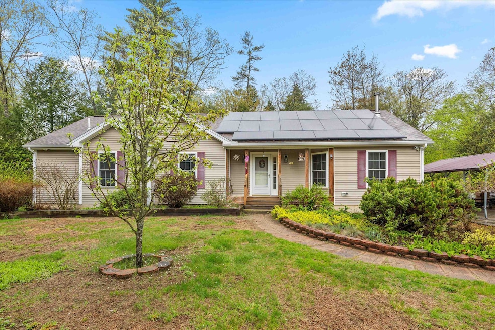
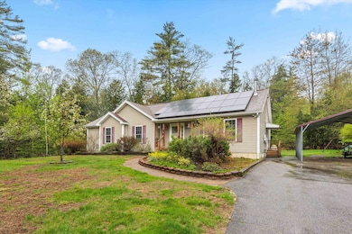
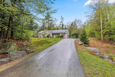
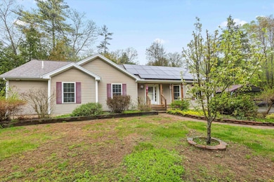
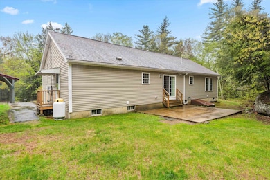
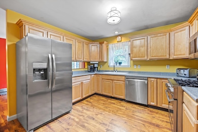
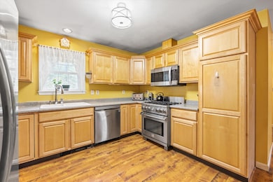
Take advantage of this GREAT VALUE, 8 acres, single level living with 3 bedrooms/3 baths and plenty of space to call your own! Home features include a fully applianced kitchen, dining room, living room with wood stove, primary bedroom with bath, large foyer and laundry room. Lower level boast over 1,000 sq ft of additional living area with 3/4 bath that could be used as a family room, media room, office space, game room, play room, mantown/girltown, additional sleeping/living space for extended family and so much more! The outdoor space includes a cement patio which was designed with a 3 season addition in mind, extra large carport to house 2 cars and so much more, oversized shed, beautiful gardens and fruit trees, large yard, covered porch, 8 acres of land to call your own, the ideas could be endless or simply to maintain privacy. Home is generator ready and also provides solar power for an abundance of savings! Easy access to shopping, schools, restaurants and close proximity to fire and police services.
Last Agent to Sell the Property
Keller Williams Realty-Metropolitan License #010642 Listed on: 05/09/2025
| Date | Buyer | Sale Price | Title Company |
|---|---|---|---|
| Timsina Dhiren | $490,000 | -- | |
| Timsina Dhiren | $490,000 | -- | |
| Presutti Samuel A | -- | None Available | |
| Presutti Samuel A | -- | None Available | |
| Presutti Samuel A | -- | None Available | |
| Samuel A Presutti Ret | -- | None Available | |
| Samuel A Presutti Ret | -- | None Available | |
| Samuel A Presutti Ret | -- | None Available |
| Date | Status | Borrower | Loan Amount |
|---|---|---|---|
| Open | Timsina Dhiren | $392,000 | |
| Closed | Timsina Dhiren | $392,000 | |
| Previous Owner | Presutti Samuel A | $239,112 |
| Date | Event | Price | List to Sale | Price per Sq Ft |
|---|---|---|---|---|
| 07/18/2025 07/18/25 | Sold | $490,000 | -2.0% | $178 / Sq Ft |
| 06/22/2025 06/22/25 | Price Changed | $499,999 | -4.7% | $182 / Sq Ft |
| 06/10/2025 06/10/25 | Price Changed | $524,500 | -0.1% | $191 / Sq Ft |
| 05/25/2025 05/25/25 | Price Changed | $525,000 | -4.5% | $191 / Sq Ft |
| 05/18/2025 05/18/25 | Price Changed | $550,000 | -3.5% | $200 / Sq Ft |
| 05/09/2025 05/09/25 | For Sale | $570,000 | -- | $207 / Sq Ft |
| Year | Tax Paid | Tax Assessment Tax Assessment Total Assessment is a certain percentage of the fair market value that is determined by local assessors to be the total taxable value of land and additions on the property. | Land | Improvement |
|---|---|---|---|---|
| 2025 | $7,350 | $435,400 | $125,500 | $309,900 |
| 2024 | $6,606 | $425,400 | $125,500 | $299,900 |
| 2023 | $6,330 | $425,400 | $125,500 | $299,900 |
| 2022 | $6,131 | $268,300 | $88,000 | $180,300 |
| 2021 | $5,980 | $268,300 | $88,000 | $180,300 |
| 2020 | $5,954 | $268,300 | $88,000 | $180,300 |
| 2019 | $5,892 | $268,300 | $88,000 | $180,300 |
| 2018 | $5,779 | $268,300 | $88,000 | $180,300 |
| 2017 | $5,396 | $234,900 | $57,000 | $177,900 |
| 2016 | $5,357 | $233,200 | $57,000 | $176,200 |
| 2015 | $5,615 | $233,200 | $57,000 | $176,200 |
| 2014 | $5,291 | $233,200 | $57,000 | $176,200 |
| 2013 | $4,983 | $229,300 | $57,000 | $172,300 |
Seller's Agent in 2025
Mary Bligh
Keller Williams Realty-Metropolitan
(603) 533-8369
1 in this area
144 Total Sales
Buyer's Agent in 2025
Julie Emerson
EXP Realty
(603) 785-1865
1 in this area
92 Total Sales
Source: PrimeMLS
MLS Number: 5040088
APN: WBST-000005-000030-000009
Disclaimer: Certain information contained herein is derived from information provided by parties other than Homes.com. All information provided is deemed reliable, but is not guaranteed to be accurate and should be independently verified.
![]() Copyright 2026 PrimeMLS, Inc. All rights reserved. This information is deemed reliable, but not guaranteed. The data relating to real estate displayed on this display comes in part from the IDX Program of PrimeMLS. The information being provided is for consumers’ personal, non-commercial use and may not be used for any purpose other than to identify prospective properties consumers may be interested in purchasing.
Copyright 2026 PrimeMLS, Inc. All rights reserved. This information is deemed reliable, but not guaranteed. The data relating to real estate displayed on this display comes in part from the IDX Program of PrimeMLS. The information being provided is for consumers’ personal, non-commercial use and may not be used for any purpose other than to identify prospective properties consumers may be interested in purchasing.
Ask me questions while you tour the home.