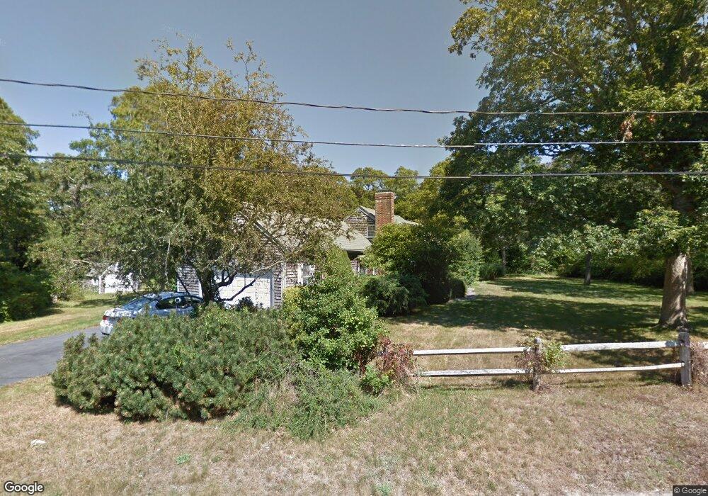
56 Captain Curtis Way Orleans, MA 02653
Estimated Value: $1,052,000 - $1,238,000
2
Beds
2
Baths
1,801
Sq Ft
$626/Sq Ft
Est. Value
About This Home
This home is located at 56 Captain Curtis Way, Orleans, MA 02653 and is currently estimated at $1,127,717, approximately $626 per square foot. 56 Captain Curtis Way is a home located in Barnstable County with nearby schools including Orleans Elementary School, Nauset Regional Middle School, and Nauset Regional High School.
Ownership History
Date
Name
Owned For
Owner Type
Purchase Details
Closed on
Aug 27, 2024
Sold by
Glavin Cynthia K
Bought by
Cindy Hamlett T and Cindy Glavin
Current Estimated Value
Purchase Details
Closed on
Nov 14, 2014
Sold by
Glavin Keith J and Glavin Cynthia K
Bought by
Glavin Cynthia K
Purchase Details
Closed on
Nov 5, 2014
Sold by
Glavin Keith J and Glavin Cynthia K
Bought by
Glavin Cynthia K
Purchase Details
Closed on
Jul 15, 2002
Sold by
Virginia P Wilson Ft and Wilson
Bought by
Glavin Keith J and Glavin Cynthia K
Home Financials for this Owner
Home Financials are based on the most recent Mortgage that was taken out on this home.
Original Mortgage
$285,000
Interest Rate
6.79%
Mortgage Type
Purchase Money Mortgage
Create a Home Valuation Report for This Property
The Home Valuation Report is an in-depth analysis detailing your home's value as well as a comparison with similar homes in the area
Home Values in the Area
Average Home Value in this Area
Purchase History
| Date | Buyer | Sale Price | Title Company |
|---|---|---|---|
| Cindy Hamlett T | -- | None Available | |
| Cindy Hamlett T | -- | None Available | |
| Glavin Cynthia K | -- | -- | |
| Glavin Cynthia K | -- | -- | |
| Glavin Keith J | $455,000 | -- | |
| Glavin Cynthia K | -- | -- | |
| Glavin Keith J | $455,000 | -- |
Source: Public Records
Mortgage History
| Date | Status | Borrower | Loan Amount |
|---|---|---|---|
| Previous Owner | Glavin Keith J | $285,000 |
Source: Public Records
Tax History Compared to Growth
Tax History
| Year | Tax Paid | Tax Assessment Tax Assessment Total Assessment is a certain percentage of the fair market value that is determined by local assessors to be the total taxable value of land and additions on the property. | Land | Improvement |
|---|---|---|---|---|
| 2025 | $6,120 | $980,800 | $330,600 | $650,200 |
| 2024 | $5,869 | $915,600 | $324,000 | $591,600 |
| 2023 | $5,325 | $854,800 | $300,100 | $554,700 |
| 2022 | $4,995 | $693,700 | $272,800 | $420,900 |
| 2021 | $5,346 | $627,300 | $271,300 | $356,000 |
| 2020 | $4,771 | $631,100 | $283,600 | $347,500 |
| 2019 | $4,417 | $596,900 | $251,700 | $345,200 |
| 2018 | $4,471 | $603,900 | $246,900 | $357,000 |
| 2017 | $4,191 | $591,800 | $246,900 | $344,900 |
| 2016 | $3,766 | $582,900 | $244,900 | $338,000 |
| 2015 | $3,604 | $561,300 | $228,600 | $332,700 |
Source: Public Records
Map
Nearby Homes
- 6 Hathorne Ln
- 3 Bramblewood Ln
- 2 Seaview Rd
- 53 Great Oak Rd
- 6 Snow Way
- 46 Freeman Ln
- 18 Cole Place
- 20 Kittiwake Ln
- 320 State Hwy
- 216 Main St
- 110 Beach Rd
- 25 Twin Rocks Dr
- 150 Old State Hwy Unit Compound
- 785 State Hwy Unit 9
- 30 Cove Rd
- 993 Intonti Way
- 995 Intonti Way
- 1061 State Hwy Unit 4
- 60 Smith Heights Way
- 20 White Pines Dr
- 52 Captain Curtis Way
- 47 Capt Curtis Way
- 60 Captain Curtis Way
- 47 Captain Curtis Way
- 62 Capt Curtis Way
- 63 Captain Curtis Way
- 46 Captain Curtis Way
- 45 Captain Curtis Way
- 67 Captain Curtis Way
- 62 Captain Curtis Way
- 214 Brick Hill Rd
- 66 Captain Curtis Way
- 41 Captain Curtis Way
- 71 Captain Curtis Way
- 172 Brick Hill Rd
- 40 Captain Curtis Way
- 70 Captain Curtis Way
- 64 Captain Curtis Way
- 39 Captain Curtis Way
- 79 Capt Curtis Way