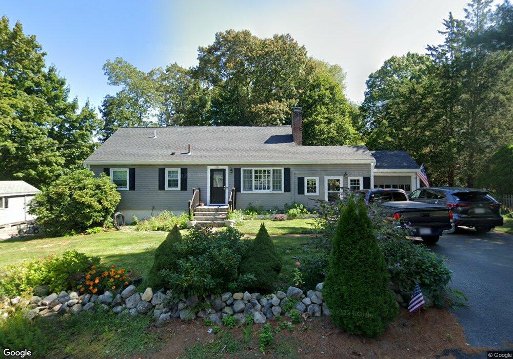
56 Chittenden Rd Scituate, MA 02066
Estimated Value: $712,000 - $892,000
3
Beds
1
Bath
1,508
Sq Ft
$544/Sq Ft
Est. Value
About This Home
This home is located at 56 Chittenden Rd, Scituate, MA 02066 and is currently estimated at $820,140, approximately $543 per square foot. 56 Chittenden Rd is a home located in Plymouth County with nearby schools including Cushing Elementary School, Lester J. Gates Middle School, and Scituate High School.
Ownership History
Date
Name
Owned For
Owner Type
Purchase Details
Closed on
Aug 31, 1993
Sold by
Fhlmc
Bought by
Dean Marc D and Dean Mary K
Current Estimated Value
Purchase Details
Closed on
Mar 19, 1993
Sold by
Doble Robert L
Bought by
Fhlmc
Create a Home Valuation Report for This Property
The Home Valuation Report is an in-depth analysis detailing your home's value as well as a comparison with similar homes in the area
Home Values in the Area
Average Home Value in this Area
Purchase History
| Date | Buyer | Sale Price | Title Company |
|---|---|---|---|
| Dean Marc D | $161,000 | -- | |
| Fhlmc | $193,400 | -- |
Source: Public Records
Mortgage History
| Date | Status | Borrower | Loan Amount |
|---|---|---|---|
| Open | Fhlmc | $75,000 | |
| Closed | Fhlmc | $50,000 | |
| Closed | Fhlmc | $30,000 |
Source: Public Records
Tax History Compared to Growth
Tax History
| Year | Tax Paid | Tax Assessment Tax Assessment Total Assessment is a certain percentage of the fair market value that is determined by local assessors to be the total taxable value of land and additions on the property. | Land | Improvement |
|---|---|---|---|---|
| 2025 | $6,763 | $677,000 | $372,200 | $304,800 |
| 2024 | $6,511 | $628,500 | $338,400 | $290,100 |
| 2023 | $6,487 | $582,800 | $324,700 | $258,100 |
| 2022 | $6,749 | $534,800 | $292,900 | $241,900 |
| 2021 | $5,887 | $485,600 | $278,900 | $206,700 |
| 2020 | $5,783 | $465,100 | $268,200 | $196,900 |
| 2019 | $6,165 | $448,700 | $262,900 | $185,800 |
| 2018 | $6,117 | $438,500 | $263,400 | $175,100 |
| 2017 | $6,023 | $427,500 | $252,400 | $175,100 |
| 2016 | $5,735 | $405,600 | $230,500 | $175,100 |
| 2015 | $5,169 | $394,600 | $219,500 | $175,100 |
Source: Public Records
Map
Nearby Homes
- 32 Fairview Ave
- 14 Aberdeen Dr
- 54 Woodland Rd
- 59 Captain Peirce Rd
- 115 Elm St
- 22 Kings Way
- 111 Elm St
- 575 First Parish Rd
- 116 Old Forge Rd
- 2 Windward Ln
- 9 Kyle Path
- 112 Hollett St
- 378 Tilden Rd
- 131 Maple St
- 11 Forest Ln
- 9 Forest Ln Unit 9
- 10 Benjamin Ln Unit 10
- 22 Forest Ln Unit 22
- 30 Irving Rd
- 16 3 Ring Rd
- 52 Chittenden Rd
- 60 Chittenden Rd
- 53 Chittenden Rd
- 91 Chittenden Rd Unit 91
- 11 Brown Rd
- 15 Brown Rd
- 7 Brown Rd
- 46 Chittenden Rd
- 47 Chittenden Rd
- 38 Utility Rd
- 60 Utility Rd
- 41 Utility Rd
- 14 Brown Rd
- 8 Brown Rd
- 42 Chittenden Rd
- 59 Utility Rd
- 43 Chittenden Rd
- 37 Utility Rd
- 78 Border (Golden Rooster Rest)
- 311 Central Ave -Waterfrt Dock Pot