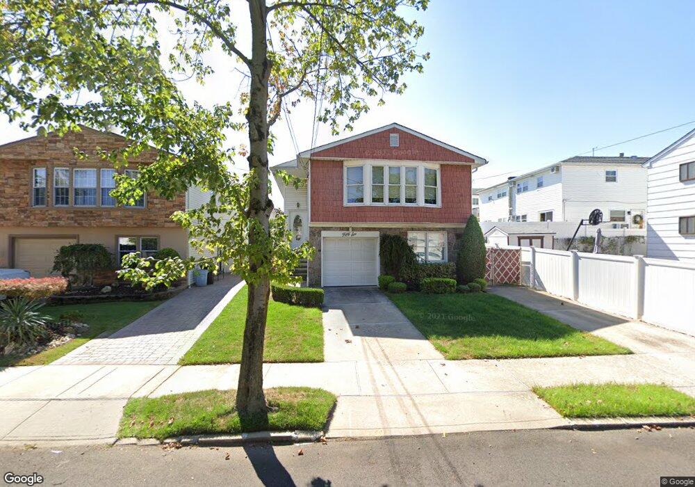
56 E Scranton Ave Staten Island, NY 10308
Great Kills NeighborhoodEstimated Value: $729,226 - $917,000
1
Bed
1
Bath
650
Sq Ft
$1,307/Sq Ft
Est. Value
About This Home
This home is located at 56 E Scranton Ave, Staten Island, NY 10308 and is currently estimated at $849,557, approximately $1,307 per square foot. 56 E Scranton Ave is a home located in Richmond County with nearby schools including P.S. 32 The Gifford School, Myra S. Barnes Intermediate School 24, and Susan E Wagner High School.
Ownership History
Date
Name
Owned For
Owner Type
Purchase Details
Closed on
Jul 20, 2000
Sold by
Marrano Vincent J and Marrano Rita C
Bought by
Marrano Richard
Current Estimated Value
Home Financials for this Owner
Home Financials are based on the most recent Mortgage that was taken out on this home.
Original Mortgage
$105,000
Interest Rate
8.06%
Create a Home Valuation Report for This Property
The Home Valuation Report is an in-depth analysis detailing your home's value as well as a comparison with similar homes in the area
Home Values in the Area
Average Home Value in this Area
Purchase History
| Date | Buyer | Sale Price | Title Company |
|---|---|---|---|
| Marrano Richard | $240,000 | First American Title Ins Co |
Source: Public Records
Mortgage History
| Date | Status | Borrower | Loan Amount |
|---|---|---|---|
| Closed | Marrano Richard | $105,000 |
Source: Public Records
Tax History
| Year | Tax Paid | Tax Assessment Tax Assessment Total Assessment is a certain percentage of the fair market value that is determined by local assessors to be the total taxable value of land and additions on the property. | Land | Improvement |
|---|---|---|---|---|
| 2025 | $7,715 | $45,780 | $11,836 | $33,944 |
| 2024 | $7,727 | $44,520 | $11,482 | $33,038 |
| 2023 | $7,781 | $39,712 | $11,241 | $28,471 |
| 2022 | $7,601 | $41,160 | $12,840 | $28,320 |
| 2021 | $7,542 | $38,040 | $12,840 | $25,200 |
| 2020 | $7,148 | $37,260 | $12,840 | $24,420 |
| 2019 | $6,647 | $38,760 | $12,840 | $25,920 |
| 2018 | $6,448 | $33,093 | $9,596 | $23,497 |
| 2017 | $6,412 | $32,926 | $12,560 | $20,366 |
| 2016 | $5,900 | $31,063 | $12,356 | $18,707 |
| 2015 | $5,001 | $29,306 | $9,589 | $19,717 |
| 2014 | $5,001 | $27,648 | $10,382 | $17,266 |
Source: Public Records
Map
Nearby Homes
- 47 E Figurea Ave
- 67 Genesee Ave
- 37 E Stroud Ave
- 478 Leverett Ave
- 115 Abingdon Ave
- 526 Leverett Ave
- 890 Armstrong Ave Unit 2-3
- 892 Armstrong Ave Unit 23
- 538 Leverett Ave
- 193 Brookfield Ave
- 1 Patty Ct
- 287 Abingdon Ave
- 254 Ridgewood Ave
- 275 Katan Ave
- 28 Fenway Cir Unit 2-2
- 147 Cortelyou Ave Unit 2-3
- 309 Abingdon Ave
- 307 Leverett Ave
- 254 Lamoka Ave
- 360 Barlow Ave Unit 1
- 52 E Scranton Ave
- 805 Armstrong Ave
- 803 Armstrong Ave
- 48 E Scranton Ave
- 809 Armstrong Ave
- 799 Armstrong Ave
- 111 Genesee Ave
- 107 Genesee Ave
- 797 Armstrong Ave
- 44 E Scranton Ave
- 103 Genesee Ave
- 793 Armstrong Ave
- 40 E Scranton Ave
- 55 E Scranton Ave
- 99 Genesee Ave
- 51 E Scranton Ave
- 59 E Scranton Ave
- 61 E Scranton Ave
- 47 E Scranton Ave
- 95 Genesee Ave
Your Personal Tour Guide
Ask me questions while you tour the home.