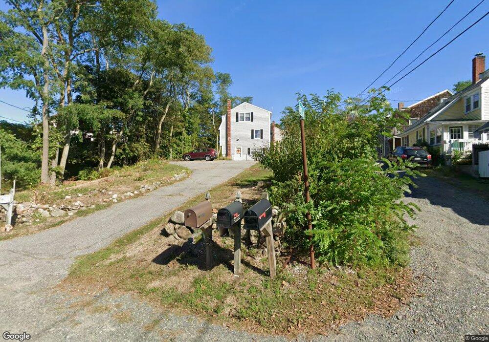
56 Eastern Point Rd Gloucester, MA 01930
East Gloucester NeighborhoodEstimated Value: $808,000 - $1,290,000
3
Beds
3
Baths
1,700
Sq Ft
$629/Sq Ft
Est. Value
About This Home
This home is located at 56 Eastern Point Rd, Gloucester, MA 01930 and is currently estimated at $1,069,776, approximately $629 per square foot. 56 Eastern Point Rd is a home located in Essex County with nearby schools including East Gloucester Elementary School, Ralph B O'maley Middle School, and Gloucester High School.
Ownership History
Date
Name
Owned For
Owner Type
Purchase Details
Closed on
Sep 16, 2021
Sold by
White Cleone B and White Mark S
Bought by
M S & Cleone B White Lt
Current Estimated Value
Purchase Details
Closed on
Mar 26, 1992
Sold by
Stoneham Coop Bank
Bought by
White Mark S and White Cleone B
Home Financials for this Owner
Home Financials are based on the most recent Mortgage that was taken out on this home.
Original Mortgage
$90,000
Interest Rate
8.66%
Mortgage Type
Purchase Money Mortgage
Create a Home Valuation Report for This Property
The Home Valuation Report is an in-depth analysis detailing your home's value as well as a comparison with similar homes in the area
Home Values in the Area
Average Home Value in this Area
Purchase History
| Date | Buyer | Sale Price | Title Company |
|---|---|---|---|
| M S & Cleone B White Lt | -- | None Available | |
| White Mark S | $152,000 | -- |
Source: Public Records
Mortgage History
| Date | Status | Borrower | Loan Amount |
|---|---|---|---|
| Previous Owner | White Mark S | $90,000 |
Source: Public Records
Tax History
| Year | Tax Paid | Tax Assessment Tax Assessment Total Assessment is a certain percentage of the fair market value that is determined by local assessors to be the total taxable value of land and additions on the property. | Land | Improvement |
|---|---|---|---|---|
| 2025 | $8,982 | $924,100 | $467,600 | $456,500 |
| 2024 | $8,829 | $907,400 | $445,400 | $462,000 |
| 2023 | $8,485 | $801,200 | $397,600 | $403,600 |
| 2022 | $8,203 | $699,300 | $345,800 | $353,500 |
| 2021 | $7,916 | $636,300 | $314,500 | $321,800 |
| 2020 | $6,911 | $560,500 | $235,100 | $325,400 |
| 2019 | $6,690 | $527,200 | $235,100 | $292,100 |
| 2018 | $6,113 | $472,800 | $204,400 | $268,400 |
| 2017 | $5,928 | $449,400 | $194,700 | $254,700 |
| 2016 | $5,632 | $413,800 | $184,700 | $229,100 |
| 2015 | $5,412 | $396,500 | $184,700 | $211,800 |
Source: Public Records
Map
Nearby Homes
- 15 Raven Ln Unit 15
- 1 Wonson St
- 10 Seaview Rd
- 73 Rocky Neck Ave Unit 2
- 11 Ocean View Dr
- 60 Rocky Neck Ave Unit 202
- 197 E Main St Unit 1
- 191 Main St Unit 3
- 191 Main St Unit 2A
- 100 Eastern Point Blvd
- 33 Middle St
- 35 Middle St Unit 4
- 139A Prospect St
- 15 Mount Vernon St
- 3 Mondello Square
- 87 Atlantic Rd Unit 2
- 20 Beacon St
- 20 Beacon St Unit 2
- 20 Beacon St Unit 1
- 113 Pleasant St
- 3 Locust Ln
- 1 Locust Ln
- 3B Locust Ln
- 58 Eastern Point Rd
- 5 Locust Ln
- 2 Locust Ln
- 62 Eastern Point Rd Unit WINTER
- 62 Eastern Point Rd Unit 2
- 62 Eastern Point Rd
- 62 Eastern Point Rd
- 62 Eastern Point Rd Unit WINTER
- 62 Eastern Point Rd Unit 1
- 62 Eastern Point Rd Unit 4
- 62 Eastern Point Rd Unit 3
- 5 Lighthouse Way
- 67 Eastern Point Rd
- 2 Lighthouse Way Unit B
- 2 Lighthouse Way Unit A
- 2 Lighthouse Way Unit 2A
- 62-64 Eastern Point Blvd
Your Personal Tour Guide
Ask me questions while you tour the home.