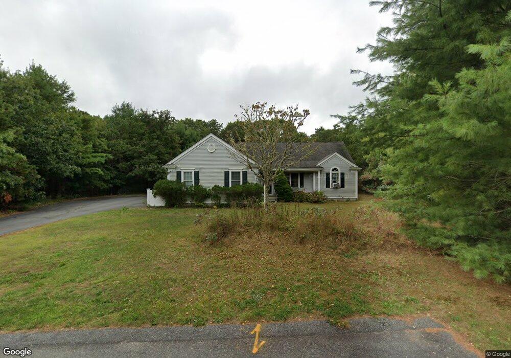
56 Harris Hill Rd East Falmouth, MA 02536
Hatchville NeighborhoodEstimated Value: $659,000 - $748,000
3
Beds
2
Baths
1,450
Sq Ft
$479/Sq Ft
Est. Value
About This Home
This home is located at 56 Harris Hill Rd, East Falmouth, MA 02536 and is currently estimated at $695,167, approximately $479 per square foot. 56 Harris Hill Rd is a home located in Barnstable County with nearby schools including Teaticket Elementary School, Morse Pond School, and Lawrence School.
Ownership History
Date
Name
Owned For
Owner Type
Purchase Details
Closed on
Feb 11, 2016
Sold by
Cataldo Ralph J and Cataldo Marion E
Bought by
Cataldo Marion E
Current Estimated Value
Purchase Details
Closed on
Nov 16, 2012
Sold by
Bow Rt and Barrett
Bought by
Cataldo Ralph J and Cataldo Marion E
Purchase Details
Closed on
Apr 6, 2007
Sold by
Virginia Barrett Liv R and Virginia Barrett
Bought by
Bow Rt and Barrett
Purchase Details
Closed on
May 30, 2003
Sold by
Peterson Dev Corp
Bought by
Virginia M Barrett Lt and Barrett
Create a Home Valuation Report for This Property
The Home Valuation Report is an in-depth analysis detailing your home's value as well as a comparison with similar homes in the area
Home Values in the Area
Average Home Value in this Area
Purchase History
| Date | Buyer | Sale Price | Title Company |
|---|---|---|---|
| Cataldo Marion E | -- | -- | |
| Cataldo Marion E | -- | -- | |
| Cataldo Ralph J | $300,000 | -- | |
| Cataldo Ralph J | $300,000 | -- | |
| Bow Rt | -- | -- | |
| Bow Rt | -- | -- | |
| Virginia M Barrett Lt | $185,000 | -- | |
| Virginia M Barrett Lt | $185,000 | -- |
Source: Public Records
Tax History Compared to Growth
Tax History
| Year | Tax Paid | Tax Assessment Tax Assessment Total Assessment is a certain percentage of the fair market value that is determined by local assessors to be the total taxable value of land and additions on the property. | Land | Improvement |
|---|---|---|---|---|
| 2025 | $4,184 | $712,700 | $253,700 | $459,000 |
| 2024 | $4,024 | $640,700 | $222,000 | $418,700 |
| 2023 | $3,699 | $534,600 | $174,400 | $360,200 |
| 2022 | $3,722 | $462,400 | $153,700 | $308,700 |
| 2021 | $3,572 | $420,200 | $140,900 | $279,300 |
| 2020 | $3,500 | $407,400 | $128,100 | $279,300 |
| 2019 | $3,186 | $372,200 | $128,100 | $244,100 |
| 2018 | $3,087 | $359,000 | $128,100 | $230,900 |
| 2017 | $2,978 | $349,100 | $128,100 | $221,000 |
| 2016 | $2,922 | $349,100 | $128,100 | $221,000 |
| 2015 | $2,859 | $349,100 | $128,100 | $221,000 |
| 2014 | $2,886 | $354,100 | $134,800 | $219,300 |
Source: Public Records
Map
Nearby Homes
- 70 Meredith Dr
- 25 Harris Hill Rd
- 100 Tanglewood Dr
- 66 Braxton Rd
- 17 Pinewood Dr
- 68 Deepwood Dr
- 590 Sandwich Rd
- 32 Jamie Ln
- 130 Old Barnstable Rd
- 33 John Parker Rd
- 273 Sandwich Rd
- 35 Old Barnstable Rd
- 149 Brick Kiln Rd
- 3 Viber Ln
- 25 Mill Pond Way
- 59 Whitecaps Dr
- 67 Vidal Ave
- 144 Strawberry Meadows
- 144 Strawberry Meadow Unit 144
- Lot 6 Sailaway Ln
- 52 Harris Hill Rd
- 55 Harris Hill Rd
- 53 Harris Hill Rd
- 36 Captain Bohnenberger Ln
- 48 Harris Hill Rd
- 47 Harris Hill Rd
- 8 Wanamaker Dr
- 8 Captain Bohnenberger Ln
- 0 Captain Bohnenberger Ln Unit 20705771
- 0 Captain Bohnenberger Ln Unit 20705769
- 0 Captain Bohnenberger Ln Unit 20705766
- 0 Captain Bohnenberger Ln Unit 20705767
- 0 Captain Bohnenberger Ln Unit 21007824
- 0 Captain Bohnenberger Ln Unit 21007823
- 0 Captain Bohnenberger Ln Unit 21007826
- 0 Captain Bohnenberger Ln Unit 21007821
- 0 Captain Bohnenberger Ln Unit 21204427
- 0 Captain Bohnenberger Ln Unit 21204428
- 0 Captain Bohnenberger Ln Unit 21204430
- 0 Captain Bohnenberger Ln Unit 21204431