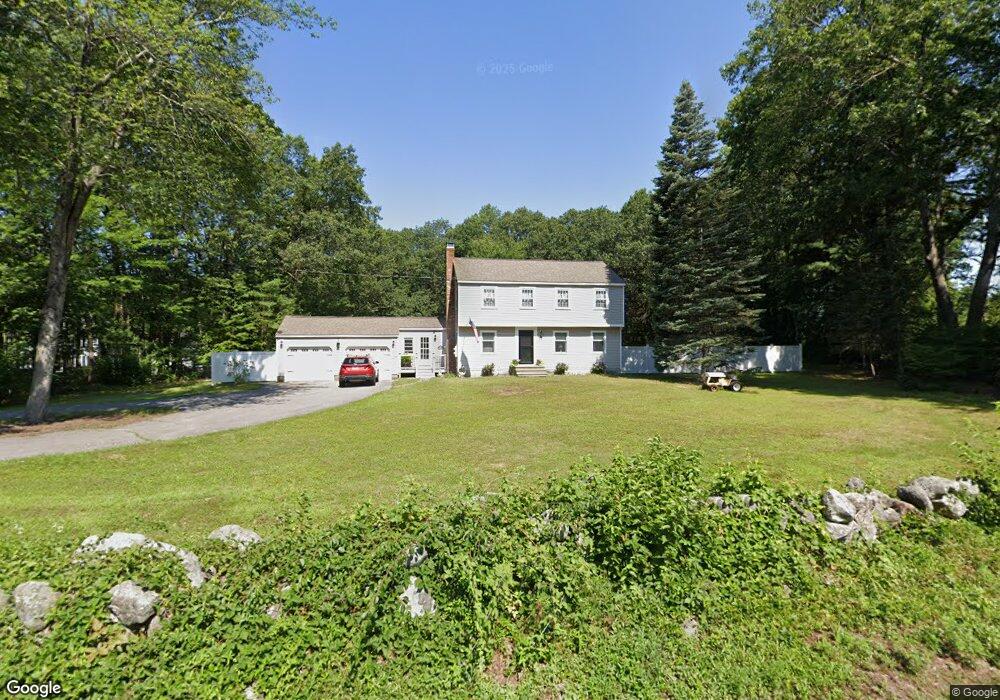
56 Howe Ln Hollis, NH 03049
Hollis NeighborhoodEstimated Value: $610,000 - $706,000
4
Beds
3
Baths
1,810
Sq Ft
$368/Sq Ft
Est. Value
About This Home
This home is located at 56 Howe Ln, Hollis, NH 03049 and is currently estimated at $665,518, approximately $367 per square foot. 56 Howe Ln is a home with nearby schools including Hollis Primary School, Hollis Upper Elementary School, and Hollis-Brookline Middle School.
Ownership History
Date
Name
Owned For
Owner Type
Purchase Details
Closed on
Nov 30, 1998
Sold by
Degges Ft
Bought by
Litchfield Sharon L and Litchfield Lawrence R
Current Estimated Value
Home Financials for this Owner
Home Financials are based on the most recent Mortgage that was taken out on this home.
Original Mortgage
$148,250
Interest Rate
6.83%
Create a Home Valuation Report for This Property
The Home Valuation Report is an in-depth analysis detailing your home's value as well as a comparison with similar homes in the area
Home Values in the Area
Average Home Value in this Area
Purchase History
| Date | Buyer | Sale Price | Title Company |
|---|---|---|---|
| Litchfield Sharon L | $150,000 | -- |
Source: Public Records
Mortgage History
| Date | Status | Borrower | Loan Amount |
|---|---|---|---|
| Open | Litchfield Sharon L | $41,000 | |
| Open | Litchfield Sharon L | $298,037 | |
| Closed | Litchfield Sharon L | $148,250 |
Source: Public Records
Tax History Compared to Growth
Tax History
| Year | Tax Paid | Tax Assessment Tax Assessment Total Assessment is a certain percentage of the fair market value that is determined by local assessors to be the total taxable value of land and additions on the property. | Land | Improvement |
|---|---|---|---|---|
| 2024 | $9,315 | $525,400 | $278,300 | $247,100 |
| 2023 | $8,753 | $525,400 | $278,300 | $247,100 |
| 2022 | $11,858 | $525,400 | $278,300 | $247,100 |
| 2021 | $7,194 | $316,900 | $165,900 | $151,000 |
| 2020 | $3,423 | $316,900 | $165,900 | $151,000 |
| 2019 | $3,294 | $316,900 | $165,900 | $151,000 |
| 2018 | $6,525 | $316,900 | $165,900 | $151,000 |
| 2017 | $6,565 | $283,600 | $145,900 | $137,700 |
| 2016 | $6,645 | $283,600 | $145,900 | $137,700 |
| 2015 | $6,528 | $283,600 | $145,900 | $137,700 |
| 2014 | $6,560 | $283,600 | $145,900 | $137,700 |
| 2013 | $6,472 | $283,600 | $145,900 | $137,700 |
Source: Public Records
Map
Nearby Homes
- 22 Cathedral Cir
- 14 Parrish Hill Dr
- 334 Broad St
- 6 Cornwall Ln Unit 7
- 199 Pine Hill Rd
- 4 Brick Manor Dr
- 3 Richmond St
- 4 Nelson St
- 28 Bartemus Trail Unit U210
- 4 Jared Cir Unit U21
- 80 Bartemus Trail Unit U229
- 5 Chatfield Dr Unit U18
- 27 Country Hill Rd Unit U90
- 17 Dunbarton Dr
- 11 Bartemus Trail Unit 204
- 1 Dunbarton Dr
- 8 Pilgrim Cir
- 10 Pilgrim Cir
- 2 Sycamore Ln
- 38 Dianne St