C
Seller's Agent in 2025
Catherine Walton
Nahant Associates, Inc.
(781) 267-9378
2 in this area
2 Total Sales


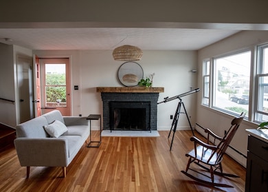
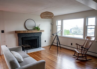
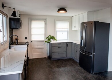
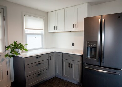
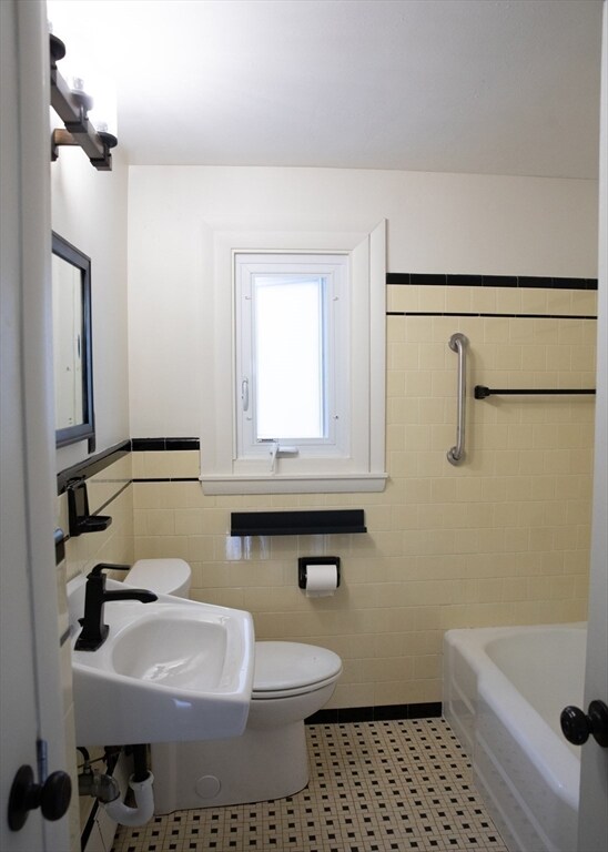
Wake up to sweeping ocean views in this charming coastal home in one of Nahant's most sought-after locations. With four spacious bedrooms, two conveniently located on first floor, this home offers flexible living and plenty of room for guests, in-laws, or a home office with a view. The bedroom balcony offers extended views of the sunrise over the ocean and Egg Rock.The bright living room features new picture window framing the ocean and a fireplace, while the recently updated kitchen with black stainless steel appliances opens to stunning water vistas. The original '50s bathroom adds a touch of vintage charm or provides the perfect canvas for your dream spa retreat. Downstairs, enjoy a one-car garage with room for storage or a tool bench, plus a basement for storage, workshop, or future expansion. Just minutes from sandy beaches you'll have the best of small-town coastal living with easy access to Boston.This home is move-in ready and full of potential. Appliances remain as gifts
| Date | Type | Sale Price | Title Company |
|---|---|---|---|
| Quit Claim Deed | -- | -- | |
| Deed | $796,000 | -- | |
| Quit Claim Deed | $450,000 | -- | |
| Quit Claim Deed | -- | -- | |
| Quit Claim Deed | -- | -- |
| Date | Status | Loan Amount | Loan Type |
|---|---|---|---|
| Open | $813,114 | Purchase Money Mortgage | |
| Previous Owner | $427,500 | New Conventional |
| Date | Event | Price | List to Sale | Price per Sq Ft |
|---|---|---|---|---|
| 10/08/2025 10/08/25 | Sold | $796,000 | 0.0% | $654 / Sq Ft |
| 09/01/2025 09/01/25 | Pending | -- | -- | -- |
| 08/27/2025 08/27/25 | For Sale | $796,000 | -- | $654 / Sq Ft |
| Year | Tax Paid | Tax Assessment Tax Assessment Total Assessment is a certain percentage of the fair market value that is determined by local assessors to be the total taxable value of land and additions on the property. | Land | Improvement |
|---|---|---|---|---|
| 2025 | $6,210 | $678,700 | $436,200 | $242,500 |
| 2024 | $5,887 | $649,100 | $419,400 | $229,700 |
| 2023 | $5,515 | $606,700 | $394,200 | $212,500 |
| 2022 | $5,100 | $520,900 | $318,700 | $202,200 |
| 2021 | $4,987 | $474,500 | $285,200 | $189,300 |
| 2020 | $4,802 | $437,700 | $285,200 | $152,500 |
| 2019 | $4,289 | $393,100 | $251,600 | $141,500 |
| 2018 | $4,029 | $393,100 | $251,600 | $141,500 |
| 2017 | $4,116 | $393,100 | $251,600 | $141,500 |
| 2016 | $3,971 | $377,500 | $243,200 | $134,300 |
| 2015 | $3,619 | $331,400 | $197,100 | $134,300 |
| 2014 | $3,655 | $331,400 | $197,100 | $134,300 |
C
Seller's Agent in 2025
Catherine Walton
Nahant Associates, Inc.
(781) 267-9378
2 in this area
2 Total Sales

Buyer's Agent in 2025
Lisa Scourtas
RE/MAX
(617) 538-2400
20 in this area
46 Total Sales
Source: MLS Property Information Network (MLS PIN)
MLS Number: 73422799
APN: NAHA-000025C-000000-000162
Disclaimer: Certain information contained herein is derived from information provided by parties other than Homes.com. All information provided is deemed reliable, but is not guaranteed to be accurate and should be independently verified.
![]() The property listing data and information, or the Images, set forth herein were provided to MLS Property Information Network, Inc. from third party sources, including sellers, lessors and public records, and were compiled by MLS Property Information Network, Inc. The property listing data and information, and the Images, are for the personal, non-commercial use of consumers having a good faith interest in purchasing or leasing listed properties of the type displayed to them and may not be used for any purpose other than to identify prospective properties which such consumers may have a good faith interest in purchasing or leasing. MLS Property Information Network, Inc. and its subscribers disclaim any and all representations and warranties as to the accuracy of the property listing data and information, or as to the accuracy of any of the Images, set forth herein.
The property listing data and information, or the Images, set forth herein were provided to MLS Property Information Network, Inc. from third party sources, including sellers, lessors and public records, and were compiled by MLS Property Information Network, Inc. The property listing data and information, and the Images, are for the personal, non-commercial use of consumers having a good faith interest in purchasing or leasing listed properties of the type displayed to them and may not be used for any purpose other than to identify prospective properties which such consumers may have a good faith interest in purchasing or leasing. MLS Property Information Network, Inc. and its subscribers disclaim any and all representations and warranties as to the accuracy of the property listing data and information, or as to the accuracy of any of the Images, set forth herein.