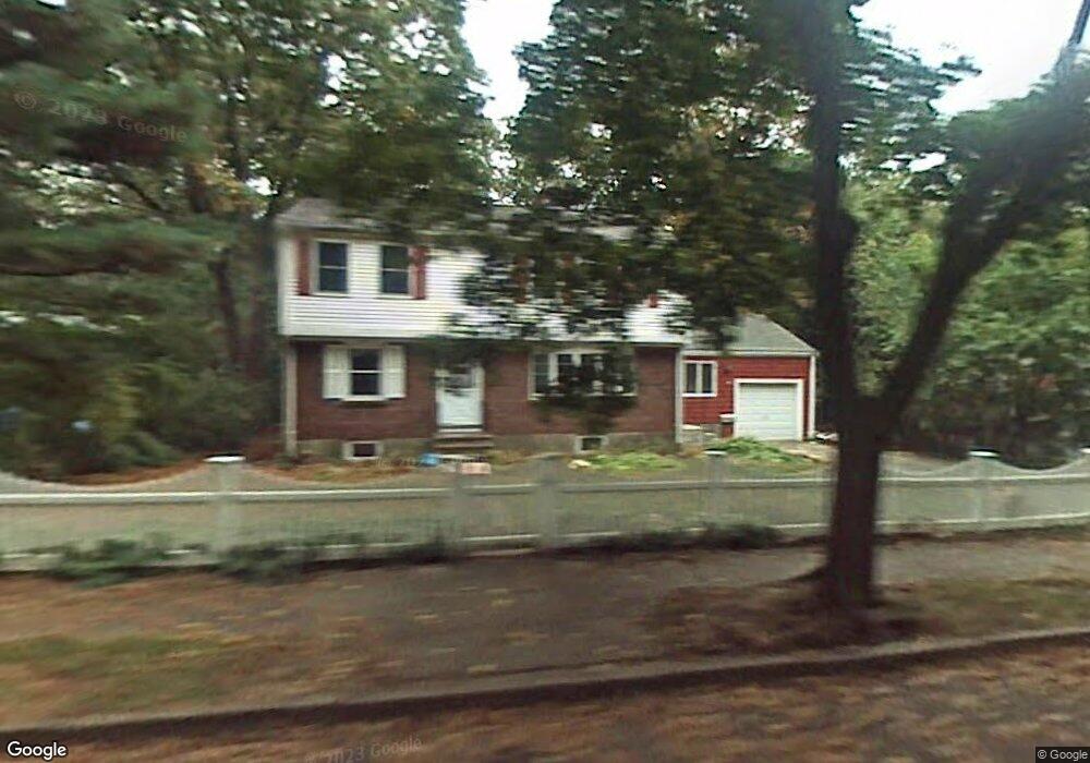
56 Oakwood Rd Auburndale, MA 02466
Auburndale NeighborhoodEstimated Value: $1,320,000 - $1,551,000
4
Beds
2
Baths
2,017
Sq Ft
$710/Sq Ft
Est. Value
About This Home
This home is located at 56 Oakwood Rd, Auburndale, MA 02466 and is currently estimated at $1,431,393, approximately $709 per square foot. 56 Oakwood Rd is a home located in Middlesex County with nearby schools including Williams Elementary School, Charles E Brown Middle School, and Newton South High School.
Create a Home Valuation Report for This Property
The Home Valuation Report is an in-depth analysis detailing your home's value as well as a comparison with similar homes in the area
Home Values in the Area
Average Home Value in this Area
Tax History Compared to Growth
Tax History
| Year | Tax Paid | Tax Assessment Tax Assessment Total Assessment is a certain percentage of the fair market value that is determined by local assessors to be the total taxable value of land and additions on the property. | Land | Improvement |
|---|---|---|---|---|
| 2025 | $11,026 | $1,125,100 | $924,400 | $200,700 |
| 2024 | $10,661 | $1,092,300 | $897,500 | $194,800 |
| 2023 | $10,008 | $983,100 | $694,100 | $289,000 |
| 2022 | $9,576 | $910,300 | $642,700 | $267,600 |
| 2021 | $9,241 | $858,800 | $606,300 | $252,500 |
| 2020 | $8,966 | $858,800 | $606,300 | $252,500 |
| 2019 | $8,713 | $833,800 | $588,600 | $245,200 |
| 2018 | $8,348 | $771,500 | $533,500 | $238,000 |
| 2017 | $8,093 | $727,800 | $503,300 | $224,500 |
| 2016 | $7,741 | $680,200 | $470,400 | $209,800 |
| 2015 | $7,380 | $635,700 | $439,600 | $196,100 |
Source: Public Records
Map
Nearby Homes
- 27 Oakwood Rd
- 17 Lasell St
- 17 Deforest Rd
- 2202 Commonwealth Ave Unit 2
- 2202 Commonwealth Ave Unit 1
- 283 Melrose St
- 224 Auburn St Unit 224
- 224 Auburn St Unit A
- 226 Auburn St Unit 226
- 283 Woodland Rd
- 1754 Washington St
- 2084 Washington St
- 13 Weir St
- 1639 Washington St
- 62-64 Rowe St Unit B
- 45 Moulton St
- 17 Gilbert St
- 51 Bourne St
- 10 Lorraine Cir
- 45 E Quinobequin Rd