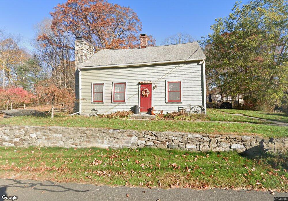
56 Obtuse Rd N Brookfield, CT 06804
Estimated Value: $556,000 - $816,000
--
Bed
2
Baths
--
Sq Ft
0.8
Acres
About This Home
This home is located at 56 Obtuse Rd N, Brookfield, CT 06804 and is currently estimated at $652,384. 56 Obtuse Rd N is a home located in Fairfield County with nearby schools including Center Elementary School, Whisconier Middle School, and Rio Mesa High School.
Ownership History
Date
Name
Owned For
Owner Type
Purchase Details
Closed on
Jun 26, 2003
Sold by
Appezzato Kenneth
Bought by
Wutzel Rodger and Wutzl Uae
Current Estimated Value
Purchase Details
Closed on
Jan 2, 2001
Sold by
Malley Mark
Bought by
Appezzato Kenneth and Appezzato Lozinda
Purchase Details
Closed on
May 21, 1997
Sold by
Osterhoudt Earl G and Osterhoudt Bertha
Bought by
Malley Mark A
Create a Home Valuation Report for This Property
The Home Valuation Report is an in-depth analysis detailing your home's value as well as a comparison with similar homes in the area
Home Values in the Area
Average Home Value in this Area
Purchase History
| Date | Buyer | Sale Price | Title Company |
|---|---|---|---|
| Wutzel Rodger | $326,000 | -- | |
| Wutzel Rodger | $326,000 | -- | |
| Appezzato Kenneth | $235,000 | -- | |
| Appezzato Kenneth | $235,000 | -- | |
| Malley Mark A | $173,500 | -- | |
| Malley Mark A | $173,500 | -- |
Source: Public Records
Mortgage History
| Date | Status | Borrower | Loan Amount |
|---|---|---|---|
| Open | Malley Mark A | $119,500 | |
| Closed | Malley Mark A | $30,000 |
Source: Public Records
Tax History Compared to Growth
Tax History
| Year | Tax Paid | Tax Assessment Tax Assessment Total Assessment is a certain percentage of the fair market value that is determined by local assessors to be the total taxable value of land and additions on the property. | Land | Improvement |
|---|---|---|---|---|
| 2025 | $9,799 | $338,700 | $95,260 | $243,440 |
| 2024 | $9,450 | $338,700 | $95,260 | $243,440 |
| 2023 | $9,097 | $338,700 | $95,260 | $243,440 |
| 2022 | $8,766 | $338,700 | $95,260 | $243,440 |
| 2021 | $13,412 | $316,250 | $105,840 | $210,410 |
| 2020 | $13,157 | $316,250 | $105,840 | $210,410 |
| 2019 | $9,216 | $316,250 | $105,840 | $210,410 |
| 2018 | $12,833 | $302,020 | $105,840 | $196,180 |
| 2017 | $12,574 | $285,930 | $105,840 | $180,090 |
| 2016 | $7,994 | $302,810 | $120,820 | $181,990 |
| 2015 | $7,782 | $302,810 | $120,820 | $181,990 |
| 2014 | $7,782 | $302,810 | $120,820 | $181,990 |
Source: Public Records
Map
Nearby Homes
- 44 Obtuse Rd N
- 7 Hearthstone Dr
- 5 Hidden Brook Dr
- 6 Lyndenwood Dr
- 70 Obtuse Hill Rd
- 5 Rabbit Ln
- 11 Winding Rd
- 26 Cove Rd
- 19 A Apache Dr
- 89 Iron Ore Hill Rd
- 409 Northrop St
- 99 Obtuse Hill Rd
- 19 Kimberly Dr
- 370 Northrop St
- 98A Tower Rd
- 34 Riverford Rd
- 140 Whisconier Rd
- 19 Riverford Rd
- 8 Cherokee Dr
- 48 High Ridge Rd