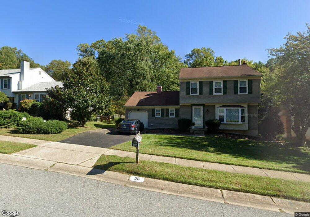
56 Quail Hollow Dr Hockessin, DE 19707
Estimated Value: $421,872 - $468,000
3
Beds
3
Baths
1,512
Sq Ft
$299/Sq Ft
Est. Value
About This Home
This home is located at 56 Quail Hollow Dr, Hockessin, DE 19707 and is currently estimated at $451,968, approximately $298 per square foot. 56 Quail Hollow Dr is a home located in New Castle County with nearby schools including Dupont (H.B.) Middle School, Thomas McKean High School, and The Independence School.
Ownership History
Date
Name
Owned For
Owner Type
Purchase Details
Closed on
Sep 9, 2002
Sold by
Woerner John A and Woerner Elaine G
Bought by
Woerner John A and Woerner Elaine G
Current Estimated Value
Home Financials for this Owner
Home Financials are based on the most recent Mortgage that was taken out on this home.
Original Mortgage
$160,000
Interest Rate
6.48%
Create a Home Valuation Report for This Property
The Home Valuation Report is an in-depth analysis detailing your home's value as well as a comparison with similar homes in the area
Home Values in the Area
Average Home Value in this Area
Purchase History
| Date | Buyer | Sale Price | Title Company |
|---|---|---|---|
| Woerner John A | -- | Commonwealth Land Title Ins |
Source: Public Records
Mortgage History
| Date | Status | Borrower | Loan Amount |
|---|---|---|---|
| Closed | Woerner John A | $160,000 |
Source: Public Records
Tax History Compared to Growth
Tax History
| Year | Tax Paid | Tax Assessment Tax Assessment Total Assessment is a certain percentage of the fair market value that is determined by local assessors to be the total taxable value of land and additions on the property. | Land | Improvement |
|---|---|---|---|---|
| 2024 | $2,856 | $87,600 | $22,300 | $65,300 |
| 2023 | $2,476 | $87,600 | $22,300 | $65,300 |
| 2022 | $2,493 | $87,600 | $22,300 | $65,300 |
| 2021 | $2,589 | $87,600 | $22,300 | $65,300 |
| 2020 | $2,590 | $87,600 | $22,300 | $65,300 |
| 2019 | $2,702 | $87,600 | $22,300 | $65,300 |
| 2018 | $2,538 | $87,600 | $22,300 | $65,300 |
| 2017 | $2,504 | $87,600 | $22,300 | $65,300 |
| 2016 | $2,262 | $87,600 | $22,300 | $65,300 |
| 2015 | $2,095 | $87,600 | $22,300 | $65,300 |
| 2014 | $1,911 | $87,600 | $22,300 | $65,300 |
Source: Public Records
Map
Nearby Homes
- 850 Stockbridge Dr
- 121 Croom Mills Dr
- 334 Shannonbridge Dr
- 204 Barclay Dr
- 24 Haileys Trail
- 8 Barclay Dr
- 1825 Graves Rd
- 21 Jarrell Farms Dr
- 253 Peoples Way
- 184 Gregg Dr
- 515 Massaferi Way
- 1300 Braken Ave
- 308 Detjen Dr
- 132 Farm Meadows Ln
- 23 Raphael Rd
- 0 Stoney Batter Rd
- 27 Raphael Rd
- 4 Meteor Ln
- 226 Cayman Ct
- 124 Shinn Cir
- 54 Quail Hollow Dr
- 58 Quail Hollow Dr
- 52 Quail Hollow Dr
- 60 Quail Hollow Dr
- 55 Quail Hollow Dr
- 2 Wintercorn Cir
- 57 Quail Hollow Dr
- 50 Quail Hollow Dr
- 59 Quail Hollow Dr
- 61 Quail Hollow Dr
- 48 Quail Hollow Dr
- 30 Signal Hill Dr
- 6 Wintercorn Cir
- 1 Wintercorn Cir
- 63 Quail Hollow Dr
- 3 Wintercorn Cir
- 29 Signal Hill Dr
- 46 Quail Hollow Dr
- 5 Wintercorn Cir
- 28 Signal Hill Dr