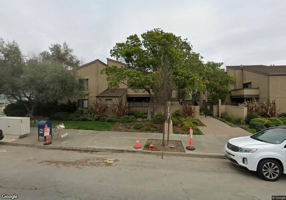
56 Sable Point Alameda, CA 94502
Harbor Bay/Bay Farm NeighborhoodEstimated Value: $1,559,025 - $1,988,000
4
Beds
3
Baths
2,090
Sq Ft
$857/Sq Ft
Est. Value
About This Home
This home is located at 56 Sable Point, Alameda, CA 94502 and is currently estimated at $1,790,256, approximately $856 per square foot. 56 Sable Point is a home located in Alameda County with nearby schools including Amelia Earhart Elementary School, Lincoln Middle School, and Alameda High School.
Ownership History
Date
Name
Owned For
Owner Type
Purchase Details
Closed on
Jul 16, 1997
Sold by
Lee Edwyn and Lee Loretta J
Bought by
Tam Roger Fai and Tam Lilian
Current Estimated Value
Home Financials for this Owner
Home Financials are based on the most recent Mortgage that was taken out on this home.
Original Mortgage
$150,000
Interest Rate
7.58%
Create a Home Valuation Report for This Property
The Home Valuation Report is an in-depth analysis detailing your home's value as well as a comparison with similar homes in the area
Home Values in the Area
Average Home Value in this Area
Purchase History
| Date | Buyer | Sale Price | Title Company |
|---|---|---|---|
| Tam Roger Fai | $390,000 | First American Title Guarant |
Source: Public Records
Mortgage History
| Date | Status | Borrower | Loan Amount |
|---|---|---|---|
| Previous Owner | Tam Roger Fai | $150,000 |
Source: Public Records
Tax History
| Year | Tax Paid | Tax Assessment Tax Assessment Total Assessment is a certain percentage of the fair market value that is determined by local assessors to be the total taxable value of land and additions on the property. | Land | Improvement |
|---|---|---|---|---|
| 2025 | $8,494 | $615,700 | $186,810 | $435,890 |
| 2024 | $8,494 | $603,494 | $183,148 | $427,346 |
| 2023 | $8,146 | $598,524 | $179,557 | $418,967 |
| 2022 | $9,169 | $579,790 | $176,037 | $410,753 |
| 2021 | $8,957 | $568,284 | $172,585 | $402,699 |
| 2020 | $8,853 | $569,387 | $170,816 | $398,571 |
| 2019 | $8,189 | $558,225 | $167,467 | $390,758 |
| 2018 | $7,887 | $547,282 | $164,184 | $383,098 |
| 2017 | $7,640 | $536,553 | $160,966 | $375,587 |
| 2016 | $7,645 | $526,035 | $157,810 | $368,225 |
| 2015 | $7,619 | $518,134 | $155,440 | $362,694 |
| 2014 | $7,287 | $507,986 | $152,396 | $355,590 |
Source: Public Records
Map
Nearby Homes
- 267 Ennismore Ct
- 30 Sea Bridge
- 137 Parfait Ln
- 179 Oyster Pond Rd
- 154 Basinside Way
- 622 Ironwood Rd
- 405 Centre Ct
- 2959 Sea View Pkwy
- 608 Centre Ct
- 632 Centre Ct Unit 48
- 641 Centre Ct
- 820 Island Dr
- 1007 Via Aliso
- 1037 Via Bonita
- 35 Leonard Ct
- 1119 Camino Del Valle
- 3037 Linda Vista
- 3218 Fir Ave
- 3032 Linda Vista
- 3211 Phoenix Ln
- 50 Sable Point
- 62 Sable Point
- 77 Basinside Way
- 12 Barnegate Bay
- 68 Sable Point
- 81 Basinside Way
- 73 Basinside Way
- 18 Barnegate Bay
- 57 Sable Point
- 63 Sable Point
- 85 Basinside Way
- 74 Sable Point
- 51 Sable Point
- 24 Barnegate Bay
- 69 Basinside Way
- 45 Sable Point
- 69 Sable Point
- 89 Basinside Way
- 80 Sable Point
- 75 Sable Point
Your Personal Tour Guide
Ask me questions while you tour the home.