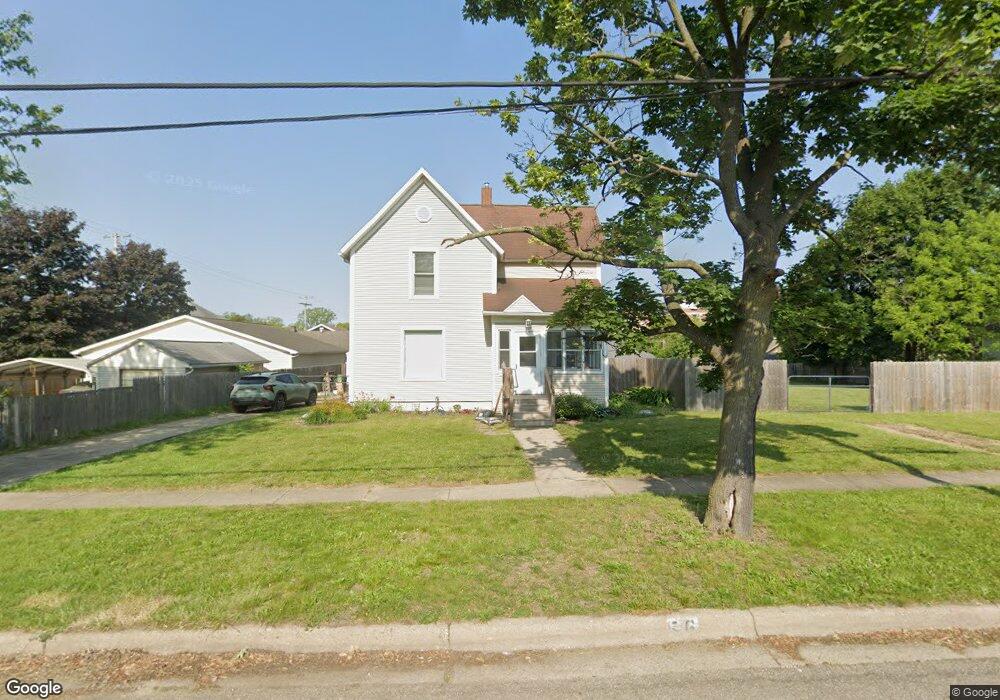
56 Vale St Battle Creek, MI 49014
Post Franklin NeighborhoodEstimated Value: $105,000 - $114,752
4
Beds
2
Baths
1,678
Sq Ft
$66/Sq Ft
Est. Value
About This Home
This home is located at 56 Vale St, Battle Creek, MI 49014 and is currently estimated at $111,188, approximately $66 per square foot. 56 Vale St is a home located in Calhoun County with nearby schools including Verona Elementary School, Springfield Middle School, and Battle Creek Central High School.
Ownership History
Date
Name
Owned For
Owner Type
Purchase Details
Closed on
Feb 11, 2025
Sold by
Withrow Patrick and Hillman Barbara
Bought by
Hillman Barbara
Current Estimated Value
Home Financials for this Owner
Home Financials are based on the most recent Mortgage that was taken out on this home.
Original Mortgage
$117,000
Outstanding Balance
$116,307
Interest Rate
6.93%
Mortgage Type
New Conventional
Estimated Equity
-$5,119
Purchase Details
Closed on
Sep 17, 2013
Sold by
Neighborhoods Inc Of Battle Creek
Bought by
Withrow Patrick and Hillman Barbara
Home Financials for this Owner
Home Financials are based on the most recent Mortgage that was taken out on this home.
Original Mortgage
$9,000
Interest Rate
4.56%
Mortgage Type
New Conventional
Purchase Details
Closed on
Sep 10, 2013
Sold by
The Calhoun County Land Bank Authority
Bought by
Neighborhoods Inc Of Battle Creek
Home Financials for this Owner
Home Financials are based on the most recent Mortgage that was taken out on this home.
Original Mortgage
$9,000
Interest Rate
4.56%
Mortgage Type
New Conventional
Purchase Details
Closed on
Dec 22, 2010
Sold by
Neighborhoods Inc Of Battle Creek
Bought by
Calhoun County Land Bank Authority
Purchase Details
Closed on
Sep 29, 2006
Sold by
Livingston Lashawn and Livingston Lisa
Bought by
Neighborhoods Inc Of Battle Creek
Purchase Details
Closed on
Mar 4, 2003
Sold by
Neighborhoods Inc Of Battle Creek
Bought by
Livingston Lashawn and Livingston Lisa
Home Financials for this Owner
Home Financials are based on the most recent Mortgage that was taken out on this home.
Original Mortgage
$58,727
Interest Rate
6.5%
Mortgage Type
Seller Take Back
Purchase Details
Closed on
Aug 22, 2002
Sold by
Bozell Frances D
Bought by
Neighborhoods Inc
Purchase Details
Closed on
Jun 27, 1997
Bought by
Bozell
Purchase Details
Closed on
Jan 8, 1997
Bought by
Neighborhoods Inc
Purchase Details
Closed on
Apr 16, 1996
Bought by
Holibaugh
Create a Home Valuation Report for This Property
The Home Valuation Report is an in-depth analysis detailing your home's value as well as a comparison with similar homes in the area
Home Values in the Area
Average Home Value in this Area
Purchase History
| Date | Buyer | Sale Price | Title Company |
|---|---|---|---|
| Hillman Barbara | -- | Lighthouse Title | |
| Hillman Barbara | -- | Lighthouse Title | |
| Withrow Patrick | $9,000 | None Available | |
| Neighborhoods Inc Of Battle Creek | -- | None Available | |
| Calhoun County Land Bank Authority | -- | None Available | |
| Neighborhoods Inc Of Battle Creek | $69,656 | None Available | |
| Livingston Lashawn | $60,000 | Fatic | |
| Neighborhoods Inc | -- | -- | |
| Bozell | $36,100 | -- | |
| Neighborhoods Inc | -- | -- | |
| Holibaugh | $36,500 | -- |
Source: Public Records
Mortgage History
| Date | Status | Borrower | Loan Amount |
|---|---|---|---|
| Open | Hillman Barbara | $117,000 | |
| Closed | Hillman Barbara | $117,000 | |
| Previous Owner | Withrow Patrick | $9,000 | |
| Previous Owner | Neighborhoods Inc Of Battle Creek | $9,000 | |
| Previous Owner | Livingston Lashawn | $58,727 |
Source: Public Records
Tax History Compared to Growth
Tax History
| Year | Tax Paid | Tax Assessment Tax Assessment Total Assessment is a certain percentage of the fair market value that is determined by local assessors to be the total taxable value of land and additions on the property. | Land | Improvement |
|---|---|---|---|---|
| 2025 | -- | $44,900 | $0 | $0 |
| 2024 | $994 | $37,964 | $0 | $0 |
| 2023 | $1,265 | $34,689 | $0 | $0 |
| 2022 | $899 | $27,175 | $0 | $0 |
| 2021 | $1,202 | $25,554 | $0 | $0 |
| 2020 | $1,099 | $25,392 | $0 | $0 |
| 2019 | $1,075 | $23,222 | $0 | $0 |
| 2018 | $1,075 | $18,637 | $660 | $17,977 |
| 2017 | $902 | $17,496 | $0 | $0 |
| 2016 | $861 | $17,292 | $0 | $0 |
| 2015 | $679 | $16,981 | $3,275 | $13,706 |
| 2014 | $679 | $14,735 | $3,275 | $11,460 |
Source: Public Records
Map
Nearby Homes
- 802 Michigan Ave E
- 222 Lathrop Ave
- 116 Inn Rd
- 232 Cliff St
- 118 Nelson St
- 174 Lathrop Ave
- 79 Clark St
- 155 Post Ave
- 23 Bradford St
- 507 Michigan Ave E
- 501 Michigan Ave E
- 180 Grenville St
- 138 Rook St
- 100 Illinois St
- 130 Cliff St
- 0 Rook St Unit 25019652
- 390 E Michigan Ave
- 136 Jericho Rd
- 50 Douglas St
- 418 Main St