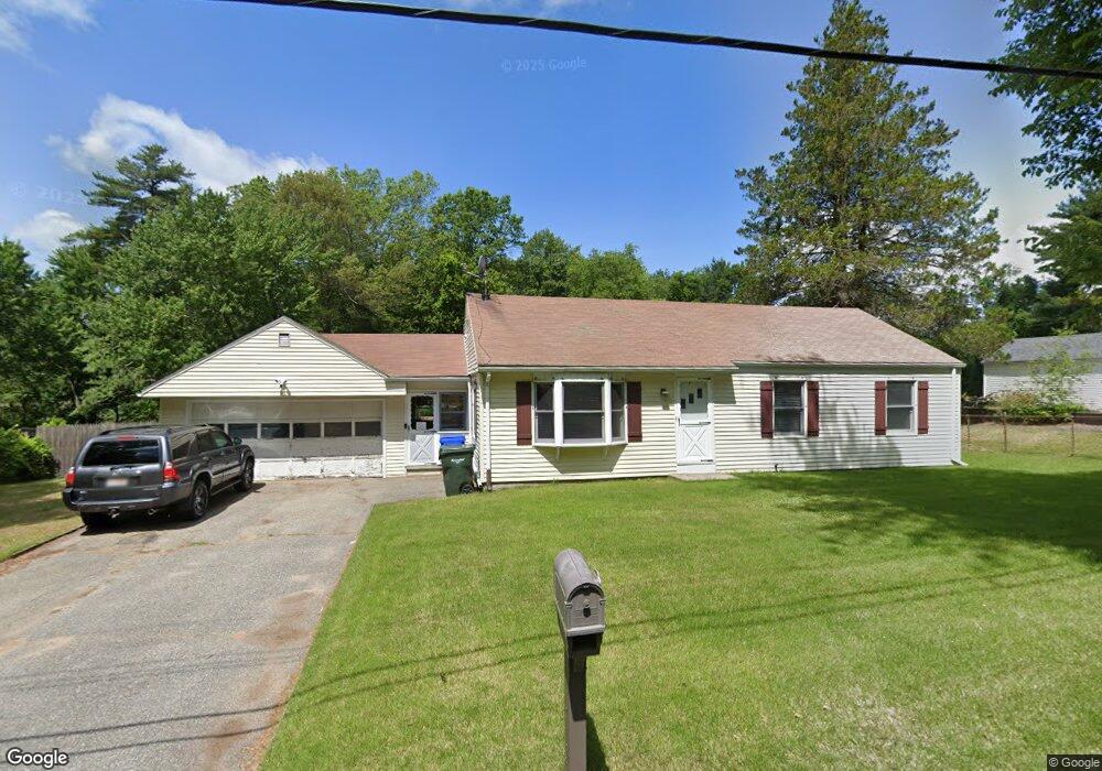
56 Wilshire Rd Unit 56 Springfield, MA 01118
Sixteen Acres NeighborhoodEstimated Value: $276,000 - $317,000
3
Beds
1
Bath
936
Sq Ft
$318/Sq Ft
Est. Value
About This Home
This home is located at 56 Wilshire Rd Unit 56, Springfield, MA 01118 and is currently estimated at $298,083, approximately $318 per square foot. 56 Wilshire Rd Unit 56 is a home located in Hampden County with nearby schools including Arthur T Talmadge Elementary School, M Marcus Kiley Middle, and Springfield High School of Science and Technology.
Ownership History
Date
Name
Owned For
Owner Type
Purchase Details
Closed on
May 14, 2013
Sold by
Martin David W and Bachand Jenny
Bought by
Martin David W
Current Estimated Value
Home Financials for this Owner
Home Financials are based on the most recent Mortgage that was taken out on this home.
Original Mortgage
$143,100
Outstanding Balance
$101,946
Interest Rate
3.6%
Mortgage Type
New Conventional
Estimated Equity
$196,137
Purchase Details
Closed on
Mar 16, 2007
Sold by
Martin David W
Bought by
Martin David W and Bachand Jenny
Home Financials for this Owner
Home Financials are based on the most recent Mortgage that was taken out on this home.
Original Mortgage
$148,490
Interest Rate
6.4%
Mortgage Type
Purchase Money Mortgage
Purchase Details
Closed on
Jan 25, 2005
Sold by
Martin David W and Hamel Michele L
Bought by
Martin David W
Home Financials for this Owner
Home Financials are based on the most recent Mortgage that was taken out on this home.
Original Mortgage
$147,000
Interest Rate
5.71%
Mortgage Type
Purchase Money Mortgage
Purchase Details
Closed on
Jul 30, 1999
Sold by
Piantek Stanley A and Piantek Dorothy E
Bought by
Martin David W and Hamel Michele L
Home Financials for this Owner
Home Financials are based on the most recent Mortgage that was taken out on this home.
Original Mortgage
$94,951
Interest Rate
7.61%
Mortgage Type
Purchase Money Mortgage
Create a Home Valuation Report for This Property
The Home Valuation Report is an in-depth analysis detailing your home's value as well as a comparison with similar homes in the area
Home Values in the Area
Average Home Value in this Area
Purchase History
| Date | Buyer | Sale Price | Title Company |
|---|---|---|---|
| Martin David W | -- | -- | |
| Martin David W | -- | -- | |
| Martin David W | -- | -- | |
| Martin David W | $95,000 | -- |
Source: Public Records
Mortgage History
| Date | Status | Borrower | Loan Amount |
|---|---|---|---|
| Open | Martin David W | $143,100 | |
| Previous Owner | Martin David W | $148,490 | |
| Previous Owner | Martin David W | $147,000 | |
| Previous Owner | Martin David W | $94,951 |
Source: Public Records
Tax History Compared to Growth
Tax History
| Year | Tax Paid | Tax Assessment Tax Assessment Total Assessment is a certain percentage of the fair market value that is determined by local assessors to be the total taxable value of land and additions on the property. | Land | Improvement |
|---|---|---|---|---|
| 2025 | $4,011 | $255,800 | $61,200 | $194,600 |
| 2024 | $3,639 | $226,600 | $61,200 | $165,400 |
| 2023 | $3,488 | $204,600 | $58,300 | $146,300 |
| 2022 | $3,395 | $180,400 | $58,300 | $122,100 |
| 2021 | $3,304 | $174,800 | $53,000 | $121,800 |
| 2020 | $3,277 | $167,800 | $53,000 | $114,800 |
| 2019 | $3,178 | $161,500 | $53,000 | $108,500 |
| 2018 | $2,818 | $143,200 | $53,000 | $90,200 |
| 2017 | $2,802 | $142,500 | $53,000 | $89,500 |
| 2016 | $2,648 | $134,700 | $53,000 | $81,700 |
| 2015 | $2,486 | $126,400 | $53,000 | $73,400 |
Source: Public Records
Map
Nearby Homes
- 41 Hillside Dr
- 41 Kerry Dr
- 82 Louis Rd
- 86 Talmadge Dr
- 99 W Crystal Brook Dr
- 331 Newhouse St
- 17 Pebble Mill Rd
- 54 Shady Brook Ln
- 767 S Branch Pkwy
- 399 Elm St
- 15 Lynwood Rd
- 55 Allen St
- 43 Sunridge Dr
- 111 Malibu Dr
- 32 Lindsay Rd
- 206 Treetop Ave
- 196 Sawmill Rd
- 5 Manor Ct Unit 5
- 19 Manor Ct Unit 19
- 1815 Parker St