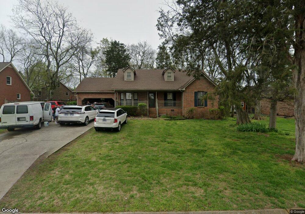
560 Highpoint Dr Smyrna, TN 37167
Estimated Value: $338,598 - $416,000
--
Bed
2
Baths
1,590
Sq Ft
$246/Sq Ft
Est. Value
About This Home
This home is located at 560 Highpoint Dr, Smyrna, TN 37167 and is currently estimated at $391,900, approximately $246 per square foot. 560 Highpoint Dr is a home located in Rutherford County with nearby schools including Smyrna Elementary School, Smyrna Middle School, and Smyrna High School.
Ownership History
Date
Name
Owned For
Owner Type
Purchase Details
Closed on
May 24, 1999
Sold by
Bearden James L
Bought by
Dohanoe Terry L and Dohanoe Esther
Current Estimated Value
Home Financials for this Owner
Home Financials are based on the most recent Mortgage that was taken out on this home.
Original Mortgage
$119,376
Outstanding Balance
$30,487
Interest Rate
6.9%
Estimated Equity
$361,413
Purchase Details
Closed on
May 4, 1994
Sold by
Cunningham Kerry B
Bought by
Bearden James L
Create a Home Valuation Report for This Property
The Home Valuation Report is an in-depth analysis detailing your home's value as well as a comparison with similar homes in the area
Home Values in the Area
Average Home Value in this Area
Purchase History
| Date | Buyer | Sale Price | Title Company |
|---|---|---|---|
| Dohanoe Terry L | $121,000 | -- | |
| Bearden James L | -- | -- |
Source: Public Records
Mortgage History
| Date | Status | Borrower | Loan Amount |
|---|---|---|---|
| Open | Bearden James L | $119,376 |
Source: Public Records
Tax History Compared to Growth
Tax History
| Year | Tax Paid | Tax Assessment Tax Assessment Total Assessment is a certain percentage of the fair market value that is determined by local assessors to be the total taxable value of land and additions on the property. | Land | Improvement |
|---|---|---|---|---|
| 2025 | $462 | $77,025 | $13,750 | $63,275 |
| 2024 | $462 | $77,025 | $13,750 | $63,275 |
| 2023 | $1,850 | $77,025 | $13,750 | $63,275 |
| 2022 | $1,650 | $77,025 | $13,750 | $63,275 |
| 2021 | $1,622 | $55,550 | $10,625 | $44,925 |
| 2020 | $1,622 | $55,550 | $10,625 | $44,925 |
| 2019 | $1,622 | $55,550 | $10,625 | $44,925 |
| 2018 | $1,555 | $55,550 | $0 | $0 |
| 2017 | $1,350 | $37,875 | $0 | $0 |
| 2016 | $1,350 | $37,875 | $0 | $0 |
| 2015 | $1,350 | $37,875 | $0 | $0 |
| 2014 | $942 | $37,875 | $0 | $0 |
| 2013 | -- | $38,975 | $0 | $0 |
Source: Public Records
Map
Nearby Homes
- 1655 Ben Johns Rd
- 307 Andy Johns Dr
- 610 Virginia Belle Dr
- 517 Matthew Miller Dr
- 411 Lake Farm Rd
- 601 Mary Alice Dr
- 314 Lake Farm Rd
- 415 Lawson Rd
- 416 Lawson Rd
- 112 Lakewood Cir
- 111 Brandon Trail
- 402 Holston Dr
- 401 Ravencliff Ct
- 313 Mayfield Dr
- 512 Holston Dr
- 307 Dartford Ct
- 100 Halfrunner Way Unit 1
- 102 Halfrunner Way Unit 2
- 104 Halfrunner Way Unit 3
- 106 Halfrunner Way Unit 4
- 562 Highpoint Dr
- 201 Creighton Rd
- 102 Anna Belle Ct
- 558 Highpoint Dr
- 203 Creighton Rd
- 102 Seward St
- 571 Highpoint Dr
- 100 Seward St
- 105 Anna Belle Ct
- 573 Highpoint Dr
- 205 Creighton Rd
- 569 Highpoint Dr
- 575 Highpoint Dr
- 200 Creighton Rd
- 567 Highpoint Dr
- 564 Highpoint Dr
- 556 Highpoint Dr
- 103 Anna Belle Ct
- 202 Creighton Rd
- 207 Creighton Rd