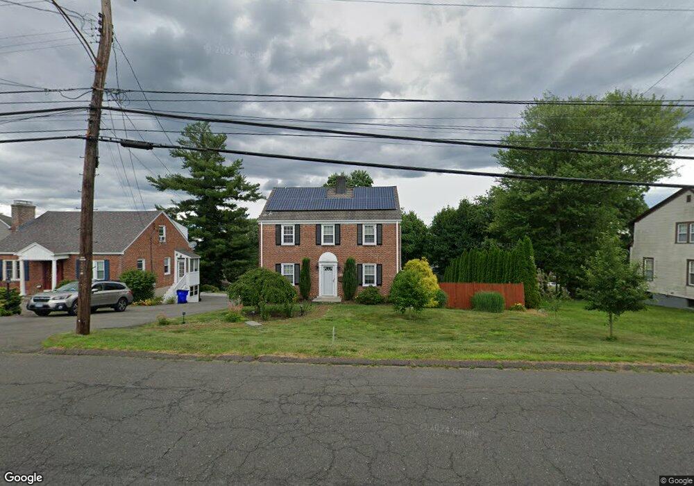
560 Ridge Rd Wethersfield, CT 06109
Estimated Value: $371,000 - $459,000
3
Beds
2
Baths
1,680
Sq Ft
$249/Sq Ft
Est. Value
About This Home
This home is located at 560 Ridge Rd, Wethersfield, CT 06109 and is currently estimated at $418,051, approximately $248 per square foot. 560 Ridge Rd is a home located in Hartford County with nearby schools including Emerson-Williams School, Silas Deane Middle School, and Wethersfield High School.
Ownership History
Date
Name
Owned For
Owner Type
Purchase Details
Closed on
Aug 2, 2011
Sold by
Perrone Jason M and Perrone Shannon E
Bought by
Myers Garth A and Hepburn Melanie C
Current Estimated Value
Home Financials for this Owner
Home Financials are based on the most recent Mortgage that was taken out on this home.
Original Mortgage
$269,100
Outstanding Balance
$185,887
Interest Rate
4.52%
Estimated Equity
$232,164
Purchase Details
Closed on
Jan 12, 2005
Sold by
Roushon Judith S
Bought by
Perrone Jason M and Perrone Shannon E
Create a Home Valuation Report for This Property
The Home Valuation Report is an in-depth analysis detailing your home's value as well as a comparison with similar homes in the area
Home Values in the Area
Average Home Value in this Area
Purchase History
| Date | Buyer | Sale Price | Title Company |
|---|---|---|---|
| Myers Garth A | $299,000 | -- | |
| Perrone Jason M | $250,000 | -- |
Source: Public Records
Mortgage History
| Date | Status | Borrower | Loan Amount |
|---|---|---|---|
| Open | Perrone Jason M | $269,100 | |
| Previous Owner | Perrone Jason M | $259,620 | |
| Previous Owner | Perrone Jason M | $262,000 |
Source: Public Records
Map
Nearby Homes
- 20 Forest Dr
- 116 Wells Farm Dr
- 273 Forest Dr
- 173 Timber Trail
- 295 Ridge Rd Unit 8
- 104 Willow St
- 48 Ridge Crest Cir
- 455 Brimfield Rd
- 19 Albert Ave
- 137 Dale Rd
- 7 Barrington Dr Unit C
- 1310 Berlin Turnpike Unit 223
- 89 Merriman Rd
- 38 Wheeler Rd
- 219 Jordan Ln Unit 221
- 87 Somerset St
- 90 Goodwin Park Rd
- 91 Somerset St
- 35 Stillwold Dr
- 108 Chamberlain Rd
Your Personal Tour Guide
Ask me questions while you tour the home.