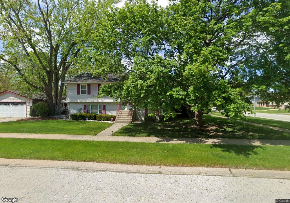
5600 Cornell Way Matteson, IL 60443
West Matteson NeighborhoodEstimated Value: $240,000 - $284,815
3
Beds
3
Baths
2,197
Sq Ft
$122/Sq Ft
Est. Value
About This Home
This home is located at 5600 Cornell Way, Matteson, IL 60443 and is currently estimated at $266,954, approximately $121 per square foot. 5600 Cornell Way is a home located in Cook County with nearby schools including Colin Powell Middle School.
Ownership History
Date
Name
Owned For
Owner Type
Purchase Details
Closed on
Mar 30, 2006
Sold by
Bynum Steven D and Bynum Linda
Bought by
Smith Lavelle and Smith Aretha
Current Estimated Value
Home Financials for this Owner
Home Financials are based on the most recent Mortgage that was taken out on this home.
Original Mortgage
$168,000
Interest Rate
6.56%
Mortgage Type
Fannie Mae Freddie Mac
Purchase Details
Closed on
Nov 25, 1998
Sold by
Newbern Leon
Bought by
Bynum Steven and Bynum Linda
Home Financials for this Owner
Home Financials are based on the most recent Mortgage that was taken out on this home.
Original Mortgage
$112,475
Interest Rate
6.8%
Mortgage Type
FHA
Create a Home Valuation Report for This Property
The Home Valuation Report is an in-depth analysis detailing your home's value as well as a comparison with similar homes in the area
Home Values in the Area
Average Home Value in this Area
Purchase History
| Date | Buyer | Sale Price | Title Company |
|---|---|---|---|
| Smith Lavelle | $168,000 | North American Title Ins Co | |
| Bynum Steven | $113,500 | -- |
Source: Public Records
Mortgage History
| Date | Status | Borrower | Loan Amount |
|---|---|---|---|
| Previous Owner | Smith Lavelle | $168,000 | |
| Previous Owner | Bynum Steven | $112,475 |
Source: Public Records
Tax History Compared to Growth
Tax History
| Year | Tax Paid | Tax Assessment Tax Assessment Total Assessment is a certain percentage of the fair market value that is determined by local assessors to be the total taxable value of land and additions on the property. | Land | Improvement |
|---|---|---|---|---|
| 2024 | $7,330 | $21,000 | $3,619 | $17,381 |
| 2023 | $8,065 | $21,000 | $3,619 | $17,381 |
| 2022 | $8,065 | $18,484 | $3,167 | $15,317 |
| 2021 | $8,189 | $18,483 | $3,166 | $15,317 |
| 2020 | $8,032 | $18,483 | $3,166 | $15,317 |
| 2019 | $7,125 | $16,470 | $2,940 | $13,530 |
| 2018 | $7,018 | $16,470 | $2,940 | $13,530 |
| 2017 | $6,856 | $16,470 | $2,940 | $13,530 |
| 2016 | $7,274 | $16,553 | $2,714 | $13,839 |
| 2015 | $7,078 | $16,553 | $2,714 | $13,839 |
| 2014 | $6,913 | $16,553 | $2,714 | $13,839 |
| 2013 | $5,735 | $15,096 | $2,714 | $12,382 |
Source: Public Records
Map
Nearby Homes
- 907 Dartmouth Ave
- 919 Dartmouth Ave
- 948 Dartmouth Ave
- 829 Princeton Ave
- 824 Dartmouth Ave
- 818 Princeton Ave
- 5631 Colgate Ln
- 856 Notre Dame Dr
- 985 Regent Dr
- 970 Regent Dr
- 997 Regent Dr
- 1005 Regent Dr
- 1030 Regent Dr
- 5345 Stanford Ln
- 1000 Warwick Dr
- 733 Old Meadow Rd
- 1008 Willow Rd
- 111 Echelon Cir
- 322 Central Ave
- 6021 Spring Ln
- 848 Central Ave
- 5616 Cornell Way
- 847 Dartmouth Ave
- 842 Central Ave
- 5601 Cornell Way
- 841 Dartmouth Ave
- 5615 Cornell Way
- 836 Central Ave
- 908 Central Ave
- 853 Central Ave
- 859 Central Ave
- 847 Central Ave
- 835 Dartmouth Ave
- 901 Central Ave
- 841 Central Ave
- 830 Central Ave
- 914 Central Ave
- 829 Dartmouth Ave
- 854 Dartmouth Ave
- 860 Dartmouth Ave