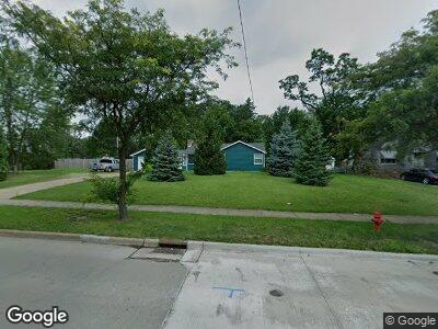
5600 Dunham Rd Maple Heights, OH 44137
Estimated Value: $137,000 - $154,000
2
Beds
2
Baths
1,182
Sq Ft
$123/Sq Ft
Est. Value
About This Home
This home is located at 5600 Dunham Rd, Maple Heights, OH 44137 and is currently estimated at $145,694, approximately $123 per square foot. 5600 Dunham Rd is a home located in Cuyahoga County with nearby schools including Abraham Lincoln Elementary School, Rockside/ J.F. Kennedy School, and Barack Obama School.
Ownership History
Date
Name
Owned For
Owner Type
Purchase Details
Closed on
Jul 12, 2001
Sold by
Filips Gerald L and Filips Donald A
Bought by
Fox Monty W
Current Estimated Value
Home Financials for this Owner
Home Financials are based on the most recent Mortgage that was taken out on this home.
Original Mortgage
$77,000
Interest Rate
7.27%
Purchase Details
Closed on
Aug 26, 1994
Sold by
Filips Theresa Ann
Bought by
Filips Brothers Const Co
Purchase Details
Closed on
Jan 1, 1975
Bought by
Filips Theresa A
Create a Home Valuation Report for This Property
The Home Valuation Report is an in-depth analysis detailing your home's value as well as a comparison with similar homes in the area
Home Values in the Area
Average Home Value in this Area
Purchase History
| Date | Buyer | Sale Price | Title Company |
|---|---|---|---|
| Fox Monty W | $91,500 | City Title Company Agency In | |
| Filips Brothers Const Co | $71,700 | -- | |
| Filips Theresa A | -- | -- |
Source: Public Records
Mortgage History
| Date | Status | Borrower | Loan Amount |
|---|---|---|---|
| Open | Fox Monty W | $40,000 | |
| Closed | Fox Monty W | $20,000 | |
| Closed | Fox Monty W | $4,400 | |
| Closed | Fox Monty W | $77,000 |
Source: Public Records
Tax History Compared to Growth
Tax History
| Year | Tax Paid | Tax Assessment Tax Assessment Total Assessment is a certain percentage of the fair market value that is determined by local assessors to be the total taxable value of land and additions on the property. | Land | Improvement |
|---|---|---|---|---|
| 2024 | $4,791 | $50,645 | $18,550 | $32,095 |
| 2023 | $3,084 | $26,110 | $15,330 | $10,780 |
| 2022 | $3,074 | $26,110 | $15,330 | $10,780 |
| 2021 | $3,259 | $26,110 | $15,330 | $10,780 |
| 2020 | $2,825 | $19,780 | $11,620 | $8,160 |
| 2019 | $2,787 | $56,500 | $33,200 | $23,300 |
| 2018 | $2,679 | $19,780 | $11,620 | $8,160 |
| 2017 | $2,791 | $19,500 | $9,520 | $9,980 |
| 2016 | $2,679 | $19,500 | $9,520 | $9,980 |
| 2015 | $2,534 | $19,500 | $9,520 | $9,980 |
| 2014 | $2,534 | $20,090 | $9,800 | $10,290 |
Source: Public Records
Map
Nearby Homes
- 14818 Kennerdown Ave
- 14819 Tabor Ave
- 5515 Dunham Rd
- 14504 Kennerdown Ave
- 14501 Kennerdown Ave
- 15705 Fernway Dr
- 15705 Benhoff Dr
- 14315 Tokay Ave
- 14405 Corridon Ave
- 15500 Maplewood Ave
- 14206 Reddington Ave
- 14206 Krems Ave
- 15613 Maplewood Ave
- 15800 Northwood Ave
- 14608 Rockside Rd
- 15812 Northwood Ave
- 15818 Maplewood Ave
- 14204 Rockside Rd
- 13729 Thraves Ave
- 13812 York Blvd
- 5600 Dunham Rd
- 5590 Dunham Rd
- 5606 Dunham Rd
- 5580 Dunham Rd
- 15105 Krems Ave
- 15103 Krems Ave
- 5599 Dunham Rd
- 5601 Dunham Rd
- 15019 Krems Ave
- 5607 Dunham Rd
- 5589 Dunham Rd
- 15015 Krems Ave
- 5585 Dunham Rd
- 5611 Dunham Rd
- 5570 Dunham Rd
- 15009 Krems Ave
- 5626 Dunham Rd
- 5615 Dunham Rd
- 15300 Fernway Dr
- 5619 Dunham Rd