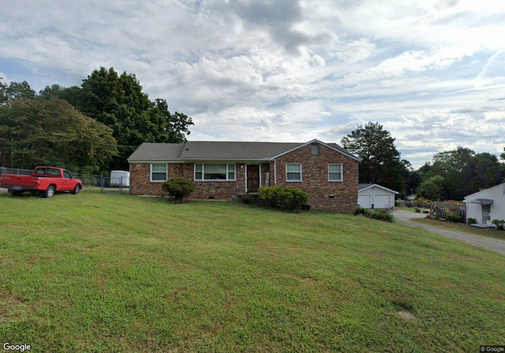
5600 Paula Rd Knoxville, TN 37912
Uptown Knoxville NeighborhoodEstimated Value: $291,000 - $367,000
3
Beds
2
Baths
1,800
Sq Ft
$181/Sq Ft
Est. Value
About This Home
This home is located at 5600 Paula Rd, Knoxville, TN 37912 and is currently estimated at $325,279, approximately $180 per square foot. 5600 Paula Rd is a home located in Knox County with nearby schools including Sterchi Elementary School, Gresham Middle School, and Central High School.
Ownership History
Date
Name
Owned For
Owner Type
Purchase Details
Closed on
Jun 8, 2021
Sold by
Greene Wilda Alva
Bought by
Greene Wilda Alba and Greene 2004 Revocab Wilda Alva
Current Estimated Value
Purchase Details
Closed on
Dec 29, 2008
Sold by
Federal National Mortgage Association
Bought by
Greene Wilda A
Purchase Details
Closed on
Sep 30, 2008
Sold by
Balch Charles R and Balch Doris A
Bought by
Federal National Mortgage Association
Create a Home Valuation Report for This Property
The Home Valuation Report is an in-depth analysis detailing your home's value as well as a comparison with similar homes in the area
Home Values in the Area
Average Home Value in this Area
Purchase History
| Date | Buyer | Sale Price | Title Company |
|---|---|---|---|
| Greene Wilda Alba | -- | First Priority Title Co Inc | |
| Greene Wilda A | $95,000 | First Priority Title Co Inc | |
| Federal National Mortgage Association | $131,168 | None Available |
Source: Public Records
Tax History Compared to Growth
Tax History
| Year | Tax Paid | Tax Assessment Tax Assessment Total Assessment is a certain percentage of the fair market value that is determined by local assessors to be the total taxable value of land and additions on the property. | Land | Improvement |
|---|---|---|---|---|
| 2024 | $1,220 | $53,500 | $0 | $0 |
| 2023 | $1,984 | $53,500 | $0 | $0 |
| 2022 | $1,984 | $53,500 | $0 | $0 |
| 2021 | $1,751 | $38,200 | $0 | $0 |
| 2020 | $1,751 | $38,200 | $0 | $0 |
| 2019 | $1,751 | $38,200 | $0 | $0 |
| 2018 | $1,751 | $38,200 | $0 | $0 |
| 2017 | $1,751 | $38,200 | $0 | $0 |
| 2016 | $1,447 | $0 | $0 | $0 |
| 2015 | $1,447 | $0 | $0 | $0 |
| 2014 | $1,447 | $0 | $0 | $0 |
Source: Public Records
Map
Nearby Homes
- 5614 Wassman Rd
- 0 Oaklett Dr Unit 1284831
- 1100 Cedar Ln
- 1115 W Parkway Ave
- 1501 Cedar Ln
- 5800 Parkdale Rd
- 1044 W Parkway Ave
- 1021 Fair Dr
- 805 Cedar Ln Unit C10
- 715 Cedar Ln Unit 118
- 715 Cedar Ln Unit 129
- 1708 Uppingham Dr
- 5415 Lynnette Dr
- 1716 Doningham Dr
- 847 Sterchi Park Way Unit H847
- 1515 Charles Dr
- 1712 Fair Dr
- 1703 Charles Dr NE
- 0 Rifle Range Dr Unit 1294861
- 809 Highland Dr
- 5604 Paula Rd
- 5516 Paula Rd
- 5601 Wassman Rd
- 5517 Wassman Rd
- 5605 Wassman Rd
- 5608 Paula Rd
- 5601 Paula Rd
- 5512 Paula Rd
- 5517 Paula Rd
- 5605 Paula Rd
- 5513 Wassman Rd Unit 1
- 5609 Wassman Rd
- 5513 Paula Rd
- 5609 Paula Rd
- 5612 Paula Rd
- 5507 Wassman Rd
- 5506 Paula Rd
- 5613 Wassman Rd
- 5509 Paula Rd
- 5613 Paula Rd NE