5601 Guy Rd Anderson, SC 29625
Estimated Value: $526,000 - $748,000
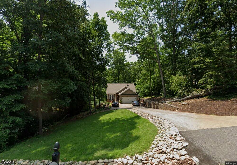
About This Home
This home is located at 5601 Guy Rd, Anderson, SC 29625 and is currently estimated at $643,949, approximately $268 per square foot. 5601 Guy Rd is a home with nearby schools including Pendleton High School.
Ownership History
We collect this data history from publicly available records. To have your information removed, we recommend requesting removal directly through your county’s website.
Purchase Details
Home Financials for this Owner
Home Financials are based on the most recent Mortgage that was taken out on this home.Purchase Details
Home Values in the Area
Average Home Value in this Area
Purchase History
We collect this data history from publicly available records. To have your information removed, we recommend requesting removal directly through your county’s website.
| Date | Buyer | Sale Price | Title Company |
|---|---|---|---|
| $465,000 | None Available | ||
| $40,000 | -- |
Mortgage History
We collect this data history from publicly available records. To have your information removed, we recommend requesting removal directly through your county’s website.
| Date | Status | Borrower | Loan Amount |
|---|---|---|---|
| Closed | $43,500 | ||
| Open | $372,000 |
Tax History
We collect this data history from publicly available records. To have your information removed, we recommend requesting removal directly through your county’s website.
| Year | Tax Paid | Tax Assessment Tax Assessment Total Assessment is a certain percentage of the fair market value that is determined by local assessors to be the total taxable value of land and additions on the property. | Land | Improvement |
|---|---|---|---|---|
| 2025 | $2,541 | $18,840 | $7,700 | $11,140 |
| 2024 | $2,541 | $18,840 | $7,700 | $11,140 |
| 2023 | $2,526 | $18,840 | $7,700 | $11,140 |
| 2022 | $2,235 | $18,840 | $7,700 | $11,140 |
| 2021 | $1,939 | $14,060 | $5,200 | $8,860 |
| 2020 | $1,911 | $14,060 | $5,200 | $8,860 |
| 2019 | $1,911 | $14,060 | $5,200 | $8,860 |
| 2018 | $1,926 | $14,060 | $5,200 | $8,860 |
| 2017 | -- | $14,060 | $5,200 | $8,860 |
| 2016 | $1,850 | $13,460 | $5,000 | $8,460 |
| 2015 | $1,862 | $13,460 | $5,000 | $8,460 |
| 2014 | $1,925 | $13,460 | $5,000 | $8,460 |
Map
- 1021 Arrowhead Point
- Lot 107 Robinhood Rd
- Lot 113 Sky Ln
- Lot 94 Sky Ln
- 150 Sky Ln
- Cann Rd
- Tract A Cann Rd
- Tract B Cann Rd
- 124 James Dr
- 360 Cann Rd
- 117 Horton Rd
- 105 Horton Rd
- 146 Sky Ln
- 207 Turk Rd
- 108 Grindstone Way
- 149 Inlet Pointe Dr
- 215 Inlet Pointe Dr
- 5531 Highway 187
- 122 Paradise Cir
- 248 Inlet Pointe Dr
Ask me questions while you tour the home.