Estimated Value: $837,000 - $915,000
4
Beds
3
Baths
2,146
Sq Ft
$407/Sq Ft
Est. Value
About This Home
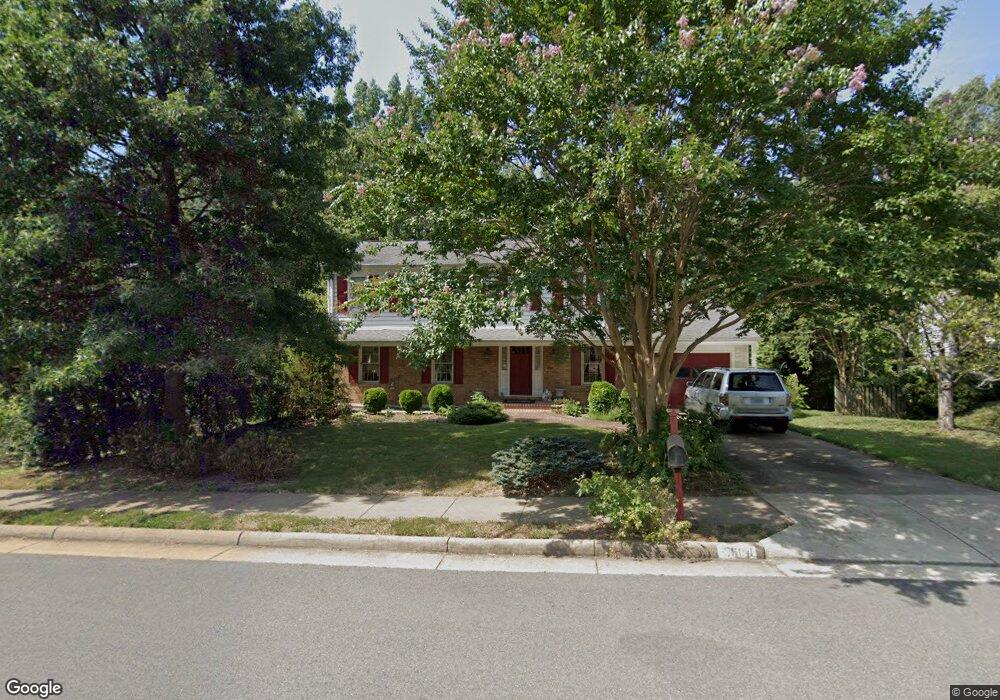
This home is located at 5604 Fort Corloran Dr, Burke, VA 22015 and is currently estimated at $872,861, approximately $406 per square foot. 5604 Fort Corloran Dr is a home located in Fairfax County with nearby schools including Ravensworth Elementary School, Lake Braddock Secondary School, and Holy Spirit School.
Ownership History
Date
Name
Owned For
Owner Type
Purchase Details
Closed on
Apr 6, 1983
Bought by
Rochester Lois F
Current Estimated Value
Create a Home Valuation Report for This Property
The Home Valuation Report is an in-depth analysis detailing your home's value as well as a comparison with similar homes in the area
Home Values in the Area
Average Home Value in this Area
Purchase History
| Date | Buyer | Sale Price | Title Company |
|---|---|---|---|
| Rochester Lois F | -- | -- |
Source: Public Records
Tax History Compared to Growth
Tax History
| Year | Tax Paid | Tax Assessment Tax Assessment Total Assessment is a certain percentage of the fair market value that is determined by local assessors to be the total taxable value of land and additions on the property. | Land | Improvement |
|---|---|---|---|---|
| 2025 | $9,459 | $840,310 | $340,000 | $500,310 |
| 2024 | $9,459 | $768,590 | $300,000 | $468,590 |
| 2023 | $9,164 | $768,590 | $300,000 | $468,590 |
| 2022 | $8,593 | $709,900 | $280,000 | $429,900 |
| 2021 | $8,122 | $658,060 | $260,000 | $398,060 |
| 2020 | $7,651 | $615,190 | $250,000 | $365,190 |
| 2019 | $7,510 | $602,030 | $244,000 | $358,030 |
| 2018 | $6,492 | $564,480 | $239,000 | $325,480 |
| 2017 | $6,817 | $557,480 | $232,000 | $325,480 |
| 2016 | $6,612 | $541,000 | $225,000 | $316,000 |
| 2015 | $6,383 | $541,000 | $225,000 | $316,000 |
| 2014 | $6,139 | $520,330 | $225,000 | $295,330 |
Source: Public Records
Map
Nearby Homes
- 5639 Fort Corloran Dr
- 5613 Mount Burnside Way
- 9009 Digory Ct
- 5511 Callander Dr
- 9001 Fox Lair Dr
- 5801 Boothe Dr
- 5835 Fitzhugh St
- 9104 Parliament Dr
- 5809 Shana Place
- 5848 Kara Place
- 9816 Pebble Weigh Ct
- 8909 Victoria Rd
- 5823 Royal Ridge Dr Unit S
- 5901 Kara Place
- 5809 Royal Ridge Dr Unit I
- 8530 Barrington Ct Unit 938
- 6010 Timber Hollow Ln
- 9060 Brook Ford Rd
- 5800 Torington Dr Unit 836
- 5816 Torington Dr Unit 860
- 5606 Fort Corloran Dr
- 5602 Fort Corloran Dr
- 5608 Fort Corloran Dr
- 5605 Fort Corloran Dr
- 8913 Lake Braddock Dr
- 5607 Fort Corloran Dr
- 5603 Fort Corloran Dr
- 5607 General Banks Ct
- 5605 General Banks Ct
- 8915 Lake Braddock Dr
- 5611 Fort Corloran Dr
- 8909 Lake Braddock Dr
- 5610 Fort Corloran Dr
- 5603 General Banks Ct
- 8917 Lake Braddock Dr
- 5621 Point Roundtop Ct
- 5606 General Banks Ct
- 5613 Fort Corloran Dr
- 8907 Lake Braddock Dr
- 5624 Point Roundtop Ct