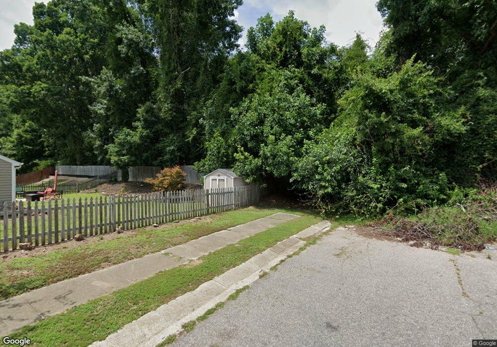
5604 Kyle Dr Raleigh, NC 27616
Northeast Raleigh NeighborhoodEstimated Value: $337,000 - $5,921,860
--
Bed
--
Bath
1,249
Sq Ft
$2,506/Sq Ft
Est. Value
About This Home
This home is located at 5604 Kyle Dr, Raleigh, NC 27616 and is currently estimated at $3,129,430, approximately $2,505 per square foot. 5604 Kyle Dr is a home located in Wake County with nearby schools including River Bend Elementary, River Bend Middle, and Rolesville High School.
Ownership History
Date
Name
Owned For
Owner Type
Purchase Details
Closed on
Jul 17, 2022
Sold by
Buffaloe Associates Llc
Bought by
Trigate-Suncrest Buffaloe Road Llc
Current Estimated Value
Purchase Details
Closed on
Jul 11, 2006
Sold by
Buffaloe Associates Llc
Bought by
The John F Philips Family Lp and Clifton L Benson Jr Family Lp
Purchase Details
Closed on
Aug 22, 2002
Sold by
Buffaloe Associates
Bought by
Robuck Properties Llc and The John F Philips Family Lp
Purchase Details
Closed on
Apr 16, 1985
Bought by
Benson Clifton L and Dickens Page Benson
Create a Home Valuation Report for This Property
The Home Valuation Report is an in-depth analysis detailing your home's value as well as a comparison with similar homes in the area
Home Values in the Area
Average Home Value in this Area
Purchase History
| Date | Buyer | Sale Price | Title Company |
|---|---|---|---|
| Trigate-Suncrest Buffaloe Road Llc | -- | None Listed On Document | |
| The John F Philips Family Lp | -- | None Available | |
| Robuck Properties Llc | -- | None Available | |
| Robuck Properties Llc | -- | -- | |
| Benson Clifton L | $478,500 | -- |
Source: Public Records
Tax History Compared to Growth
Tax History
| Year | Tax Paid | Tax Assessment Tax Assessment Total Assessment is a certain percentage of the fair market value that is determined by local assessors to be the total taxable value of land and additions on the property. | Land | Improvement |
|---|---|---|---|---|
| 2025 | $34,437 | $5,381,044 | $5,376,540 | $4,504 |
| 2024 | $33,436 | $5,381,044 | $5,376,540 | $4,504 |
| 2023 | $34,976 | $4,483,286 | $4,480,450 | $2,836 |
| 2022 | $16,499 | $4,483,286 | $4,480,450 | $2,836 |
| 2021 | $16,054 | $4,483,286 | $4,480,450 | $2,836 |
| 2020 | $15,787 | $4,483,286 | $4,480,450 | $2,836 |
| 2019 | $23,055 | $5,538,410 | $5,530,245 | $8,165 |
| 2018 | $21,185 | $5,538,410 | $5,530,245 | $8,165 |
| 2017 | $20,074 | $5,538,410 | $5,530,245 | $8,165 |
| 2016 | $19,665 | $5,538,410 | $5,530,245 | $8,165 |
| 2015 | $18,925 | $5,333,105 | $5,325,400 | $7,705 |
| 2014 | $17,932 | $5,333,105 | $5,325,400 | $7,705 |
Source: Public Records
Map
Nearby Homes
- 5500 Scenic Brook Ln
- 5200 Fieldwood Ct
- 4804 Spring Forest Rd
- 5012 Silverdene St
- 5325 Marthonna Way
- 4800 Arbor Lodge Dr
- 4905 Will-O-dean Rd
- 4945 Abundance Ave
- 5708 Sea Fox Ct
- 6205 Remington Lake Dr
- 4625 Fox Rd
- 5321 Glass Ridge Rd
- 4804 Tolley Ct
- 6112 Balance Ct
- 6414 Astor Elgin St
- 5915 River Landings Dr
- 4804 Sinclair Dr
- 5216 Invention Way
- 5320 Spring Pines Way
- 5217 Invention Way
- 5305 Mallard Grove Dr
- 5301 Mallard Grove Dr
- 5309 Mallard Grove Dr
- 5239 Mallard Grove Dr
- 5235 Mallard Grove Dr
- 5315 Mallard Grove Dr
- LOT 31 Mallard Grove Dr
- 5319 Mallard Grove Dr
- 5300 Mallard Grove Dr
- 5304 Mallard Grove Dr
- 5308 Mallard Grove Dr
- 5323 Mallard Grove Dr
- 5238 Mallard Grove Dr
- 5312 Mallard Grove Dr
- 5327 Mallard Grove Dr
- 5316 Mallard Grove Dr
- 5234 Mallard Grove Dr
- 5231 Mallard Grove Dr
- 5230 Mallard Grove Dr
- 5320 Mallard Grove Dr
