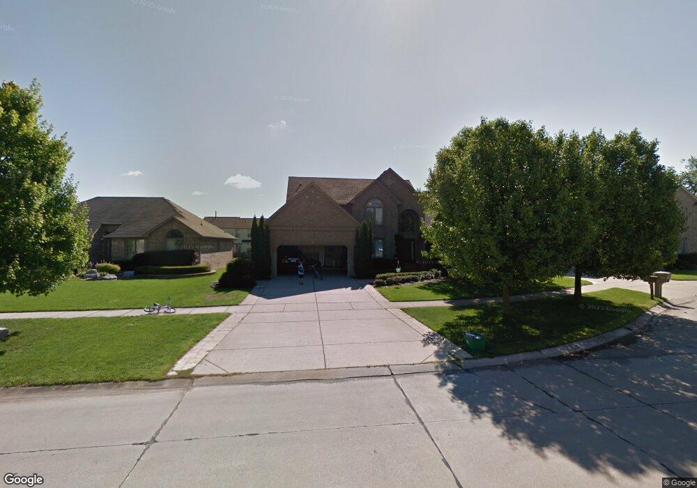
56048 Saint Andrews Dr Macomb, MI 48042
Estimated Value: $498,867 - $603,000
--
Bed
1
Bath
2,902
Sq Ft
$187/Sq Ft
Est. Value
About This Home
This home is located at 56048 Saint Andrews Dr, Macomb, MI 48042 and is currently estimated at $542,717, approximately $187 per square foot. 56048 Saint Andrews Dr is a home located in Macomb County with nearby schools including Beacon Tree Elementary School, Shelby Junior High School, and Eisenhower High School.
Ownership History
Date
Name
Owned For
Owner Type
Purchase Details
Closed on
Jun 17, 2019
Sold by
Cihone Ralph and Cihone Melinda
Bought by
Cihone Ralph
Current Estimated Value
Home Financials for this Owner
Home Financials are based on the most recent Mortgage that was taken out on this home.
Original Mortgage
$234,000
Outstanding Balance
$205,743
Interest Rate
4.1%
Mortgage Type
New Conventional
Estimated Equity
$336,974
Purchase Details
Closed on
Jan 27, 2006
Sold by
Brown Lester G and Brown Sharon L
Bought by
Cihone Ralph and Cihone Melinda
Create a Home Valuation Report for This Property
The Home Valuation Report is an in-depth analysis detailing your home's value as well as a comparison with similar homes in the area
Home Values in the Area
Average Home Value in this Area
Purchase History
| Date | Buyer | Sale Price | Title Company |
|---|---|---|---|
| Cihone Ralph | -- | None Available | |
| Cihone Ralph | $325,000 | Metropolitan Title Company |
Source: Public Records
Mortgage History
| Date | Status | Borrower | Loan Amount |
|---|---|---|---|
| Open | Cihone Ralph | $234,000 |
Source: Public Records
Tax History Compared to Growth
Tax History
| Year | Tax Paid | Tax Assessment Tax Assessment Total Assessment is a certain percentage of the fair market value that is determined by local assessors to be the total taxable value of land and additions on the property. | Land | Improvement |
|---|---|---|---|---|
| 2025 | $4,603 | $235,400 | $0 | $0 |
| 2024 | $2,979 | $230,300 | $0 | $0 |
| 2023 | $2,822 | $209,800 | $0 | $0 |
| 2022 | $4,172 | $188,300 | $0 | $0 |
| 2021 | $4,060 | $178,200 | $0 | $0 |
| 2020 | $2,597 | $174,600 | $0 | $0 |
| 2019 | $3,731 | $165,600 | $0 | $0 |
| 2018 | $3,678 | $162,500 | $0 | $0 |
| 2017 | $3,630 | $157,290 | $34,500 | $122,790 |
| 2016 | $3,421 | $157,290 | $0 | $0 |
| 2015 | $3,380 | $146,830 | $0 | $0 |
| 2014 | $3,380 | $130,120 | $23,500 | $106,620 |
| 2013 | $2,160 | $130,120 | $0 | $0 |
Source: Public Records
Map
Nearby Homes
- 17541 Stallman Dr Unit 89
- 55841 Jones Dr Unit 114
- 17829 Stallman Dr
- 17524 Stallman Dr
- 55809 Jones Dr Unit 113
- 17492 Stallman Dr
- 55802 Jones Dr
- 17413 Stallman Dr Unit 85
- 55777 Jones Dr
- 17381 Stallman Dr
- 17835 Player Dr
- 56098 Walker Ct
- 17349 Stallman Dr
- 17447 Megan Dr
- 17332 Stallman Dr
- 18005 Player Dr
- 17221 Stallman Dr
- 18037 Player Dr
- 17317 Megan Dr Unit 45
- 18064 Stallman Dr
- 56076 Saint Andrews Dr
- 56020 Saint Andrews Dr
- 56076 St Andrews
- 56020 St Andrews Dr
- 56065 Skyline Dr
- 56091 Skyline Dr
- 56041 Skyline Dr
- 56104 Saint Andrews Dr
- 17684 Augusta Dr
- 17599 Augusta Dr
- 56117 Skyline Dr
- 17650 Augusta Dr
- 56017 Skyline Dr
- 17596 Country Club Dr
- 17616 Augusta Dr
- 17565 Augusta Dr
- 17771 Bayside Dr
- 17582 Augusta Dr
- 17564 Country Club Dr
- 57401 RAY CENTER Country Club Dr