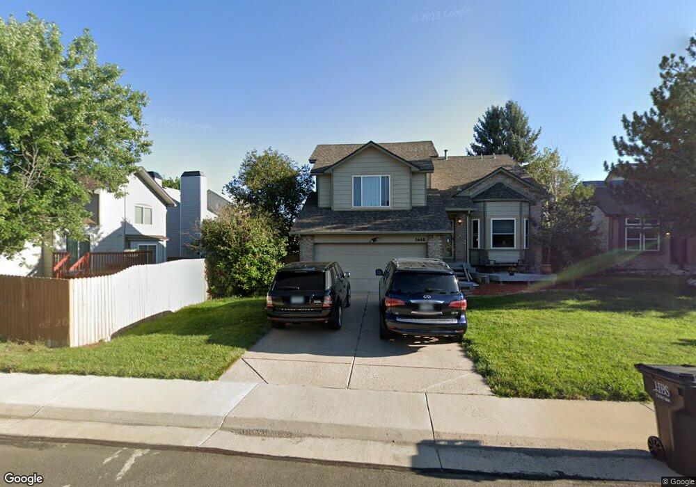
5608 E Prescott Ave Castle Rock, CO 80104
Founders Village NeighborhoodEstimated Value: $511,000 - $542,000
3
Beds
3
Baths
1,763
Sq Ft
$297/Sq Ft
Est. Value
About This Home
This home is located at 5608 E Prescott Ave, Castle Rock, CO 80104 and is currently estimated at $523,613, approximately $297 per square foot. 5608 E Prescott Ave is a home located in Douglas County with nearby schools including Rock Ridge Elementary School, Mesa Middle School, and Douglas County High School.
Ownership History
Date
Name
Owned For
Owner Type
Purchase Details
Closed on
Jan 29, 2001
Sold by
Jon Ricky and Wass Jolene Patric
Bought by
Moore Christopher T and Moore Kindra K
Current Estimated Value
Home Financials for this Owner
Home Financials are based on the most recent Mortgage that was taken out on this home.
Original Mortgage
$186,079
Outstanding Balance
$67,466
Interest Rate
7.13%
Mortgage Type
FHA
Estimated Equity
$456,147
Purchase Details
Closed on
Dec 27, 1985
Sold by
Richmond Belmont Ltd
Bought by
Wass Ricky Jon and Wass Jolene Patric
Create a Home Valuation Report for This Property
The Home Valuation Report is an in-depth analysis detailing your home's value as well as a comparison with similar homes in the area
Home Values in the Area
Average Home Value in this Area
Purchase History
| Date | Buyer | Sale Price | Title Company |
|---|---|---|---|
| Moore Christopher T | $189,000 | Land Title | |
| Wass Ricky Jon | $100,300 | -- |
Source: Public Records
Mortgage History
| Date | Status | Borrower | Loan Amount |
|---|---|---|---|
| Open | Moore Christopher T | $186,079 |
Source: Public Records
Tax History Compared to Growth
Tax History
| Year | Tax Paid | Tax Assessment Tax Assessment Total Assessment is a certain percentage of the fair market value that is determined by local assessors to be the total taxable value of land and additions on the property. | Land | Improvement |
|---|---|---|---|---|
| 2024 | $5,439 | $36,790 | $8,670 | $28,120 |
| 2023 | $5,471 | $36,790 | $8,670 | $28,120 |
| 2022 | $4,107 | $25,940 | $6,370 | $19,570 |
| 2021 | $4,186 | $25,940 | $6,370 | $19,570 |
| 2020 | $3,937 | $25,130 | $5,360 | $19,770 |
| 2019 | $3,939 | $25,130 | $5,360 | $19,770 |
| 2018 | $3,301 | $20,900 | $4,140 | $16,760 |
| 2017 | $3,178 | $20,900 | $4,140 | $16,760 |
| 2016 | $2,720 | $18,680 | $3,990 | $14,690 |
| 2015 | $2,755 | $18,680 | $3,990 | $14,690 |
| 2014 | $2,286 | $14,880 | $3,420 | $11,460 |
Source: Public Records
Map
Nearby Homes
- 5617 E Prescott Ave
- 613 N Brentwood Ct
- 330 N Wagonwheel Trail
- 5521 Spruce Ave
- 5939 Still Meadow Place
- 5938 Still Meadow Place
- 364 N Willow St
- 109 N Quicksilver Ave
- 5326 E Howe St
- 5323 E Sandpiper Ave
- 650 Howe Cir
- 535 Howe St
- 157 S Quicksilver Ave
- 612 Blue Teal Dr
- 950 Sundown Dr
- 718 Blue Teal Dr
- 107 S Edge Cliff St
- 1273 N Heritage Ave
- 132 Vista Canyon Dr
- 176 S Pembrook St
- 5612 E Prescott Ave
- 606 N Bentley St
- 610 N Bentley St
- 614 N Bentley St
- 5616 E Prescott Ave
- 617 N Brentwood Ct
- 5609 E Prescott Ave
- 609 N Brentwood Ct
- 5605 E Prescott Ave
- 5613 E Prescott Ave
- 5620 E Prescott Ave
- 5621 E Prescott Ave
- 5601 E Prescott Ave
- 622 N Bentley St
- 5516 E Prescott Ave
- 612 N Brentwood Ct
- 621 N Brentwood Ct
- 611 N Bentley St
- 5519 E Prescott Ave
- 615 N Bentley St