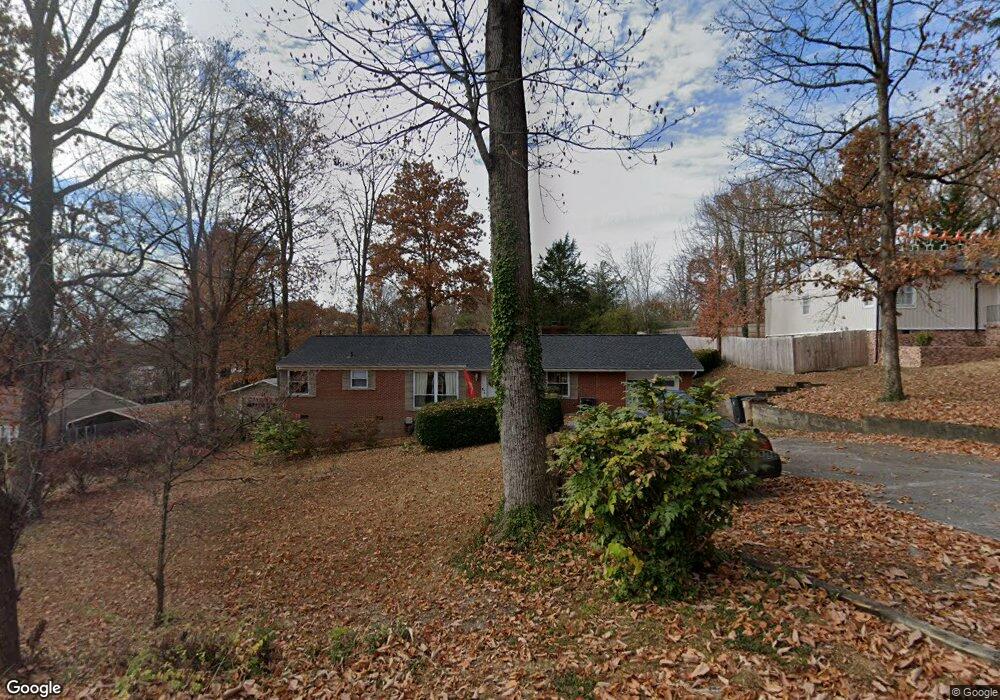
5609 Wassman Rd Knoxville, TN 37912
Uptown Knoxville NeighborhoodEstimated Value: $295,000 - $346,000
3
Beds
1
Bath
1,725
Sq Ft
$185/Sq Ft
Est. Value
About This Home
This home is located at 5609 Wassman Rd, Knoxville, TN 37912 and is currently estimated at $319,764, approximately $185 per square foot. 5609 Wassman Rd is a home located in Knox County with nearby schools including Sterchi Elementary School, Gresham Middle School, and Central High School.
Ownership History
Date
Name
Owned For
Owner Type
Purchase Details
Closed on
Feb 2, 1999
Sold by
Anne Jones Deborah and Jones Deborah Anne
Bought by
Welch William E and Welch Deborah Jones
Current Estimated Value
Home Financials for this Owner
Home Financials are based on the most recent Mortgage that was taken out on this home.
Original Mortgage
$80,000
Outstanding Balance
$19,114
Interest Rate
6.85%
Mortgage Type
Purchase Money Mortgage
Estimated Equity
$300,650
Purchase Details
Closed on
Nov 14, 1994
Sold by
Marsha Haas
Bought by
Anne Jones Deborah
Create a Home Valuation Report for This Property
The Home Valuation Report is an in-depth analysis detailing your home's value as well as a comparison with similar homes in the area
Home Values in the Area
Average Home Value in this Area
Purchase History
| Date | Buyer | Sale Price | Title Company |
|---|---|---|---|
| Welch William E | -- | Title Professionals Inc | |
| Anne Jones Deborah | $62,900 | -- |
Source: Public Records
Mortgage History
| Date | Status | Borrower | Loan Amount |
|---|---|---|---|
| Open | Welch William E | $80,000 |
Source: Public Records
Tax History Compared to Growth
Tax History
| Year | Tax Paid | Tax Assessment Tax Assessment Total Assessment is a certain percentage of the fair market value that is determined by local assessors to be the total taxable value of land and additions on the property. | Land | Improvement |
|---|---|---|---|---|
| 2024 | $1,055 | $48,950 | $0 | $0 |
| 2023 | $1,055 | $48,950 | $0 | $0 |
| 2022 | $1,816 | $48,950 | $0 | $0 |
| 2021 | $1,389 | $30,300 | $0 | $0 |
| 2020 | $1,389 | $30,300 | $0 | $0 |
| 2019 | $1,389 | $30,300 | $0 | $0 |
| 2018 | $1,389 | $30,300 | $0 | $0 |
| 2017 | $1,389 | $30,300 | $0 | $0 |
| 2016 | $1,214 | $0 | $0 | $0 |
| 2015 | $1,214 | $0 | $0 | $0 |
| 2014 | $1,214 | $0 | $0 | $0 |
Source: Public Records
Map
Nearby Homes
- 5614 Wassman Rd
- 0 Oaklett Dr Unit 1284831
- 1100 Cedar Ln
- 1115 W Parkway Ave
- 1501 Cedar Ln
- 5800 Parkdale Rd
- 1044 W Parkway Ave
- 1021 Fair Dr
- 805 Cedar Ln Unit C10
- 715 Cedar Ln Unit 118
- 715 Cedar Ln Unit 129
- 1708 Uppingham Dr
- 5415 Lynnette Dr
- 1716 Doningham Dr
- 847 Sterchi Park Way Unit H847
- 1515 Charles Dr
- 1712 Fair Dr
- 1703 Charles Dr NE
- 0 Rifle Range Dr Unit 1294861
- 809 Highland Dr
- 5605 Wassman Rd
- 5613 Wassman Rd
- 5608 Paula Rd
- 5601 Wassman Rd
- 5612 Paula Rd
- 5604 Paula Rd
- 5617 Wassman Rd
- 5608 Wassman Rd
- 5612 Wassman Rd
- 5616 Paula Rd
- 5600 Paula Rd
- 5604 Wassman Rd
- 5517 Wassman Rd
- 5701 Wassman Rd
- 5600 Wassman Rd
- 5700 Paula Rd
- 5516 Paula Rd
- 5700 Wassman Rd
- 5609 Paula Rd
- 5613 Paula Rd NE