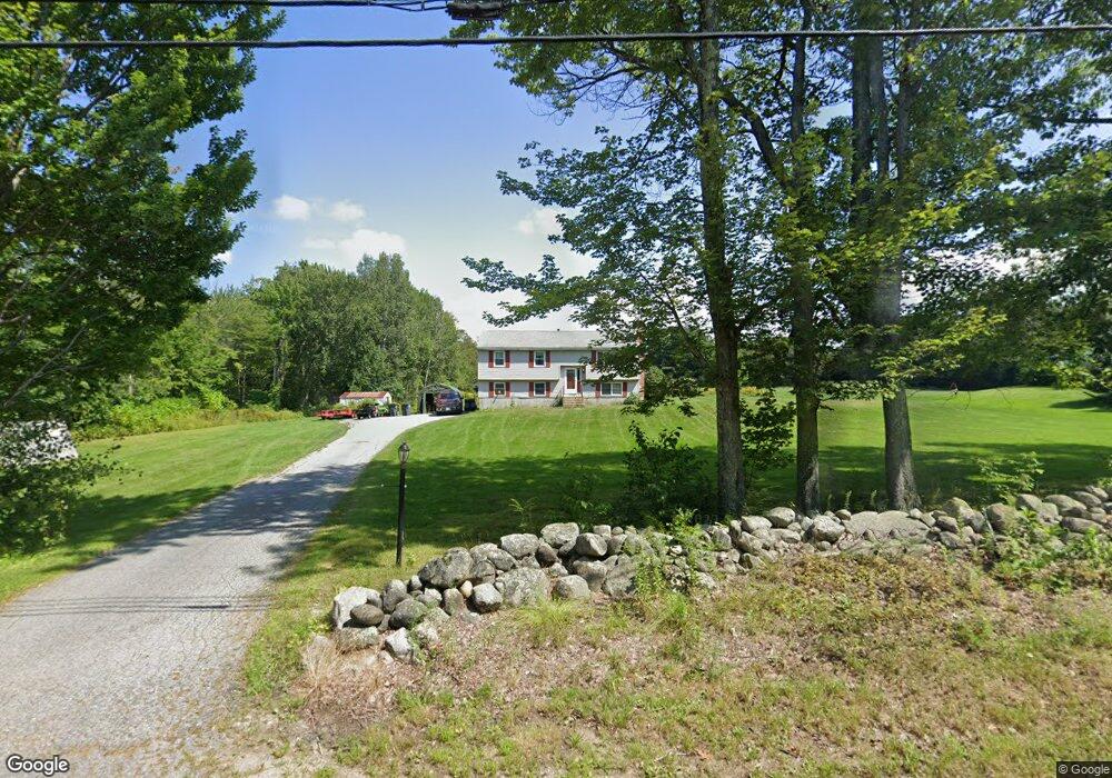
561 4th Range Rd Pembroke, NH 03275
Estimated Value: $368,000 - $518,000
3
Beds
1
Bath
1,085
Sq Ft
$406/Sq Ft
Est. Value
About This Home
This home is located at 561 4th Range Rd, Pembroke, NH 03275 and is currently estimated at $440,634, approximately $406 per square foot. 561 4th Range Rd is a home located in Merrimack County with nearby schools including Pembroke Hill School, Pembroke Village School, and Three Rivers School.
Ownership History
Date
Name
Owned For
Owner Type
Purchase Details
Closed on
Aug 24, 2015
Sold by
Casker Lynn L
Bought by
Faucher Karen and Tardif Stephen
Current Estimated Value
Home Financials for this Owner
Home Financials are based on the most recent Mortgage that was taken out on this home.
Original Mortgage
$222,888
Outstanding Balance
$175,538
Interest Rate
4.07%
Mortgage Type
FHA
Estimated Equity
$265,096
Purchase Details
Closed on
Oct 1, 2014
Sold by
Levasseur Denis R and Levasseur Chantal J
Bought by
Casker Lynn L
Purchase Details
Closed on
Aug 3, 2004
Sold by
Schofield Faith
Bought by
Levasseur Denis R and Levasseur Chantal J
Purchase Details
Closed on
Jul 30, 1998
Sold by
Dupee Matthew S
Bought by
Scofield Faith I
Create a Home Valuation Report for This Property
The Home Valuation Report is an in-depth analysis detailing your home's value as well as a comparison with similar homes in the area
Home Values in the Area
Average Home Value in this Area
Purchase History
| Date | Buyer | Sale Price | Title Company |
|---|---|---|---|
| Faucher Karen | $227,000 | -- | |
| Faucher Karen | $227,000 | -- | |
| Casker Lynn L | $216,000 | -- | |
| Casker Lynn L | $216,000 | -- | |
| Levasseur Denis R | $219,900 | -- | |
| Levasseur Denis R | $219,900 | -- | |
| Scofield Faith I | $106,900 | -- | |
| Scofield Faith I | $106,900 | -- |
Source: Public Records
Mortgage History
| Date | Status | Borrower | Loan Amount |
|---|---|---|---|
| Open | Scofield Faith I | $222,888 | |
| Closed | Scofield Faith I | $222,888 |
Source: Public Records
Tax History Compared to Growth
Tax History
| Year | Tax Paid | Tax Assessment Tax Assessment Total Assessment is a certain percentage of the fair market value that is determined by local assessors to be the total taxable value of land and additions on the property. | Land | Improvement |
|---|---|---|---|---|
| 2024 | $6,717 | $342,000 | $138,000 | $204,000 |
| 2023 | $6,306 | $226,200 | $90,900 | $135,300 |
| 2022 | $5,632 | $226,200 | $90,900 | $135,300 |
| 2021 | $5,429 | $226,200 | $90,900 | $135,300 |
| 2020 | $5,565 | $226,200 | $90,900 | $135,300 |
| 2019 | $5,334 | $226,200 | $90,900 | $135,300 |
| 2018 | $5,198 | $198,100 | $83,000 | $115,100 |
| 2017 | $5,895 | $198,100 | $83,000 | $115,100 |
| 2015 | $5,018 | $173,400 | $74,200 | $99,200 |
| 2014 | $5,150 | $173,400 | $74,200 | $99,200 |
| 2011 | $4,979 | $188,300 | $82,100 | $106,200 |
Source: Public Records
Map
Nearby Homes
- 348 Brickett Hill Rd Unit 3
- 344 Brickett Hill Rd Unit 2
- 344 Brickett Hill Rd
- 340 Brickett Hill Rd
- 245 Beacon Hill Rd Unit B
- 401 Sixth Range Rd
- 509 Ashley Dr
- 203 Brickett Hill Rd
- 455 Carrie Ave
- 667 Borough Rd
- 425 Grady Ln Unit 28
- 412 Deerpath Ln
- 452 Blane Cir Unit 45
- 441 Blane Cir Unit 12
- 91 Whittemore Rd
- 440 Micol Rd
- 214 Pembroke St
- 33 Mulberry St Unit 2
- 347 Pembroke St
- 107 Garvins Falls Rd
- 561 Fourth Range Rd
- 557 4th Range Rd
- 562 4th Range Rd
- 603 4th Range Rd
- 406 Brush Rd
- 549 4th Range Rd
- 414A Brush Rd
- 608 4th Range Rd
- 547 4th Range Rd
- 348 Beacon Hill Rd
- 348 Beacon Hill Rd
- 348 Beacon Hill Rd
- 618 4th Range Rd
- 342 Beacon Hill Rd
- 539 4th Range Rd
- 621 4th Range Rd
- 339 Beacon Hill Rd
- 627 4th Range Rd
- 624 4th Range Rd
- 340 Beacon Hill Rd
