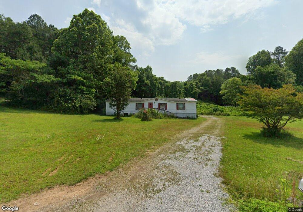
561 Burnt Mill Rd Flintstone, GA 30725
Flintstone NeighborhoodEstimated Value: $199,000 - $265,000
3
Beds
2
Baths
1,792
Sq Ft
$134/Sq Ft
Est. Value
About This Home
This home is located at 561 Burnt Mill Rd, Flintstone, GA 30725 and is currently estimated at $241,000, approximately $134 per square foot. 561 Burnt Mill Rd is a home located in Walker County with nearby schools including Stone Creek Elementary School, Rossville Middle School, and Ridgeland High School.
Ownership History
Date
Name
Owned For
Owner Type
Purchase Details
Closed on
Jun 7, 2011
Sold by
Walker David W
Bought by
Blakemore B C
Current Estimated Value
Purchase Details
Closed on
Apr 5, 2011
Sold by
Pittman Robert
Bought by
Wells Fargo Bank Na
Purchase Details
Closed on
Jan 13, 2003
Sold by
Pittman Robert and Pittman Sandra
Bought by
Pittman Robert
Purchase Details
Closed on
Aug 22, 1999
Sold by
Chattanooga Rope and Chattanooga Leather
Bought by
Pittman Robert and Pittman Sandra
Purchase Details
Closed on
Jan 1, 1972
Bought by
Chattanooga Rope and Chattanooga Leather
Create a Home Valuation Report for This Property
The Home Valuation Report is an in-depth analysis detailing your home's value as well as a comparison with similar homes in the area
Home Values in the Area
Average Home Value in this Area
Purchase History
| Date | Buyer | Sale Price | Title Company |
|---|---|---|---|
| Blakemore B C | -- | -- | |
| Walker David W | $10,000 | -- | |
| Wells Fargo Bank Na | $25,075 | -- | |
| Pittman Robert | -- | -- | |
| Pittman Robert | $95,000 | -- | |
| Chattanooga Rope | -- | -- |
Source: Public Records
Tax History Compared to Growth
Tax History
| Year | Tax Paid | Tax Assessment Tax Assessment Total Assessment is a certain percentage of the fair market value that is determined by local assessors to be the total taxable value of land and additions on the property. | Land | Improvement |
|---|---|---|---|---|
| 2024 | $148 | $7,302 | $7,302 | $0 |
| 2023 | $120 | $5,796 | $5,796 | $0 |
| 2022 | $56 | $2,390 | $2,390 | $0 |
| 2021 | $61 | $2,390 | $2,390 | $0 |
| 2020 | $64 | $2,390 | $2,390 | $0 |
| 2019 | $65 | $2,390 | $2,390 | $0 |
| 2018 | $63 | $2,390 | $2,390 | $0 |
| 2017 | $58 | $2,390 | $2,390 | $0 |
| 2016 | $58 | $2,390 | $2,390 | $0 |
| 2015 | $125 | $4,816 | $4,816 | $0 |
| 2014 | $122 | $4,816 | $4,816 | $0 |
| 2013 | $63 | $4,816 | $4,816 | $0 |
Source: Public Records
Map
Nearby Homes
- 5720 Saint Elmo Ave
- 1317 Thomas Ave Unit 8
- 1317 Thomas Ave
- 1297 Thomas Ave
- 5413 Lee Ave
- 5601 Alabama Ave
- 5422 Saint Elmo Ave
- 0 Slayton Ave Unit 1504633
- 724 Shelly Ln
- Lots 7 & 5 Slayton Ave
- 717 W James St
- 5405 Saint Elmo Ave
- 5342 Slayton Ave
- 1402 W 53rd St
- 5301 Saint Elmo Ave
- 715 W James St
- 1014 Wilson Rd
- 53 Charlsie Trail Unit 12
- 635 N Sherry Dr
- 5107 Beulah Ave
- 0 Lafayette Dr Unit 1391033
- 0 Lafayette Dr Unit 1262796
- 0 Lafayette Dr Unit RTC2668661
- 0 Lafayette Dr
- 1140 Lafayette Dr
- 1124 Lafayette Dr
- 513 Burnt Mill Rd
- 625 Burnt Mill Rd
- 625 Burnt Mill Rd
- 625 Burnt Mill Rd
- 491 Burnt Mill Rd
- 1122 Lafayette Dr
- 144 Burnt Mill Cir
- 747 Burnt Mill Rd
- 162 Burnt Mill Cir
- 773 Burnt Mill Rd
- 1100 Lafayette Dr
- 964 Seymour Ave
- 964 1/2 Seymour Ave
- 112 Burnt Mill Cir