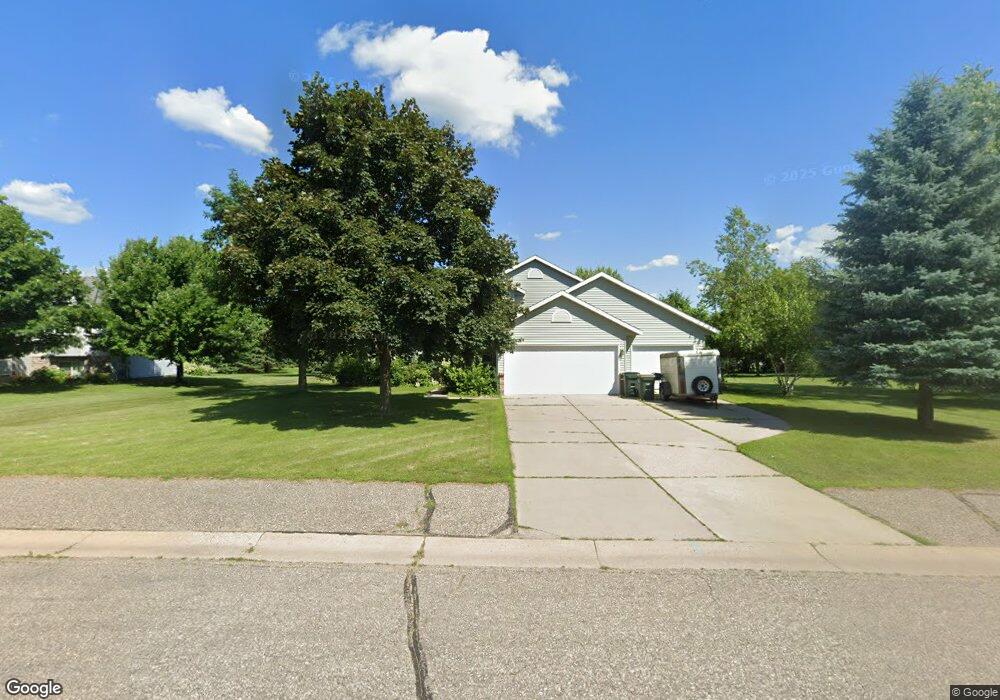
561 Hickory St S Annandale, MN 55302
Estimated Value: $325,000 - $392,000
3
Beds
2
Baths
1,762
Sq Ft
$203/Sq Ft
Est. Value
About This Home
This home is located at 561 Hickory St S, Annandale, MN 55302 and is currently estimated at $358,363, approximately $203 per square foot. 561 Hickory St S is a home located in Wright County with nearby schools including Annandale Elementary School, Annandale Middle School, and Annandale Senior High School.
Ownership History
Date
Name
Owned For
Owner Type
Purchase Details
Closed on
Oct 29, 2018
Sold by
Pipo Tiranda R
Bought by
Pipo Robert P
Current Estimated Value
Purchase Details
Closed on
Mar 27, 1997
Sold by
Dayle Veches Construction Inc
Bought by
Pipo Robert P and Pipo Tiranda R
Purchase Details
Closed on
Sep 13, 1996
Sold by
Southbrook Development Corp
Bought by
Dayle Veches Construction Inc
Create a Home Valuation Report for This Property
The Home Valuation Report is an in-depth analysis detailing your home's value as well as a comparison with similar homes in the area
Home Values in the Area
Average Home Value in this Area
Purchase History
| Date | Buyer | Sale Price | Title Company |
|---|---|---|---|
| Pipo Robert P | -- | Central Land Title | |
| Pipo Robert P | $112,000 | -- | |
| Dayle Veches Construction Inc | $24,900 | -- |
Source: Public Records
Tax History Compared to Growth
Tax History
| Year | Tax Paid | Tax Assessment Tax Assessment Total Assessment is a certain percentage of the fair market value that is determined by local assessors to be the total taxable value of land and additions on the property. | Land | Improvement |
|---|---|---|---|---|
| 2025 | $2,718 | $285,500 | $52,000 | $233,500 |
| 2024 | $2,690 | $286,300 | $60,000 | $226,300 |
| 2023 | $2,874 | $279,500 | $50,000 | $229,500 |
| 2022 | $2,694 | $267,800 | $55,000 | $212,800 |
| 2021 | $2,694 | $222,700 | $35,000 | $187,700 |
| 2020 | $2,712 | $216,700 | $35,000 | $181,700 |
| 2019 | $2,680 | $211,500 | $0 | $0 |
| 2018 | $2,506 | $188,400 | $0 | $0 |
| 2017 | $2,302 | $177,400 | $0 | $0 |
| 2016 | $2,380 | $0 | $0 | $0 |
| 2015 | $2,290 | $0 | $0 | $0 |
| 2014 | -- | $0 | $0 | $0 |
Source: Public Records
Map
Nearby Homes
- 800 Morrison Ave NW
- 810 Morrison Ave NW
- 750 Morrison Ave S
- 800 Beech Ln S
- 970 Acacia Dr S
- 945 Acacia Cir S
- 7425 Nevens Ave NW
- 7581 Lake John Dr
- 7541 Lake John Dr
- 681 Irwin Cir
- 520 Douglas Dr S
- 510 Douglas Dr S
- Hancock Plan at Triplett Farms
- Henderson Plan at Triplett Farms
- Lincoln Plan at Triplett Farms
- Madden Plan at Triplett Farms
- Rachel Plan at Triplett Farms
- Goodhue Plan at Triplett Farms
- Olson Plan at Triplett Farms
- Floyd Plan at Triplett Farms
- 551 Hickory St S
- 630 Morrison Ave S
- 620 Morrison Ave S
- 640 Morrison Ave S
- 541 Hickory St S
- 610 Morrison Ave S
- 580 Hickory St S
- 1285 Cypress Dr W
- 570 Hickory St S
- 600 Morrison Ave S
- 600 600 Morrison-Avenue-
- 1286 Cypress Dr W
- 1272 Cypress Dr W
- 1288 Cypress Dr W
- 531 Hickory St S
- 560 Hickory St S
- 1284 Cypress Dr W
- 1290 Cypress Dr W
- 530 Morrison Ave S
- 1281 Cypress Dr W