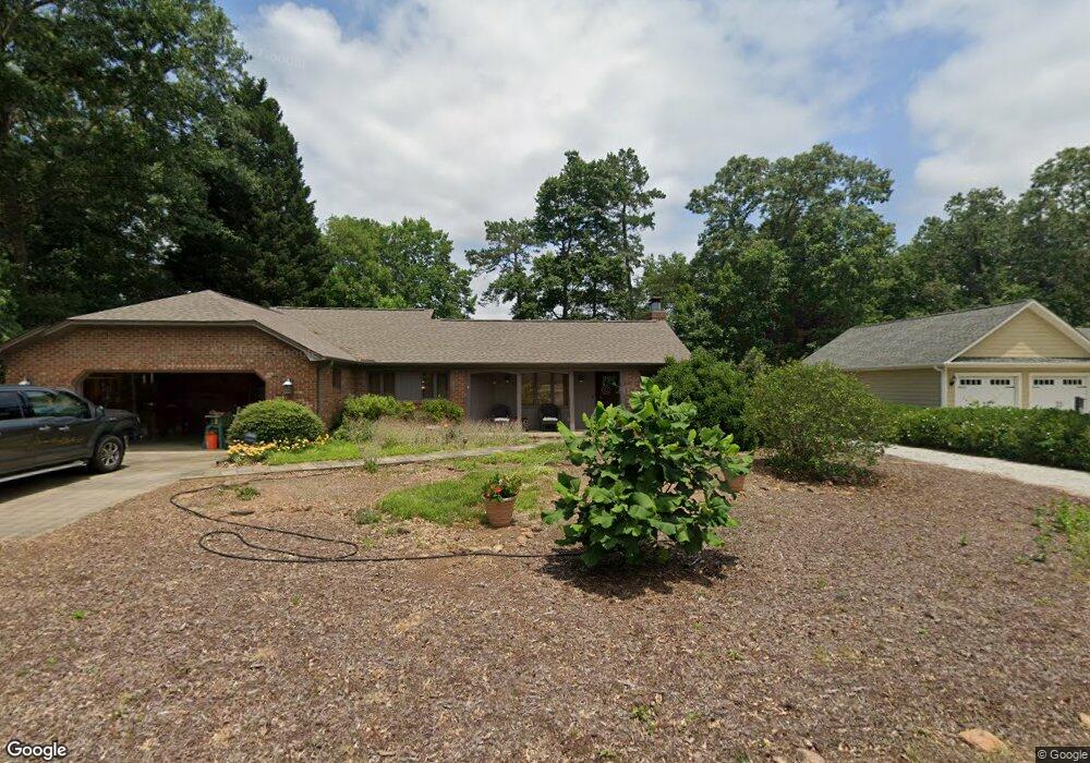
561 Hidden Point Rd Hartwell, GA 30643
Estimated Value: $719,954 - $1,010,000
3
Beds
4
Baths
2,369
Sq Ft
$341/Sq Ft
Est. Value
About This Home
This home is located at 561 Hidden Point Rd, Hartwell, GA 30643 and is currently estimated at $806,739, approximately $340 per square foot. 561 Hidden Point Rd is a home located in Hart County with nearby schools including Hart County High School.
Ownership History
Date
Name
Owned For
Owner Type
Purchase Details
Closed on
Aug 29, 2016
Sold by
David Dale A and David Cynthia A
Bought by
Greene Walter D and Greene Jeanna W
Current Estimated Value
Home Financials for this Owner
Home Financials are based on the most recent Mortgage that was taken out on this home.
Original Mortgage
$415,800
Outstanding Balance
$332,658
Interest Rate
3.48%
Mortgage Type
New Conventional
Estimated Equity
$474,081
Purchase Details
Closed on
Oct 1, 1997
Purchase Details
Closed on
Jul 1, 1977
Create a Home Valuation Report for This Property
The Home Valuation Report is an in-depth analysis detailing your home's value as well as a comparison with similar homes in the area
Home Values in the Area
Average Home Value in this Area
Purchase History
| Date | Buyer | Sale Price | Title Company |
|---|---|---|---|
| Greene Walter D | $462,000 | -- | |
| -- | $218,000 | -- | |
| -- | $17,500 | -- |
Source: Public Records
Mortgage History
| Date | Status | Borrower | Loan Amount |
|---|---|---|---|
| Open | Greene Walter D | $415,800 |
Source: Public Records
Tax History Compared to Growth
Tax History
| Year | Tax Paid | Tax Assessment Tax Assessment Total Assessment is a certain percentage of the fair market value that is determined by local assessors to be the total taxable value of land and additions on the property. | Land | Improvement |
|---|---|---|---|---|
| 2024 | $2,900 | $189,758 | $106,000 | $83,758 |
| 2023 | $2,959 | $177,692 | $106,000 | $71,692 |
| 2022 | $2,850 | $171,132 | $106,000 | $65,132 |
| 2021 | $2,442 | $131,650 | $72,000 | $59,650 |
| 2020 | $2,497 | $128,944 | $72,000 | $56,944 |
| 2019 | $2,331 | $119,266 | $64,800 | $54,466 |
| 2018 | $2,366 | $119,657 | $64,800 | $54,857 |
| 2017 | $2,368 | $119,103 | $64,800 | $54,303 |
| 2016 | $2,396 | $118,780 | $64,800 | $53,980 |
| 2015 | $2,252 | $117,642 | $64,800 | $52,842 |
| 2014 | $2,703 | $138,090 | $80,000 | $58,090 |
| 2013 | -- | $138,787 | $80,000 | $58,787 |
Source: Public Records
Map
Nearby Homes
- 398 Hidden Point Rd
- 168 Wilderness Point
- 133 Admiral Dr
- 1047 Tranquility Ln
- 0 Wilderness Point Unit 10649762
- 0 Sidney Point Unit PHASE II
- LOT 17 Sidney Point
- 171 Friendship Dr
- 25 C and C Cir Unit (TRACT B)
- 0 Bramblewood Dr Unit 10541621
- 0 Bramblewood Dr Unit 20288802
- 149 Foxtail Dr
- 0 Crawfords Ferry Point Unit 10450888
- LOT E Majestic Shores Dr
- LOT 9 Majestic Shores Trail
- 0 Majestic Shores Trail
- Lot 25 Majestic Shores Trail
- LOT 23 Majestic Shores Ln
- LOT 22 Majestic Shores Ln
- LOT 22 Majestic Shores Rd
- 541 Hidden Point Rd
- 564 Hidden Point Rd
- 579 Hidden Point Rd
- 550 Hidden Point Rd
- 550 Hidden Point
- 607 Hidden Point Rd
- 515 Hidden Point Rd
- 633 Hidden Point Rd
- 621 Hidden Point Rd
- 638 Hidden Point Rd
- 503 Hidden Point Rd
- 664 Hidden Point Rd
- 30 Apache Trail
- 637 Hidden Point Rd
- 80 Apache Trail
- 100 Apache Trail
- 71 Apache Trail
- 679 Hidden Point Rd
- 450 Hidden Point Rd
- 118 Apache Trail