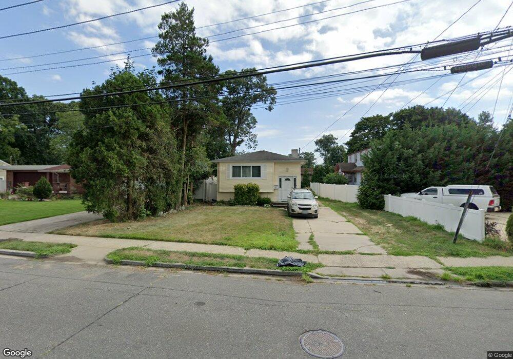
561 Pinebrook Ave West Hempstead, NY 11552
Estimated Value: $573,000 - $714,932
--
Bed
2
Baths
1,023
Sq Ft
$629/Sq Ft
Est. Value
About This Home
This home is located at 561 Pinebrook Ave, West Hempstead, NY 11552 and is currently estimated at $643,966, approximately $629 per square foot. 561 Pinebrook Ave is a home located in Nassau County with nearby schools including Davison Avenue Intermediate School, Maurice W. Downing Primary K-2 School, and Howard T Herber Middle School.
Ownership History
Date
Name
Owned For
Owner Type
Purchase Details
Closed on
Dec 23, 2011
Sold by
Boston Harry
Bought by
Plummer Gwendolyn
Current Estimated Value
Home Financials for this Owner
Home Financials are based on the most recent Mortgage that was taken out on this home.
Original Mortgage
$268,028
Interest Rate
4.24%
Mortgage Type
FHA
Purchase Details
Closed on
Dec 11, 2009
Sold by
Boston Harry and Boston Joan
Bought by
Boston Harry
Purchase Details
Closed on
Mar 22, 1997
Create a Home Valuation Report for This Property
The Home Valuation Report is an in-depth analysis detailing your home's value as well as a comparison with similar homes in the area
Home Values in the Area
Average Home Value in this Area
Purchase History
| Date | Buyer | Sale Price | Title Company |
|---|---|---|---|
| Plummer Gwendolyn | $275,000 | -- | |
| Boston Harry | -- | -- | |
| -- | -- | -- |
Source: Public Records
Mortgage History
| Date | Status | Borrower | Loan Amount |
|---|---|---|---|
| Previous Owner | Plummer Gwendolyn | $268,028 |
Source: Public Records
Tax History Compared to Growth
Tax History
| Year | Tax Paid | Tax Assessment Tax Assessment Total Assessment is a certain percentage of the fair market value that is determined by local assessors to be the total taxable value of land and additions on the property. | Land | Improvement |
|---|---|---|---|---|
| 2025 | $9,053 | $405 | $176 | $229 |
| 2024 | $3,942 | $405 | $176 | $229 |
| 2023 | $9,871 | $405 | $176 | $229 |
| 2022 | $9,871 | $404 | $176 | $228 |
| 2021 | $10,233 | $382 | $166 | $216 |
| 2020 | $7,581 | $519 | $409 | $110 |
| 2019 | $8,901 | $556 | $333 | $223 |
| 2018 | $8,988 | $732 | $0 | $0 |
| 2017 | $6,727 | $732 | $438 | $294 |
| 2016 | $11,033 | $732 | $438 | $294 |
| 2015 | $4,029 | $732 | $438 | $294 |
| 2014 | $4,029 | $732 | $438 | $294 |
| 2013 | $4,219 | $814 | $438 | $376 |
Source: Public Records
Map
Nearby Homes
- 26 Parkside Rd
- 1025 Ontario Rd
- 529 Clinton Ave
- 362 Langdon Blvd
- 7 Hopatcong Ave
- 461 Pinebrook Ave
- 1070 Mahopac Rd
- 1024 Mahopac Rd
- 501 Lafayette Ave
- 486 Champlain Ave
- 492 Pershing Blvd
- 419 Coolidge Ave
- 10 Pinebrook Ave
- 44 School St
- 924 Otsego Ct
- 1269 Dekoven St
- 394 Pinebrook Ave
- 919 Pinelake Dr
- 36 School St
- 402 Clinton Ave
- 565 Pinebrook Ave
- 571 Pinebrook Ave
- 559 Pinebrook Ct
- 550 Pinebrook Ct
- 564 Pinebrook Ave
- 541 Pinebrook Ave
- 80 Pinebrook Ave
- 555 Pinebrook Ct
- 581 Pinebrook Ave
- 1092 Lehman Rd
- 542 Pinebrook Ave
- 1098 Lehman Rd
- 1068 Ontario Rd
- 540 Pinebrook Ct
- 576 Pinebrook Ave
- 533 Pinebrook Ave
- 549 Pinebrook Ct
- 12 Lehman Rd
- 536 Pinebrook Ave
- 1067 Ontario Rd