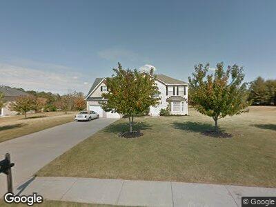
561 Trotters Ln McDonough, GA 30252
Estimated Value: $374,000 - $416,000
5
Beds
3
Baths
3,231
Sq Ft
$121/Sq Ft
Est. Value
About This Home
This home is located at 561 Trotters Ln, McDonough, GA 30252 and is currently estimated at $391,439, approximately $121 per square foot. 561 Trotters Ln is a home located in Henry County with nearby schools including Timber Ridge Elementary School, Union Grove Middle School, and Union Grove High School.
Ownership History
Date
Name
Owned For
Owner Type
Purchase Details
Closed on
Sep 19, 2019
Sold by
Gill Monique M
Bought by
Mejia Julissa Jacqueline Orti
Current Estimated Value
Home Financials for this Owner
Home Financials are based on the most recent Mortgage that was taken out on this home.
Original Mortgage
$193,600
Outstanding Balance
$172,196
Interest Rate
3.5%
Mortgage Type
New Conventional
Estimated Equity
$219,125
Purchase Details
Closed on
Dec 2, 2005
Sold by
Homelife Communities Of Henry
Bought by
Wright Monique M
Home Financials for this Owner
Home Financials are based on the most recent Mortgage that was taken out on this home.
Original Mortgage
$39,850
Interest Rate
5.85%
Mortgage Type
New Conventional
Create a Home Valuation Report for This Property
The Home Valuation Report is an in-depth analysis detailing your home's value as well as a comparison with similar homes in the area
Home Values in the Area
Average Home Value in this Area
Purchase History
| Date | Buyer | Sale Price | Title Company |
|---|---|---|---|
| Mejia Julissa Jacqueline Orti | $242,000 | -- | |
| Wright Monique M | $199,200 | -- |
Source: Public Records
Mortgage History
| Date | Status | Borrower | Loan Amount |
|---|---|---|---|
| Open | Mejia Julissa Jacqueline Orti | $193,600 | |
| Previous Owner | Wright Monique M | $39,850 | |
| Previous Owner | Wright Monique M | $159,250 |
Source: Public Records
Tax History Compared to Growth
Tax History
| Year | Tax Paid | Tax Assessment Tax Assessment Total Assessment is a certain percentage of the fair market value that is determined by local assessors to be the total taxable value of land and additions on the property. | Land | Improvement |
|---|---|---|---|---|
| 2024 | $6,038 | $149,840 | $16,000 | $133,840 |
| 2023 | $5,859 | $150,520 | $14,800 | $135,720 |
| 2022 | $4,897 | $125,440 | $14,800 | $110,640 |
| 2021 | $3,711 | $94,520 | $14,800 | $79,720 |
| 2020 | $3,560 | $90,600 | $12,800 | $77,800 |
| 2019 | $3,037 | $88,240 | $12,000 | $76,240 |
| 2018 | $2,834 | $79,640 | $10,800 | $68,840 |
| 2016 | $2,620 | $73,160 | $10,000 | $63,160 |
| 2015 | $2,266 | $62,440 | $8,000 | $54,440 |
| 2014 | $2,034 | $56,080 | $8,000 | $48,080 |
Source: Public Records
Map
Nearby Homes
- 561 Trotters Ln
- 557 Trotters Ln
- 565 Trotters Ln
- 0 Turner Dr
- 0 Turner Dr Unit 7423702
- 0 Turner Dr Unit 7246256
- 0 Turner Dr Unit 7134250
- 0 Turner Dr Unit 7001332
- 0 Turner Dr Unit 3262341
- 0 Turner Dr Unit 3224327
- 0 Turner Dr Unit 8685030
- 0 Turner Dr Unit 8638232
- 0 Turner Dr Unit 8475434
- 0 Turner Dr Unit 8257754
- 0 Turner Dr Unit 7531159
- 0 Turner Dr Unit 7349837
- 0 Turner Dr Unit 8618895
- 0 Turner Dr Unit 8557150
- 0 Turner Dr Unit 8504333
- 0 Turner Dr Unit 8462319