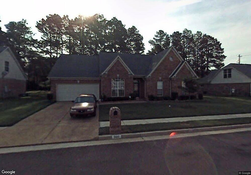
5610 Bridge Mill Ln Memphis, TN 38125
Southern Shelby County NeighborhoodEstimated Value: $254,000 - $308,000
3
Beds
2
Baths
2,311
Sq Ft
$122/Sq Ft
Est. Value
About This Home
This home is located at 5610 Bridge Mill Ln, Memphis, TN 38125 and is currently estimated at $282,134, approximately $122 per square foot. 5610 Bridge Mill Ln is a home located in Shelby County with nearby schools including Highland Oaks Elementary School, Highland Oaks Middle School, and Southwind High School.
Ownership History
Date
Name
Owned For
Owner Type
Purchase Details
Closed on
May 21, 2003
Sold by
Mark Matthews Development Llc
Bought by
King Fred H and King Pamela W
Current Estimated Value
Home Financials for this Owner
Home Financials are based on the most recent Mortgage that was taken out on this home.
Original Mortgage
$126,024
Outstanding Balance
$54,772
Interest Rate
5.79%
Mortgage Type
Purchase Money Mortgage
Estimated Equity
$227,362
Create a Home Valuation Report for This Property
The Home Valuation Report is an in-depth analysis detailing your home's value as well as a comparison with similar homes in the area
Home Values in the Area
Average Home Value in this Area
Purchase History
| Date | Buyer | Sale Price | Title Company |
|---|---|---|---|
| King Fred H | $157,530 | -- |
Source: Public Records
Mortgage History
| Date | Status | Borrower | Loan Amount |
|---|---|---|---|
| Open | King Fred H | $126,024 | |
| Closed | King Fred H | $31,506 |
Source: Public Records
Tax History Compared to Growth
Tax History
| Year | Tax Paid | Tax Assessment Tax Assessment Total Assessment is a certain percentage of the fair market value that is determined by local assessors to be the total taxable value of land and additions on the property. | Land | Improvement |
|---|---|---|---|---|
| 2025 | $1,773 | $69,050 | $14,000 | $55,050 |
| 2024 | $1,773 | $52,300 | $8,750 | $43,550 |
| 2023 | $1,773 | $52,300 | $8,750 | $43,550 |
| 2022 | $1,773 | $52,300 | $8,750 | $43,550 |
| 2021 | $1,804 | $52,300 | $8,750 | $43,550 |
| 2020 | $1,522 | $37,575 | $8,750 | $28,825 |
| 2019 | $1,522 | $37,575 | $8,750 | $28,825 |
| 2018 | $1,522 | $37,575 | $8,750 | $28,825 |
| 2017 | $1,544 | $37,575 | $8,750 | $28,825 |
| 2016 | $1,359 | $31,100 | $0 | $0 |
| 2014 | $1,359 | $31,100 | $0 | $0 |
Source: Public Records
Map
Nearby Homes
- 7206 State Line Rd
- 7129 Brook Mill Cove
- 6400 State Line Rd
- 9444 Geneva Loop E
- 5583 Liberty Ridge Cove
- 9387 Joe Lyon Blvd
- 9164 Superior Cove
- 5563 Annandale Dr
- 8971 Tahoe Cove
- 9097 Gavin Dr
- 5456 Stone Arch Place
- 9178 William Paul Dr
- 9195 Lakeside Dr
- 9081 Lakeside Dr
- 8939 Travis Dr
- 5324 Annandale Dr Unit 5324 Annandale Dr TN
- 5252 Lake Village Dr
- 5442 Riverstone Dr
- 5469 Briardale Dr
- 8992 Gavin Dr
- 5602 Bridge Mill Ln
- 5620 Bridge Mill Ln
- 5611 Bridge Mill Ln
- 7186 State Line Rd
- 5605 Bridge Mill Ln
- 5594 Bridge Mill Ln
- 5619 Bridge Mill Ln
- 5595 Bridge Mill Ln
- 5591 Bridge Mill Ln
- 5586 Bridge Mill Ln
- 7150 Queens Crown Ct
- 7146 Queens Crown Ct
- 7142 Queens Crown Ct
- 5585 Bridge Mill Ln
- 7138 Queens Crown Ct
- 7133 Queens Crown Ct
- 5576 Bridge Mill Ln
- 7179 Brook Mill Dr
- 5575 Bridge Mill Ln
- 7185 Brook Mill Dr