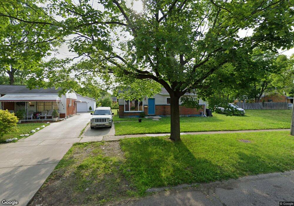
5610 Leslie Dr Flint, MI 48504
Bel-Aire Woods NeighborhoodEstimated Value: $49,000 - $62,000
3
Beds
1
Bath
950
Sq Ft
$60/Sq Ft
Est. Value
About This Home
This home is located at 5610 Leslie Dr, Flint, MI 48504 and is currently estimated at $57,159, approximately $60 per square foot. 5610 Leslie Dr is a home located in Genesee County with nearby schools including Brownell STEM Academy, The New Standard Academy, and Eagle's Nest Academy.
Ownership History
Date
Name
Owned For
Owner Type
Purchase Details
Closed on
Feb 5, 2010
Sold by
Sun Management Inc
Bought by
Williams Shalom
Current Estimated Value
Purchase Details
Closed on
Jan 30, 2009
Sold by
Hicks Kathy
Bought by
Sun Management Inc
Purchase Details
Closed on
Aug 17, 2007
Sold by
Menifee Lanessa
Bought by
Wells Fargo Bank Na
Purchase Details
Closed on
Dec 17, 2003
Sold by
Robinson Lanessa and Menifee Lanessa
Bought by
Quality Real Estate & Investment Inc
Purchase Details
Closed on
Nov 25, 2003
Sold by
Menifee Lanessa and Robinson Lanessa
Bought by
Menifee Lanessa
Purchase Details
Closed on
Apr 23, 2003
Sold by
Menifee Montel
Bought by
Robinson Lanessa
Purchase Details
Closed on
Jul 19, 2002
Sold by
Robinson Lanessa
Bought by
Menifee Montel
Purchase Details
Closed on
Nov 28, 2001
Sold by
Spight John T and Spight Juana Jean
Bought by
Wells Fargo Bank Minnesota National Assn
Create a Home Valuation Report for This Property
The Home Valuation Report is an in-depth analysis detailing your home's value as well as a comparison with similar homes in the area
Home Values in the Area
Average Home Value in this Area
Purchase History
| Date | Buyer | Sale Price | Title Company |
|---|---|---|---|
| Williams Shalom | $11,900 | Parks Title | |
| Sun Management Inc | -- | None Available | |
| Wells Fargo Bank Na | $42,900 | None Available | |
| Quality Real Estate & Investment Inc | -- | -- | |
| Menifee Lanessa | -- | -- | |
| Robinson Lanessa | -- | Stewart Title Guaranty Compa | |
| Menifee Montel | -- | Stewart Title Guaranty Compa | |
| Wells Fargo Bank Minnesota National Assn | $16,250 | -- |
Source: Public Records
Tax History
| Year | Tax Paid | Tax Assessment Tax Assessment Total Assessment is a certain percentage of the fair market value that is determined by local assessors to be the total taxable value of land and additions on the property. | Land | Improvement |
|---|---|---|---|---|
| 2025 | $666 | $14,800 | $0 | $0 |
| 2024 | $614 | $13,400 | $0 | $0 |
| 2023 | $610 | $11,100 | $0 | $0 |
| 2022 | $0 | $8,100 | $0 | $0 |
| 2021 | $626 | $8,200 | $0 | $0 |
| 2020 | $576 | $8,000 | $0 | $0 |
| 2019 | $569 | $6,400 | $0 | $0 |
| 2018 | $588 | $7,100 | $0 | $0 |
| 2017 | $698 | $0 | $0 | $0 |
| 2016 | $694 | $0 | $0 | $0 |
| 2015 | -- | $0 | $0 | $0 |
| 2014 | -- | $0 | $0 | $0 |
| 2012 | -- | $12,700 | $0 | $0 |
Source: Public Records
Map
Nearby Homes
- 5413 Fleming Rd
- 1720 Marlowe Dr
- 5620 Marlowe Dr
- 1511 W Home Ave
- 1709 W Home Ave
- 5502 Susan St
- 5705 Winthrop Blvd
- 5905 Cloverlawn Dr
- 5106 Cloverlawn Dr
- 1216 Barbara Dr
- 1909 Cherrylawn Dr
- 5610 Baldwin Blvd
- 4702 Warrington Dr
- 4539 Trumbull Dr
- 6310 Valorie Ln
- 4807 Birchcrest Dr
- 2013 Canniff St
- 6414 Valorie Ln
- 1816 Russet Place
- 2106 Janice Dr
- 5614 Leslie Dr
- 1618 W Mott Ave
- 5602 Leslie Dr
- 5618 Leslie Dr
- 5611 Fleming Rd
- 5615 Fleming Rd
- 5619 Fleming Rd
- 1604 W Mott Ave
- 5622 Leslie Dr
- 5623 Fleming Rd
- 5611 Leslie Dr
- 5619 Leslie Ct
- 1702 Griggs Dr
- 5626 Leslie Dr
- 1619 W Mott Ave
- 5631 Fleming Rd
- 5702 Leslie Dr
- 5610 Fleming Rd
- 5510 Leslie Dr
- 1516 W Mott Ave
Your Personal Tour Guide
Ask me questions while you tour the home.