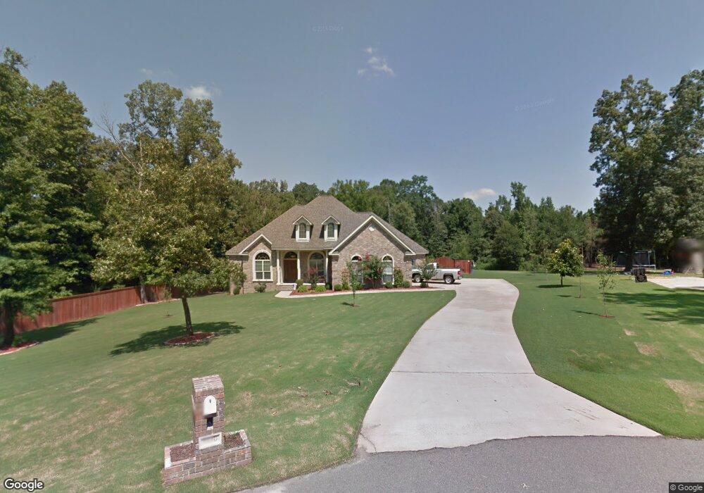
5610 Pear Tree Dr Little Rock, AR 72206
Estimated Value: $369,228 - $470,000
--
Bed
3
Baths
2,416
Sq Ft
$169/Sq Ft
Est. Value
About This Home
This home is located at 5610 Pear Tree Dr, Little Rock, AR 72206 and is currently estimated at $407,307, approximately $168 per square foot. 5610 Pear Tree Dr is a home located in Saline County with nearby schools including Sheridan High School.
Ownership History
Date
Name
Owned For
Owner Type
Purchase Details
Closed on
May 12, 2021
Sold by
Ware Eric S and Ware Stephanie G
Bought by
Mcginley Clinton J and Mcginley Jodie
Current Estimated Value
Home Financials for this Owner
Home Financials are based on the most recent Mortgage that was taken out on this home.
Original Mortgage
$225,008
Outstanding Balance
$203,913
Interest Rate
3.1%
Mortgage Type
New Conventional
Estimated Equity
$203,394
Purchase Details
Closed on
Jun 1, 2018
Sold by
Lee Charles B
Bought by
Ware Eric S and Ware Stephanie G
Home Financials for this Owner
Home Financials are based on the most recent Mortgage that was taken out on this home.
Original Mortgage
$284,000
Interest Rate
4.5%
Mortgage Type
VA
Purchase Details
Closed on
Jan 11, 2008
Sold by
W & L Development Co
Bought by
Lee Charles B
Home Financials for this Owner
Home Financials are based on the most recent Mortgage that was taken out on this home.
Original Mortgage
$230,000
Interest Rate
5.94%
Mortgage Type
New Conventional
Create a Home Valuation Report for This Property
The Home Valuation Report is an in-depth analysis detailing your home's value as well as a comparison with similar homes in the area
Home Values in the Area
Average Home Value in this Area
Purchase History
| Date | Buyer | Sale Price | Title Company |
|---|---|---|---|
| Mcginley Clinton J | $285,000 | Lenders Title Company | |
| Ware Eric S | $284,000 | Lenders Title Company | |
| Lee Charles B | $252,000 | First National Title |
Source: Public Records
Mortgage History
| Date | Status | Borrower | Loan Amount |
|---|---|---|---|
| Open | Mcginley Clinton J | $225,008 | |
| Previous Owner | Ware Eric S | $284,000 | |
| Previous Owner | Lee Charles B | $230,000 |
Source: Public Records
Tax History Compared to Growth
Tax History
| Year | Tax Paid | Tax Assessment Tax Assessment Total Assessment is a certain percentage of the fair market value that is determined by local assessors to be the total taxable value of land and additions on the property. | Land | Improvement |
|---|---|---|---|---|
| 2025 | $3,213 | $70,317 | $10,560 | $59,757 |
| 2024 | $2,946 | $70,317 | $10,560 | $59,757 |
| 2023 | $2,928 | $70,317 | $10,560 | $59,757 |
| 2022 | $2,978 | $70,317 | $10,560 | $59,757 |
| 2021 | $1,329 | $55,640 | $8,800 | $46,840 |
| 2020 | $95 | $55,640 | $8,800 | $46,840 |
| 2019 | $95 | $55,640 | $8,800 | $46,840 |
| 2018 | $2,190 | $55,640 | $8,800 | $46,840 |
| 2017 | $2,190 | $55,640 | $8,800 | $46,840 |
| 2016 | $2,242 | $53,500 | $8,800 | $44,700 |
| 2015 | $2,118 | $50,560 | $8,800 | $41,760 |
| 2014 | $1,833 | $50,560 | $8,800 | $41,760 |
Source: Public Records
Map
Nearby Homes
- 5389 Pear Orchard Dr
- 214 Chick Ln
- 135 Chick Ln
- 4406 Springlake Cutoff
- 4309 Springlake Cutoff
- 18530 Winbury Cove
- 21189 Meadows Acres Dr
- 000 Arch St
- 5810 E Sardis Rd
- 144 Mountain Pine Rd Unit Tract 5
- 000 Ram Rd
- 201 Mountain Pine Rd Unit Tract 174
- 209 Mountain Pine Rd Unit Tract 173
- 170 Mountain Pine Rd Unit Tract 7
- 156 Mountain Pine Rd Unit Tract 6
- 323 Bristlecone Ln Unit Tract 170
- 262 Mountain Pine Rd Unit Tract 39
- 17630 Felton Ln
- 308 Bristlecone Rd Unit Tract 46
- 8210 Clearlake Dr
- 5606 Pear Tree Dr
- 5601 Pear Tree Dr
- 5600 Pear Tree Dr
- 5605 Pear Tree Dr
- 5439 Plantation Dr
- 5434 Plantation Dr
- 5440 Plantation Dr
- 5423 Plantation Dr
- 5430 Plantation Dr
- 5446 Plantation Dr
- 5451 Plantation Dr
- 5424 Plantation Dr
- 5452 Plantation Dr
- 19701 Lawhorn Dr
- 5418 Plantation Dr
- 19700 Lawhorn Dr
- 19700 Lawhon Dr
- 5390 Pear Orchard Dr
- 5365 Pear Orchard Dr
- 5476 Plantation Dr