
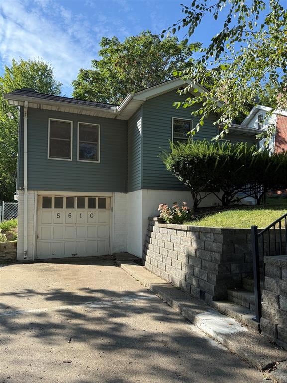
5610 University Ave Des Moines, IA 50311
Waveland Woods NeighborhoodEstimated payment $1,065/month
Highlights
- Ranch Style House
- Formal Dining Room
- Wood Fence
- No HOA
- Forced Air Heating and Cooling System
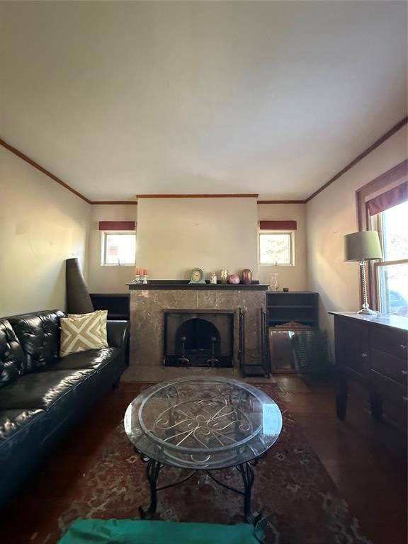
- Wood Burning Fireplace
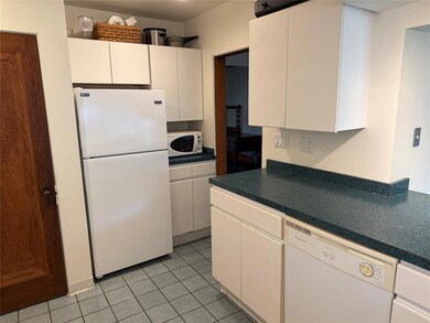
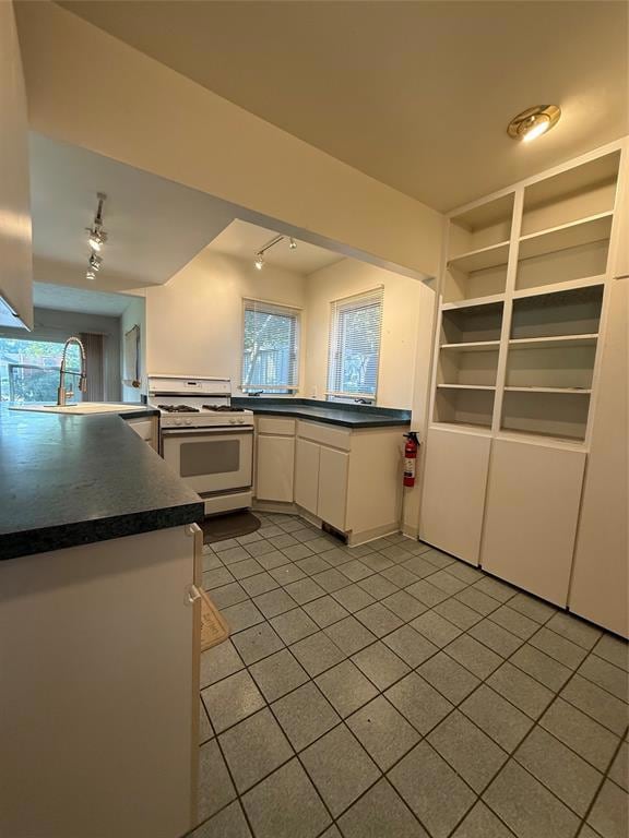
About This Home
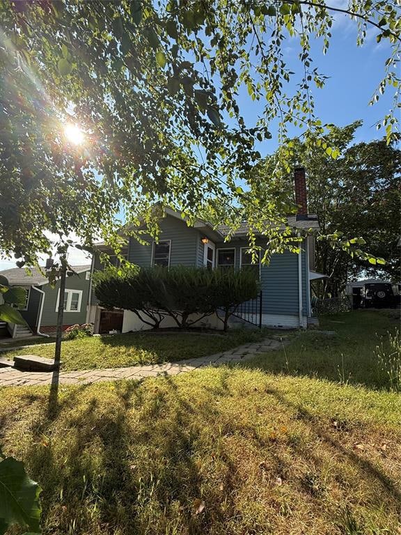
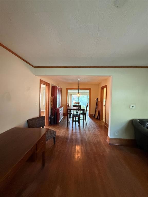
New to the market, this 2-bedroom, 1-bath home offers 1,014 square feet of finished space and plenty of upside. Hardwood floors run throughout, and a fireplace with a marble surround adds character. A finished attic with windows provides excellent storage or project space. The fenced yard and low-maintenance metal siding are already in place. Located between 56th and 63rd Street on University Avenue, with quick access to I-235 and the entire metro area. This property is being sold as-is and is ready for your vision—whether you’re an investor or a handy buyer looking for a fixer-upper.
Call your local REALTOR® today and Make It Home.
Home Details
Home Type
- Single Family
Est. Annual Taxes
- $2,965
Year Built
- Built in 1926
Lot Details
- 7,000 Sq Ft Lot
- Lot Dimensions are 50x140
- Wood Fence
- Chain Link Fence
- Property is zoned N3B
Home Design
- Ranch Style House
- Brick Foundation
- Asphalt Shingled Roof
- Metal Siding
- Vinyl Siding
Interior Spaces
- 1,014 Sq Ft Home
- Wood Burning Fireplace
- Formal Dining Room
- Unfinished Basement
Kitchen
- Stove
- Dishwasher
Bedrooms and Bathrooms
- 2 Main Level Bedrooms
- 1 Full Bathroom
Parking
- 1 Car Attached Garage
- Driveway
Utilities
- Forced Air Heating and Cooling System
Community Details
- No Home Owners Association
Listing and Financial Details
- Assessor Parcel Number 09007733000000
Map
Home Values in the Area
Average Home Value in this Area
Tax History
| Year | Tax Paid | Tax Assessment Tax Assessment Total Assessment is a certain percentage of the fair market value that is determined by local assessors to be the total taxable value of land and additions on the property. | Land | Improvement |
|---|---|---|---|---|
| 2025 | $2,648 | $181,200 | $41,700 | $139,500 |
| 2024 | $2,648 | $160,700 | $36,800 | $123,900 |
| 2023 | $2,874 | $160,700 | $36,800 | $123,900 |
| 2022 | $2,850 | $134,200 | $31,700 | $102,500 |
| 2021 | $2,792 | $134,200 | $31,700 | $102,500 |
| 2020 | $2,894 | $123,800 | $29,300 | $94,500 |
| 2019 | $2,656 | $123,800 | $29,300 | $94,500 |
| 2018 | $2,622 | $110,600 | $26,000 | $84,600 |
| 2017 | $2,302 | $110,600 | $26,000 | $84,600 |
| 2016 | $2,236 | $96,900 | $22,600 | $74,300 |
| 2015 | $2,236 | $96,900 | $22,600 | $74,300 |
| 2014 | $2,140 | $95,900 | $21,900 | $74,000 |
Property History
| Date | Event | Price | List to Sale | Price per Sq Ft |
|---|---|---|---|---|
| 10/07/2025 10/07/25 | Pending | -- | -- | -- |
| 09/22/2025 09/22/25 | For Sale | $155,000 | -- | $153 / Sq Ft |
Purchase History
| Date | Type | Sale Price | Title Company |
|---|---|---|---|
| Quit Claim Deed | -- | None Listed On Document | |
| Warranty Deed | $108,500 | None Available |
Mortgage History
| Date | Status | Loan Amount | Loan Type |
|---|---|---|---|
| Previous Owner | $112,597 | VA |
Source: Des Moines Area Association of REALTORS®
MLS Number: 726729
APN: 090-07733000000
Disclaimer: Certain information contained herein is derived from information provided by parties other than Homes.com. All information provided is deemed reliable, but is not guaranteed to be accurate and should be independently verified.
![]() IDX information is provided exclusively for personal, non-commercial use, and may not be used for any purpose other than to identify prospective properties consumers may be interested in purchasing. Information is deemed reliable but not guaranteed.
IDX information is provided exclusively for personal, non-commercial use, and may not be used for any purpose other than to identify prospective properties consumers may be interested in purchasing. Information is deemed reliable but not guaranteed.
