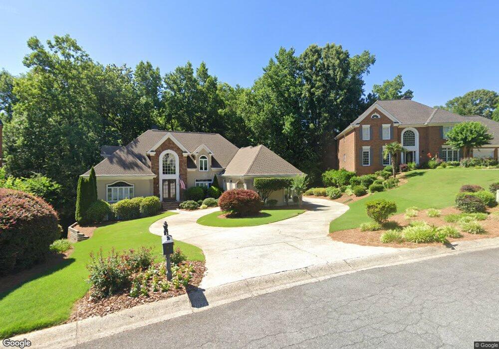
5612 Asheforde Ln Unit 1 Marietta, GA 30068
East Cobb NeighborhoodEstimated Value: $1,149,000 - $1,328,000
4
Beds
4
Baths
4,343
Sq Ft
$287/Sq Ft
Est. Value
About This Home
This home is located at 5612 Asheforde Ln Unit 1, Marietta, GA 30068 and is currently estimated at $1,244,622, approximately $286 per square foot. 5612 Asheforde Ln Unit 1 is a home located in Cobb County with nearby schools including Mount Bethel Elementary School, Dickerson Middle School, and St Francis Day School.
Ownership History
Date
Name
Owned For
Owner Type
Purchase Details
Closed on
Aug 15, 2003
Sold by
Jones Robert D and Jones Susan J
Bought by
Scott Earl H and Scott Diane
Current Estimated Value
Home Financials for this Owner
Home Financials are based on the most recent Mortgage that was taken out on this home.
Original Mortgage
$350,000
Outstanding Balance
$53,283
Interest Rate
3.13%
Mortgage Type
New Conventional
Estimated Equity
$1,191,339
Purchase Details
Closed on
Feb 28, 1994
Sold by
Griffith Herman E Judith
Bought by
Jones Robert D Susan
Home Financials for this Owner
Home Financials are based on the most recent Mortgage that was taken out on this home.
Original Mortgage
$300,000
Interest Rate
7.04%
Create a Home Valuation Report for This Property
The Home Valuation Report is an in-depth analysis detailing your home's value as well as a comparison with similar homes in the area
Home Values in the Area
Average Home Value in this Area
Purchase History
| Date | Buyer | Sale Price | Title Company |
|---|---|---|---|
| Scott Earl H | $550,000 | -- | |
| Jones Robert D Susan | $412,500 | -- |
Source: Public Records
Mortgage History
| Date | Status | Borrower | Loan Amount |
|---|---|---|---|
| Open | Scott Earl H | $350,000 | |
| Previous Owner | Jones Robert D Susan | $300,000 |
Source: Public Records
Tax History Compared to Growth
Tax History
| Year | Tax Paid | Tax Assessment Tax Assessment Total Assessment is a certain percentage of the fair market value that is determined by local assessors to be the total taxable value of land and additions on the property. | Land | Improvement |
|---|---|---|---|---|
| 2025 | $2,540 | $350,932 | $72,000 | $278,932 |
| 2024 | $2,547 | $350,932 | $72,000 | $278,932 |
| 2023 | $2,341 | $350,932 | $72,000 | $278,932 |
| 2022 | $2,379 | $294,828 | $60,000 | $234,828 |
| 2021 | $7,762 | $294,828 | $60,000 | $234,828 |
| 2020 | $7,762 | $294,828 | $60,000 | $234,828 |
| 2019 | $7,762 | $294,828 | $60,000 | $234,828 |
| 2018 | $7,503 | $282,984 | $60,000 | $222,984 |
| 2017 | $7,230 | $282,984 | $60,000 | $222,984 |
| 2016 | $7,241 | $282,984 | $60,000 | $222,984 |
| 2015 | $7,393 | $282,984 | $60,000 | $222,984 |
| 2014 | $7,410 | $281,516 | $0 | $0 |
Source: Public Records
Map
Nearby Homes
- 5617 Asheforde Ln
- 889 Waterford Green
- 1731 E Bank Dr
- 1281 Riversound Dr
- 1294 Waterford Green Trail
- 220 High Branch Way
- 1382 Huntingford Dr Unit 2
- 1525 Huntingford Dr
- 5473 Heyward Square Place
- 5184 Deering Trail Unit 2
- 1129 Topaz Way
- 1720 Little Willeo Rd
- 3245 Bywater Trail Unit 6B
- 5122 Sapphire Dr
- 5150 Timber Ridge Rd
- 5157 Forest Brook Pkwy
- 5140 Timber Ridge Rd
- 5122 Timber Ridge Rd
- 5610 Asheforde Ln Unit 1
- 5614 Asheforde Ln
- 5530 Asheforde Way
- 1572 E Bank Dr Unit 1
- 5616 Asheforde Ln
- 5608 Asheforde Ln
- 1568 E Bank Dr
- 5526 Asheforde Way
- 1592 E Bank Dr
- 1564 E Bank Dr
- 5621 Asheforde Ln Unit 1
- 5618 Asheforde Ln Unit 1
- 5538 Asheforde Way
- 5606 Asheforde Ln
- 5607 Asheforde Ln Unit 1
- 1602 E Bank Dr Unit 1
- 5623 Asheforde Ln
- 5620 Asheforde Ln
- 5542 Asheforde Way Unit 2
- 5605 Asheforde Ln