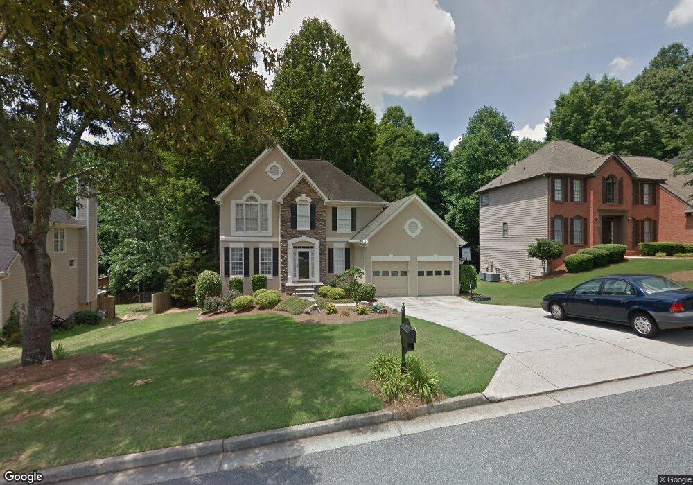
5615 Ashwind Trace Unit 5 Alpharetta, GA 30005
Estimated Value: $594,000 - $647,000
4
Beds
3
Baths
2,252
Sq Ft
$276/Sq Ft
Est. Value
About This Home
This home is located at 5615 Ashwind Trace Unit 5, Alpharetta, GA 30005 and is currently estimated at $620,561, approximately $275 per square foot. 5615 Ashwind Trace Unit 5 is a home located in Fulton County with nearby schools including Abbotts Hill Elementary School, Taylor Road Middle School, and Chattahoochee High School.
Ownership History
Date
Name
Owned For
Owner Type
Purchase Details
Closed on
Jun 8, 2001
Sold by
Reiner Karen
Bought by
Coram Mary A and Coram Jack C
Current Estimated Value
Home Financials for this Owner
Home Financials are based on the most recent Mortgage that was taken out on this home.
Original Mortgage
$190,000
Outstanding Balance
$72,216
Interest Rate
7.11%
Mortgage Type
New Conventional
Estimated Equity
$548,345
Purchase Details
Closed on
Nov 13, 2000
Sold by
Lederer William
Bought by
Lederer William
Create a Home Valuation Report for This Property
The Home Valuation Report is an in-depth analysis detailing your home's value as well as a comparison with similar homes in the area
Purchase History
| Date | Buyer | Sale Price | Title Company |
|---|---|---|---|
| Coram Mary A | $237,500 | -- | |
| Lederer William | -- | -- |
Source: Public Records
Mortgage History
| Date | Status | Borrower | Loan Amount |
|---|---|---|---|
| Open | Coram Mary A | $190,000 |
Source: Public Records
Tax History
| Year | Tax Paid | Tax Assessment Tax Assessment Total Assessment is a certain percentage of the fair market value that is determined by local assessors to be the total taxable value of land and additions on the property. | Land | Improvement |
|---|---|---|---|---|
| 2025 | $2,074 | $213,840 | $67,280 | $146,560 |
| 2023 | $5,142 | $182,160 | $35,920 | $146,240 |
| 2022 | $1,974 | $153,920 | $37,840 | $116,080 |
| 2021 | $1,940 | $126,480 | $25,280 | $101,200 |
| 2020 | $2,982 | $135,960 | $30,080 | $105,880 |
| 2019 | $352 | $133,560 | $29,560 | $104,000 |
| 2018 | $3,474 | $124,840 | $26,120 | $98,720 |
| 2017 | $3,111 | $103,560 | $14,600 | $88,960 |
| 2016 | $2,784 | $95,400 | $14,600 | $80,800 |
| 2015 | $3,095 | $104,280 | $14,600 | $89,680 |
| 2014 | $3,176 | $104,280 | $14,600 | $89,680 |
Source: Public Records
Map
Nearby Homes
- 1010 Vinebrook Ln
- 11840 Windbrooke Way
- 775 Ellsborough Ct
- 230 Leaf Ct Unit 604
- 5325 Hillgate Crossing
- 130 Wyndlam Ct
- 200 Blue Spruce Cir
- 11735 Bentham Ct
- 5965 Barrington Ln
- 11705 Bentham Ct Unit 1
- 335 Dunhill Way Ct
- 385 Cadeleigh Ct
- 11480 Bentham Ct Unit 2
- 5260 Cresslyn Ridge
- 5200 Cresslyn Ridge
- 6395 Bannerhorn Run
- 1895 Oak Tree Hollow
- 11619 Davenport Ln
- 12215 Winding Oak Trail
- 5071 Garrett Ct
- 5625 Ashwind Trace
- 5605 Ashwind Trace
- 5635 Ashwind Trace
- 11635 Windbrooke Way
- 5595 Ashwind Trace
- 11625 Windbrooke Way
- 605 Windland Close Unit 5
- 600 Windland Close
- 11645 Windbrooke Way Unit 2
- 5645 Ashwind Trace
- 5585 Ashwind Trace Unit 5
- 11605 Windbrooke Way
- 615 Windland Close Unit 5
- 610 Windland Close Unit 5
- 5640 Ashwind Trace Unit 5
- 11595 Windbrooke Way Unit 2
- 5600 Ashwind Trace
- 11655 Windbrooke Way
- 5655 Ashwind Trace
- 11585 Windbrooke Way
Your Personal Tour Guide
Ask me questions while you tour the home.