Estimated Value: $262,000 - $330,000
3
Beds
2
Baths
1,092
Sq Ft
$263/Sq Ft
Est. Value
About This Home
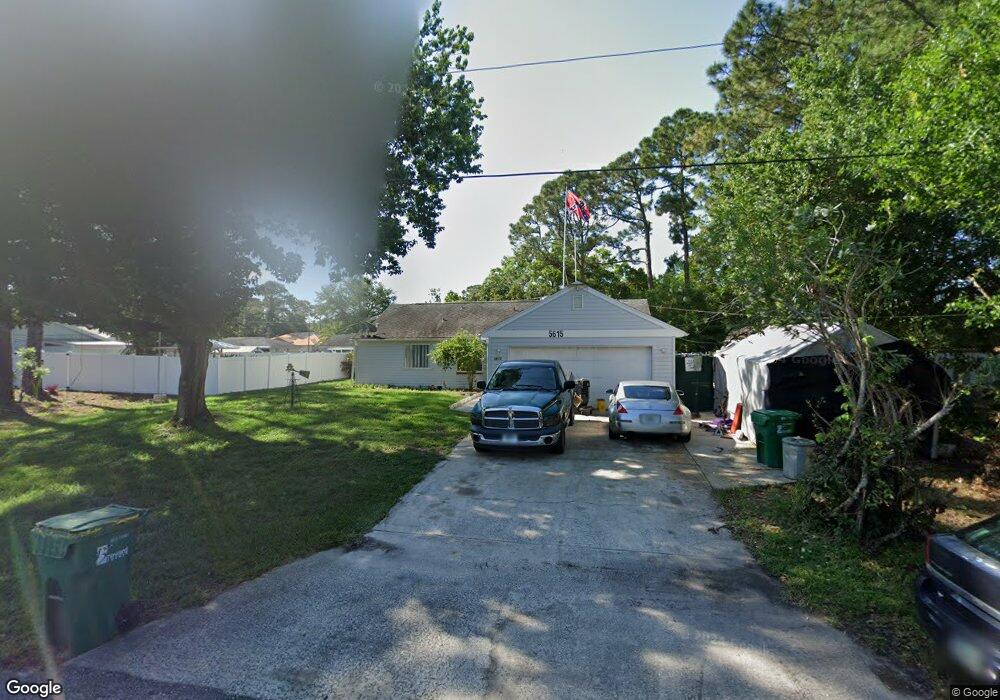
This home is located at 5615 Datura St, Cocoa, FL 32927 and is currently estimated at $287,550, approximately $263 per square foot. 5615 Datura St is a home located in Brevard County with nearby schools including Enterprise Elementary School, Space Coast Junior/Senior High School, and East Atlantic Prep of Brevard County.
Ownership History
Date
Name
Owned For
Owner Type
Purchase Details
Closed on
Jun 2, 2007
Sold by
King Debora B
Bought by
King William C
Current Estimated Value
Purchase Details
Closed on
Apr 17, 2000
Sold by
Lettman Carol and Lettman Jacquie
Bought by
King William C and King Debora B
Purchase Details
Closed on
Aug 26, 1994
Sold by
Cubbedge Timothy J
Bought by
Lloyd Ruby J
Home Financials for this Owner
Home Financials are based on the most recent Mortgage that was taken out on this home.
Original Mortgage
$45,700
Interest Rate
8.74%
Create a Home Valuation Report for This Property
The Home Valuation Report is an in-depth analysis detailing your home's value as well as a comparison with similar homes in the area
Home Values in the Area
Average Home Value in this Area
Purchase History
| Date | Buyer | Sale Price | Title Company |
|---|---|---|---|
| King William C | $20,000 | None Available | |
| King William C | $10,500 | -- | |
| Lloyd Ruby J | $61,000 | -- |
Source: Public Records
Mortgage History
| Date | Status | Borrower | Loan Amount |
|---|---|---|---|
| Previous Owner | Lloyd Ruby J | $45,700 |
Source: Public Records
Tax History Compared to Growth
Tax History
| Year | Tax Paid | Tax Assessment Tax Assessment Total Assessment is a certain percentage of the fair market value that is determined by local assessors to be the total taxable value of land and additions on the property. | Land | Improvement |
|---|---|---|---|---|
| 2025 | $1,097 | $86,910 | -- | -- |
| 2024 | $1,064 | $84,470 | -- | -- |
| 2023 | $1,064 | $82,010 | $0 | $0 |
| 2022 | $985 | $79,630 | $0 | $0 |
| 2021 | $976 | $77,320 | $0 | $0 |
| 2020 | $935 | $76,260 | $0 | $0 |
| 2019 | $874 | $74,550 | $0 | $0 |
| 2018 | $877 | $73,160 | $0 | $0 |
| 2017 | $881 | $71,660 | $0 | $0 |
| 2016 | $890 | $70,190 | $36,000 | $34,190 |
| 2015 | $900 | $69,710 | $30,000 | $39,710 |
| 2014 | $905 | $69,160 | $22,000 | $47,160 |
Source: Public Records
Map
Nearby Homes
- 7065 Hundred Acre Dr
- TBD Freeport Rd
- 7230 Venus Ave
- 5730 Friendly St
- 7635 Fringe Place
- 7358 Crepe Myrtle Ct
- 6643 Emil Ave
- 7469 Hackberry Rd
- 5155 Mayflower St
- 6615 Dock Ave
- 7545 Fringe Place
- 6581 Bancroft Ave
- 5575 Curtis Blvd
- 5090 Market St
- 5170 Everett St
- 6665 Addie Ave
- 4650 N Highway 1 Hwy
- 5715 Fairbridge St
- 7310 Joshua Place
- 7275 Durban Ave