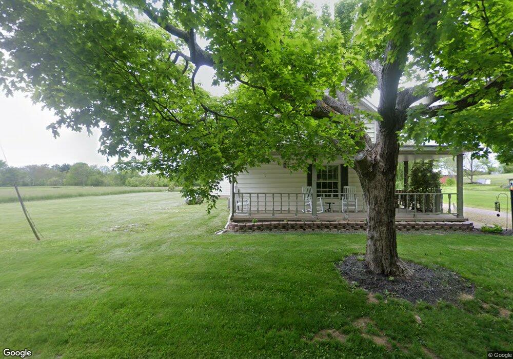
5615 Lower Bloomfield Rd New Concord, OH 43762
Estimated Value: $212,000 - $338,000
3
Beds
1
Bath
1,479
Sq Ft
$186/Sq Ft
Est. Value
About This Home
This home is located at 5615 Lower Bloomfield Rd, New Concord, OH 43762 and is currently estimated at $274,382, approximately $185 per square foot. 5615 Lower Bloomfield Rd is a home located in Muskingum County with nearby schools including New Concord Elementary School, East Muskingum Middle School, and Larry Miller Intermediate Elementary School.
Ownership History
Date
Name
Owned For
Owner Type
Purchase Details
Closed on
Sep 20, 2019
Sold by
Estate Of John Thomas
Bought by
Thomas Connie Jo
Current Estimated Value
Purchase Details
Closed on
Jan 27, 1997
Sold by
Ballantine H R
Bought by
Thomas John D and Thomas Connie Jo
Home Financials for this Owner
Home Financials are based on the most recent Mortgage that was taken out on this home.
Original Mortgage
$55,000
Outstanding Balance
$7,039
Interest Rate
9%
Mortgage Type
New Conventional
Estimated Equity
$267,343
Create a Home Valuation Report for This Property
The Home Valuation Report is an in-depth analysis detailing your home's value as well as a comparison with similar homes in the area
Home Values in the Area
Average Home Value in this Area
Purchase History
| Date | Buyer | Sale Price | Title Company |
|---|---|---|---|
| Thomas Connie Jo | -- | None Available | |
| Thomas John D | $55,000 | -- |
Source: Public Records
Mortgage History
| Date | Status | Borrower | Loan Amount |
|---|---|---|---|
| Open | Thomas John D | $55,000 |
Source: Public Records
Tax History Compared to Growth
Tax History
| Year | Tax Paid | Tax Assessment Tax Assessment Total Assessment is a certain percentage of the fair market value that is determined by local assessors to be the total taxable value of land and additions on the property. | Land | Improvement |
|---|---|---|---|---|
| 2024 | $1,848 | $56,490 | $4,585 | $51,905 |
| 2023 | $1,430 | $40,880 | $3,395 | $37,485 |
| 2022 | $1,401 | $40,880 | $3,395 | $37,485 |
| 2021 | $1,384 | $40,880 | $3,395 | $37,485 |
| 2020 | $1,239 | $35,525 | $2,940 | $32,585 |
| 2019 | $1,232 | $35,525 | $2,940 | $32,585 |
| 2018 | $1,259 | $35,525 | $2,940 | $32,585 |
| 2017 | $1,019 | $27,860 | $2,940 | $24,920 |
| 2016 | $1,021 | $27,860 | $2,940 | $24,920 |
| 2015 | $1,046 | $27,860 | $2,940 | $24,920 |
| 2013 | $1,124 | $27,860 | $2,940 | $24,920 |
Source: Public Records
Map
Nearby Homes
- 0 Norfield Unit 5174011
- 0 Norfield Unit 5173946
- 0 Bloomfield Rd
- 12985 John Glenn School Rd
- 6825 Barr Rd
- 760 Friendship Dr
- 112 Thompson Ave
- 110 Cherry Ln
- 8 E Main St
- 67 E Main St
- 1420 Glenn Hwy
- 0 Boden Rd
- 0 Haught Rd
- 0 Haught Rd Unit LOTWP001 24504411
- 0 Homestead Dr Unit 11611647
- 0 Homestead Dr Unit 5174212
- 64318 Haught Rd
- 3029 Best Rd
- 0 Maple Ln
- 0 Rix Mills Rd
- 5635 Lower Bloomfield Rd
- 5690 Lower Bloomfield Rd
- 5830 Friendship Dr
- 5825 Friendship Dr
- 5670 Cambridge Rd
- 5720 Cambridge Rd
- 5736 Avon Ln
- 5675 Cambridge Rd
- 5895 Friendship Dr
- 5725 Cambridge Rd
- 5725 Cambridge Rd
- 5725 Cambridge Rd
- 5741 Cambridge Rd
- 5795 Friendship Dr
- 5525 Lower Bloomfield Rd
- 5645 Lower Bloomfield Rd
- 5645 Lower Bloomfield Rd
- 5745 Cambridge Rd
- 5709 Avon Ln
- 5710 Friendship Dr