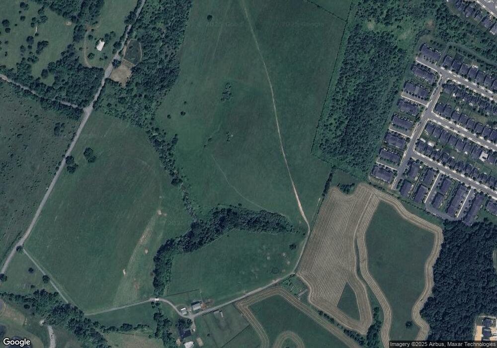
562 Milburn Rd Winchester, VA 22603
Stephenson NeighborhoodEstimated Value: $813,000 - $1,276,520
3
Beds
5
Baths
3,624
Sq Ft
$269/Sq Ft
Est. Value
About This Home
This home is located at 562 Milburn Rd, Winchester, VA 22603 and is currently estimated at $973,880, approximately $268 per square foot. 562 Milburn Rd is a home located in Frederick County with nearby schools including Stonewall Elementary School, James Wood Middle School, and James Wood High School.
Ownership History
Date
Name
Owned For
Owner Type
Purchase Details
Closed on
Apr 9, 2021
Sold by
Slaughter Judith Mccann
Bought by
Stephenson Associates Lc
Current Estimated Value
Purchase Details
Closed on
Sep 29, 2006
Sold by
Stephenson Assoc
Bought by
Slaughter Judith M
Create a Home Valuation Report for This Property
The Home Valuation Report is an in-depth analysis detailing your home's value as well as a comparison with similar homes in the area
Home Values in the Area
Average Home Value in this Area
Purchase History
| Date | Buyer | Sale Price | Title Company |
|---|---|---|---|
| Stephenson Associates Lc | -- | None Listed On Document | |
| Shenandoah Valley Battlefields Foundatio | -- | None Listed On Document | |
| Slaughter Judith M | $154,000 | -- |
Source: Public Records
Tax History Compared to Growth
Tax History
| Year | Tax Paid | Tax Assessment Tax Assessment Total Assessment is a certain percentage of the fair market value that is determined by local assessors to be the total taxable value of land and additions on the property. | Land | Improvement |
|---|---|---|---|---|
| 2025 | $3,973 | $827,660 | $143,700 | $683,960 |
| 2024 | $1,906 | $1,221,200 | $600,600 | $620,600 |
| 2023 | $3,811 | $1,221,200 | $600,600 | $620,600 |
| 2022 | $3,724 | $1,044,900 | $551,400 | $493,500 |
| 2021 | $3,724 | $1,044,900 | $551,400 | $493,500 |
| 2020 | $3,722 | $1,044,600 | $551,400 | $493,200 |
| 2019 | $3,722 | $1,044,600 | $551,400 | $493,200 |
| 2018 | $3,475 | $1,004,000 | $546,400 | $457,600 |
| 2017 | $3,417 | $1,004,000 | $546,400 | $457,600 |
| 2016 | $3,245 | $963,900 | $533,700 | $430,200 |
| 2015 | $3,029 | $963,900 | $533,700 | $430,200 |
| 2014 | $959 | $892,300 | $533,700 | $358,600 |
Source: Public Records
Map
Nearby Homes
- 108 Magpie Ln
- 105 Castaway Place
- 115 Sapphire St
- 105 Castaway Place
- 110 Carnation Way
- Fitzgerald Plan at Hiatt Pointe at Snowden Bridge - 55+ Garden Homes Collection
- Hemingway Plan at Hiatt Pointe at Snowden Bridge - 55+ Garden Homes Collection
- Matisse Plan at Hiatt Pointe at Snowden Bridge - 55+ Single Family Homes Collection
- Rembrandt Plan at Hiatt Pointe at Snowden Bridge - 55+ Single Family Homes Collection
- Rockwell Plan at Hiatt Pointe at Snowden Bridge - 55+ Single Family Homes Collection
- Northgate Plan at Hiatt Pointe at Snowden Bridge - 55+ Villas Collection
- 123 Castaway Place
- 126 Wagtail Ln
- 128 Wagtail Ln
- 119 Sapphire St
- 106 Alabaster Ln
- 108 Lawford
- 124 Wagtail Ln
- 2369 Sapphire St
- Scot 40-F2 Plan at Snowden Bridge - Single Family
- 0 Magpie Ln Unit VAFV2021472
- 109 Domino Ct
- 107 Domino Ct
- 105 Domino Ct
- 103 Domino Ct
- 101 Domino Ct
- 215 Arrow Crown Ct
- 110 Domino Ct
- 211 Arrow Crown Ct
- 116 Pintangle Ct
- 108 Domino Ct
- 209 Arrow Crown Ct
- 106 Domino Ct
- 114 Pintangle Ct
- 104 Domino Ct
- 207 Arrow Crown Ct
- 102 Domino Ct
- 100 Domino Ct
- 110 Pintangle Ct
- 115 Pintangle Ct
