Estimated Value: $787,361 - $857,000
4
Beds
3
Baths
1,764
Sq Ft
$470/Sq Ft
Est. Value
About This Home
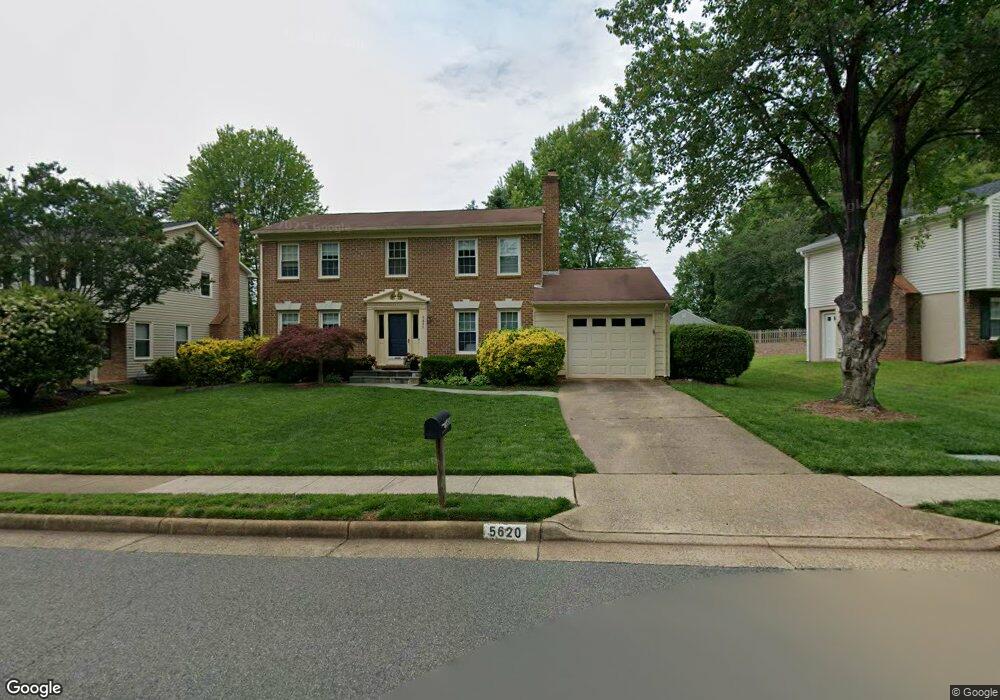
This home is located at 5620 Mount Burnside Way, Burke, VA 22015 and is currently estimated at $828,590, approximately $469 per square foot. 5620 Mount Burnside Way is a home located in Fairfax County with nearby schools including Ravensworth Elementary School, Lake Braddock Secondary School, and Holy Spirit School.
Ownership History
Date
Name
Owned For
Owner Type
Purchase Details
Closed on
Apr 18, 2015
Sold by
Cashman Peter
Bought by
Cashman Megan
Current Estimated Value
Home Financials for this Owner
Home Financials are based on the most recent Mortgage that was taken out on this home.
Original Mortgage
$364,683
Outstanding Balance
$280,842
Interest Rate
3.75%
Mortgage Type
New Conventional
Estimated Equity
$547,748
Purchase Details
Closed on
Jul 12, 2010
Sold by
Vogel Edward B
Bought by
Cashman Peter
Home Financials for this Owner
Home Financials are based on the most recent Mortgage that was taken out on this home.
Original Mortgage
$400,000
Interest Rate
4.78%
Mortgage Type
New Conventional
Create a Home Valuation Report for This Property
The Home Valuation Report is an in-depth analysis detailing your home's value as well as a comparison with similar homes in the area
Home Values in the Area
Average Home Value in this Area
Purchase History
| Date | Buyer | Sale Price | Title Company |
|---|---|---|---|
| Cashman Megan | $51,000 | -- | |
| Cashman Peter | $500,000 | -- |
Source: Public Records
Mortgage History
| Date | Status | Borrower | Loan Amount |
|---|---|---|---|
| Open | Cashman Megan | $364,683 | |
| Previous Owner | Cashman Peter | $400,000 |
Source: Public Records
Tax History
| Year | Tax Paid | Tax Assessment Tax Assessment Total Assessment is a certain percentage of the fair market value that is determined by local assessors to be the total taxable value of land and additions on the property. | Land | Improvement |
|---|---|---|---|---|
| 2025 | $8,935 | $800,440 | $339,000 | $461,440 |
| 2024 | $8,935 | $723,320 | $299,000 | $424,320 |
| 2023 | $8,653 | $723,320 | $299,000 | $424,320 |
| 2022 | $8,117 | $668,280 | $279,000 | $389,280 |
| 2021 | $7,669 | $619,440 | $259,000 | $360,440 |
| 2020 | $7,231 | $579,680 | $249,000 | $330,680 |
| 2019 | $7,098 | $567,200 | $243,000 | $324,200 |
| 2018 | $6,126 | $532,730 | $238,000 | $294,730 |
| 2017 | $6,449 | $525,730 | $231,000 | $294,730 |
| 2016 | $6,255 | $510,150 | $224,000 | $286,150 |
Source: Public Records
Map
Nearby Homes
- 9101 Blue Jug Landing
- 9010 Lake Braddock Dr
- 5004 Prince Caspian Ln
- 5844 Kara Place
- 9145 Schoolcraft Ln
- 5802 Silchester St
- 5835 Fitzhugh St
- 9078 Brook Ford Rd
- 5515 Westcliff Ct
- 5613 Eastbourne Dr
- 5513 Westcliff Ct
- 5519 Yorkshire St
- 9056 Brook Ford Rd
- 5829 Parakeet Dr
- 8802 Parliament Dr
- 9225 Sand Creek Ct
- 9329 Raintree Rd
- 5840 Burke Manor Ct
- 6027 Ridge Ford Dr
- 5822 Burke Manor Ct
- 5622 Mount Burnside Way
- 5618 Mount Burnside Way
- 9083 Blue Jug Landing
- 9081 Blue Jug Landing
- 5624 Mount Burnside Way
- 5612 Mount Burnside Way
- 5619 Mount Burnside Way
- 9085 Blue Jug Landing
- 5623 Mount Burnside Way
- 9079 Blue Jug Landing
- 5626 Mount Burnside Way
- 5608 Mount Burnside Way
- 5617 Mount Burnside Way
- 5625 Mount Burnside Way
- 5631 Herberts Crossing Dr
- 5626 Herberts Crossing Dr
- 9087 Blue Jug Landing
- 5615 Mount Burnside Way
- 5606 Mount Burnside Way
- 5628 Mount Burnside Way
Your Personal Tour Guide
Ask me questions while you tour the home.