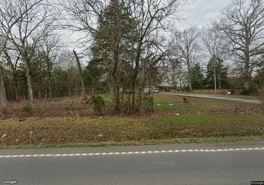
5625 State Highway 58 S Decatur, TN 37322
Estimated Value: $186,371 - $361,000
--
Bed
2
Baths
1,200
Sq Ft
$242/Sq Ft
Est. Value
About This Home
This home is located at 5625 State Highway 58 S, Decatur, TN 37322 and is currently estimated at $290,843, approximately $242 per square foot. 5625 State Highway 58 S is a home located in Meigs County with nearby schools including Meigs County High School.
Ownership History
Date
Name
Owned For
Owner Type
Purchase Details
Closed on
Mar 9, 2024
Sold by
Strickland Deborah A and Strickland Christopher
Bought by
Suttles Elsie and Strickland Christopher
Current Estimated Value
Purchase Details
Closed on
Jan 27, 1995
Bought by
Strickland Charles E %Amsouth Bank Of Tn
Purchase Details
Closed on
Jul 26, 1993
Bought by
Cofer Zendal L and Cofer Donna J
Purchase Details
Closed on
Feb 8, 1993
Bought by
Parker David R and Parker Bea
Purchase Details
Closed on
Jul 22, 1991
Bought by
Whitener Herbert and Whitener Patricia M
Purchase Details
Closed on
Nov 20, 1986
Bought by
Parker David R
Purchase Details
Closed on
Nov 25, 1985
Bought by
Farmers Home Administration
Purchase Details
Closed on
Aug 25, 1981
Purchase Details
Closed on
Aug 21, 1981
Purchase Details
Closed on
May 2, 1977
Create a Home Valuation Report for This Property
The Home Valuation Report is an in-depth analysis detailing your home's value as well as a comparison with similar homes in the area
Home Values in the Area
Average Home Value in this Area
Purchase History
| Date | Buyer | Sale Price | Title Company |
|---|---|---|---|
| Suttles Elsie | -- | None Listed On Document | |
| Suttles Elsie | -- | None Listed On Document | |
| Strickland Charles E %Amsouth Bank Of Tn | $36,900 | -- | |
| Strickland Charles E %Amsouth Bank Of Tn | $36,900 | -- | |
| Cofer Zendal L | $35,000 | -- | |
| Cofer Zendal L | $35,000 | -- | |
| Parker David R | -- | -- | |
| Parker David R | -- | -- | |
| Whitener Herbert | $33,000 | -- | |
| Whitener Herbert | $33,000 | -- | |
| Parker David R | $12,500 | -- | |
| Parker David R | $12,500 | -- | |
| Farmers Home Administration | -- | -- | |
| Farmers Home Administration | -- | -- | |
| -- | -- | -- | |
| -- | -- | -- | |
| -- | -- | -- | |
| -- | -- | -- | |
| -- | -- | -- | |
| -- | -- | -- |
Source: Public Records
Tax History Compared to Growth
Tax History
| Year | Tax Paid | Tax Assessment Tax Assessment Total Assessment is a certain percentage of the fair market value that is determined by local assessors to be the total taxable value of land and additions on the property. | Land | Improvement |
|---|---|---|---|---|
| 2024 | $512 | $30,325 | $2,825 | $27,500 |
| 2023 | $512 | $30,325 | $2,825 | $27,500 |
| 2022 | $512 | $30,325 | $2,825 | $27,500 |
| 2021 | $512 | $30,325 | $2,825 | $27,500 |
| 2020 | $512 | $30,325 | $2,825 | $27,500 |
| 2019 | $512 | $25,825 | $2,875 | $22,950 |
| 2018 | $512 | $25,825 | $2,875 | $22,950 |
| 2017 | $512 | $25,825 | $2,875 | $22,950 |
| 2016 | $512 | $25,825 | $2,875 | $22,950 |
| 2015 | $484 | $25,825 | $2,875 | $22,950 |
| 2014 | $485 | $25,925 | $3,000 | $22,925 |
Source: Public Records
Map
Nearby Homes
- 5682 Tennessee 58
- 783 Lakehaven Cir
- 383 Lakehaven Cir
- Tract 1 Redman Ridge Ln
- Tract 1 Redman Ridge Ln
- 482 Hiwassee Dr
- 152 Hiwassee Dr
- 132 Hiwassee Dr
- 3851 Redman Ln
- 2b Redman Ridge Ln
- 2a Redman Ridge Ln
- 3313 Redman Ln
- 334 Windmill Ln
- 362 Windmill Ln
- 132 Burkett Chapel Rd
- 1043 Mt Carmel Rd
- 238 Ware Ln
- 1063 Mt Carmel Rd
- 119 Agency Creek Ln
- 5742 State Highway 58 S
- 5766 State Highway 58 S
- 5745 State Highway 58 S
- 5766 Tennessee 58
- 2 Tennessee 58
- Lot 2 State Highway 58 N
- 5745 Tennessee 58
- 5788 State Highway 58 S
- 546 Randolph Ln
- 0 Randolph Ln Unit RTC2917444
- 0 Randolph Ln Unit 16145
- 0 Randolph Ln Unit 776858
- 5533 State Highway 58 S
- 5533 State Highway 58 S
- 147 Cameron Rd
- 5584 State Highway 58 S
- 594 Randolph Ln
- 571 Randolph Ln
- 5465 State Highway 58 S
- 221 Randolph Ln
