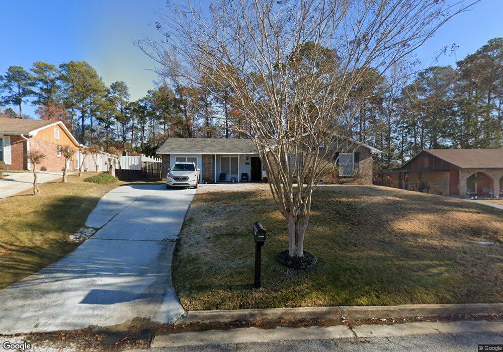
5627 Monmouth Dr Columbus, GA 31907
Eastern Columbus NeighborhoodEstimated Value: $154,017 - $190,000
4
Beds
2
Baths
1,523
Sq Ft
$110/Sq Ft
Est. Value
About This Home
This home is located at 5627 Monmouth Dr, Columbus, GA 31907 and is currently estimated at $168,254, approximately $110 per square foot. 5627 Monmouth Dr is a home located in Muscogee County with nearby schools including Dawson Elementary School, East Columbus Magnet Academy, and Spencer High School.
Ownership History
Date
Name
Owned For
Owner Type
Purchase Details
Closed on
Jun 26, 2020
Sold by
Jones Maurice
Bought by
Edmond Daryl and Edmond Kirren
Current Estimated Value
Home Financials for this Owner
Home Financials are based on the most recent Mortgage that was taken out on this home.
Original Mortgage
$112,420
Outstanding Balance
$99,687
Interest Rate
3.1%
Mortgage Type
New Conventional
Estimated Equity
$68,567
Purchase Details
Closed on
Aug 25, 2008
Sold by
Wells Fargo Bank Na
Bought by
Jones Maurice and Jones Sonja L
Purchase Details
Closed on
Jan 3, 2008
Sold by
Jones Windiey
Bought by
Wells Fargo Bank Na and First Franklin Mortgage Loan Trust 2006-
Create a Home Valuation Report for This Property
The Home Valuation Report is an in-depth analysis detailing your home's value as well as a comparison with similar homes in the area
Home Values in the Area
Average Home Value in this Area
Purchase History
| Date | Buyer | Sale Price | Title Company |
|---|---|---|---|
| Edmond Daryl | $118,420 | -- | |
| Jones Maurice | $85,000 | None Available | |
| Wells Fargo Bank Na | $106,631 | None Available |
Source: Public Records
Mortgage History
| Date | Status | Borrower | Loan Amount |
|---|---|---|---|
| Open | Edmond Daryl | $112,420 |
Source: Public Records
Tax History Compared to Growth
Tax History
| Year | Tax Paid | Tax Assessment Tax Assessment Total Assessment is a certain percentage of the fair market value that is determined by local assessors to be the total taxable value of land and additions on the property. | Land | Improvement |
|---|---|---|---|---|
| 2025 | $1,806 | $46,132 | $12,660 | $33,472 |
| 2024 | $1,806 | $46,132 | $12,660 | $33,472 |
| 2023 | $1,817 | $46,132 | $12,660 | $33,472 |
| 2022 | $1,418 | $34,740 | $12,660 | $22,080 |
| 2021 | $1,372 | $33,596 | $12,660 | $20,936 |
| 2020 | $1,372 | $33,596 | $12,660 | $20,936 |
| 2019 | $1,376 | $33,596 | $12,660 | $20,936 |
| 2018 | $1,376 | $33,596 | $12,660 | $20,936 |
| 2017 | $1,381 | $33,596 | $12,660 | $20,936 |
| 2016 | $1,885 | $45,690 | $5,832 | $39,858 |
| 2015 | $1,887 | $45,690 | $5,832 | $39,858 |
| 2014 | $1,889 | $45,690 | $5,832 | $39,858 |
| 2013 | -- | $45,690 | $5,832 | $39,858 |
Source: Public Records
Map
Nearby Homes
- 5664 St Marys Rd
- 5613 Quebec Dr
- 5644 Quebec Dr
- 5728 Lexington Dr
- 5310 Stoney Point Rd
- 4462 Walking Stick Way
- 1513 Alamo Dr
- 5336 Gettysburg Way
- 1238 Brandywine Dr
- 1340 Bunker Ridge Ln
- 1210 Bunker Hill Rd
- 4408 Walking Stick Way
- 5219 Argonne Dr
- 5109 Lexington Ln
- 5090 Lexington Ln
- 849 Bunker Hill Rd
- 780 Honey Do Ct
- 4939 Aaron Dr
- 1025 Belmar St
- 4965 Brightstar Ln
- 5633 Monmouth Dr
- 5621 Monmouth Dr
- 0 Monmouth Dr Unit 8028387
- 5639 Monmouth Dr
- 5615 Monmouth Dr
- 5624 Monmouth Dr
- 5634 Monmouth Dr
- 5645 Monmouth Dr
- 5609 Monmouth Dr
- 5642 Monmouth Dr
- 5608 Monmouth Dr
- 5651 Monmouth Dr
- 5648 Monmouth Dr
- 5601 Monmouth Dr
- 5602 Monmouth Dr
- 1300 Trenton Ct
- 1881 Bunker Hill Rd
- 1304 Trenton Ct
- 1955 Bunker Hill Rd
- 5640 Saint Marys Rd