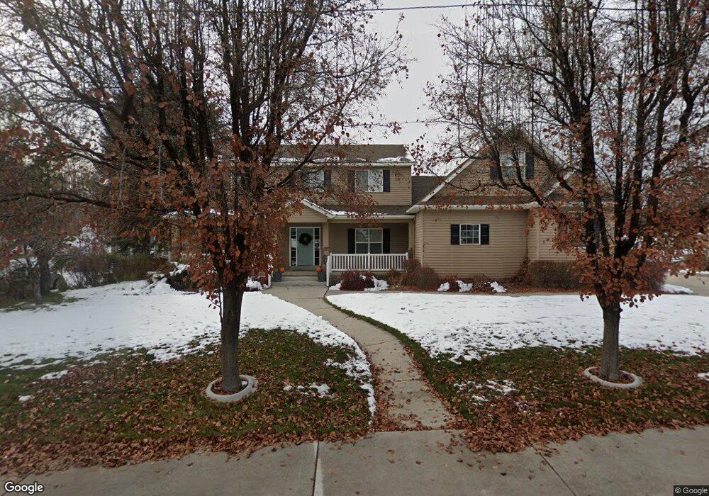
563 Grove Dr Alpine, UT 84004
Estimated Value: $716,000 - $1,003,000
4
Beds
3
Baths
2,565
Sq Ft
$352/Sq Ft
Est. Value
About This Home
This home is located at 563 Grove Dr, Alpine, UT 84004 and is currently estimated at $903,447, approximately $352 per square foot. 563 Grove Dr is a home located in Utah County with nearby schools including Alpine School, Timberline Middle School, and Lone Peak High School.
Ownership History
Date
Name
Owned For
Owner Type
Purchase Details
Closed on
Jul 28, 2008
Sold by
Johnson Chris H and Johnson Colette J
Bought by
Johnson Christopher H and Johnson Colette J
Current Estimated Value
Home Financials for this Owner
Home Financials are based on the most recent Mortgage that was taken out on this home.
Original Mortgage
$293,000
Outstanding Balance
$193,058
Interest Rate
6.41%
Mortgage Type
New Conventional
Estimated Equity
$710,389
Purchase Details
Closed on
Aug 21, 2003
Sold by
Erickson Douglas V and Erickson Mary S
Bought by
Johnson Chris H and Johnson Colette J
Home Financials for this Owner
Home Financials are based on the most recent Mortgage that was taken out on this home.
Original Mortgage
$67,500
Interest Rate
3.75%
Mortgage Type
Purchase Money Mortgage
Create a Home Valuation Report for This Property
The Home Valuation Report is an in-depth analysis detailing your home's value as well as a comparison with similar homes in the area
Home Values in the Area
Average Home Value in this Area
Purchase History
| Date | Buyer | Sale Price | Title Company |
|---|---|---|---|
| Johnson Christopher H | -- | Equity Title Insurance Agen | |
| Johnson Chris H | -- | West Title Company |
Source: Public Records
Mortgage History
| Date | Status | Borrower | Loan Amount |
|---|---|---|---|
| Open | Johnson Christopher H | $293,000 | |
| Closed | Johnson Chris H | $67,500 |
Source: Public Records
Tax History
| Year | Tax Paid | Tax Assessment Tax Assessment Total Assessment is a certain percentage of the fair market value that is determined by local assessors to be the total taxable value of land and additions on the property. | Land | Improvement |
|---|---|---|---|---|
| 2025 | $3,586 | $452,980 | -- | -- |
| 2024 | $3,586 | $417,945 | $0 | $0 |
| 2023 | $3,354 | $419,650 | $0 | $0 |
| 2022 | $3,678 | $446,985 | $0 | $0 |
| 2021 | $3,039 | $573,700 | $227,700 | $346,000 |
| 2020 | $2,855 | $527,500 | $198,000 | $329,500 |
| 2019 | $2,512 | $484,500 | $198,000 | $286,500 |
| 2018 | $2,341 | $446,000 | $190,100 | $255,900 |
| 2017 | $2,211 | $224,235 | $0 | $0 |
| 2016 | $2,205 | $208,450 | $0 | $0 |
| 2015 | $2,173 | $194,370 | $0 | $0 |
| 2014 | $2,049 | $181,280 | $0 | $0 |
Source: Public Records
Map
Nearby Homes
- 475 Grove Dr
- 358 Eastview Dr
- 499 E 300 N
- 151 Glacier Lily Dr
- 48 N 100 E
- 381 E Watkins Cir Unit 28
- 30 S Main St
- 382 E Heritage Hills Dr
- 19 E Elk Ct
- 463 Heritage Hills Dr
- 102 E Deer Crest Ln
- 1319 N Eastview Ln Unit 214
- 887 E Village Way
- 820 Eagleview Dr
- 1333 N Eastview Ln
- 250 S Main St Unit 25
- 250 S Main St Unit 20
- 250 S Main St Unit 9
- 250 S Main St Unit 7
- 202 E Alpine Dr
- 581 Grove Dr
- 539 Grove Dr
- 256 Pioneer Dr
- 595 Grove Dr
- 580 Grove Dr
- 542 Grove Dr
- 560 Grove Dr
- 521 Grove Dr
- 299 E Pioneer Rd
- 516 Grove Dr
- 299 Pioneer Dr
- 499 Grove Dr
- 623 N Patterson Ln
- 468 Grove Dr
- 525 Mountainville Cir
- 239 Pioneer Dr
- 615 Grove Dr
- 543 Mountainville Cir
- 602 Grove Dr
- 509 Mountainville Cir
Your Personal Tour Guide
Ask me questions while you tour the home.