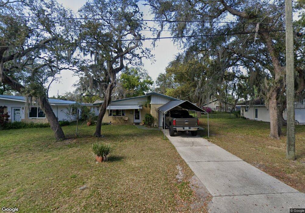
5630 Palm Ave Port Orange, FL 32127
Harbor Oaks NeighborhoodEstimated Value: $146,000 - $253,000
2
Beds
2
Baths
1,275
Sq Ft
$175/Sq Ft
Est. Value
About This Home
This home is located at 5630 Palm Ave, Port Orange, FL 32127 and is currently estimated at $223,400, approximately $175 per square foot. 5630 Palm Ave is a home located in Volusia County with nearby schools including Port Orange Elementary School, Silver Sands Middle School, and Spruce Creek High School.
Ownership History
Date
Name
Owned For
Owner Type
Purchase Details
Closed on
Oct 23, 2003
Sold by
Tindell Deborah Poulin
Bought by
Tindell Deborah Poulin and Tindell Charles
Current Estimated Value
Purchase Details
Closed on
Nov 29, 1999
Sold by
Rodgers David K
Bought by
Rodgers Deborah Jane Poulin
Purchase Details
Closed on
Feb 15, 1989
Bought by
Tindell Deborah Poulin
Purchase Details
Closed on
Jun 15, 1988
Bought by
Tindell Deborah Poulin
Purchase Details
Closed on
Aug 15, 1972
Bought by
Tindell Deborah Poulin
Create a Home Valuation Report for This Property
The Home Valuation Report is an in-depth analysis detailing your home's value as well as a comparison with similar homes in the area
Home Values in the Area
Average Home Value in this Area
Purchase History
| Date | Buyer | Sale Price | Title Company |
|---|---|---|---|
| Tindell Deborah Poulin | -- | -- | |
| Rodgers Deborah Jane Poulin | -- | -- | |
| Tindell Deborah Poulin | $51,400 | -- | |
| Tindell Deborah Poulin | $100 | -- | |
| Tindell Deborah Poulin | $21,000 | -- |
Source: Public Records
Tax History Compared to Growth
Tax History
| Year | Tax Paid | Tax Assessment Tax Assessment Total Assessment is a certain percentage of the fair market value that is determined by local assessors to be the total taxable value of land and additions on the property. | Land | Improvement |
|---|---|---|---|---|
| 2025 | $676 | $83,124 | -- | -- |
| 2024 | $676 | $80,782 | -- | -- |
| 2023 | $676 | $78,430 | $0 | $0 |
| 2022 | $704 | $76,146 | $0 | $0 |
| 2021 | $712 | $73,928 | $0 | $0 |
| 2020 | $703 | $72,907 | $0 | $0 |
| 2019 | $703 | $71,268 | $0 | $0 |
| 2018 | $710 | $69,939 | $0 | $0 |
| 2017 | $719 | $68,500 | $0 | $0 |
| 2016 | $718 | $67,091 | $0 | $0 |
| 2015 | $740 | $66,625 | $0 | $0 |
| 2014 | $746 | $66,096 | $0 | $0 |
Source: Public Records
Map
Nearby Homes
- 5650 Palm Ave
- 720 Palm Circle Dr
- 720 Palm Cir Dr
- 5476 W Bayshore Dr
- 411 Acacia Cir
- 418 Acacia Cir
- 5585 Lancewood Cir S Unit S
- 5585 Lancewood Cir S
- 5561 Magnolia Ave
- 5563 W Magnolia Ave
- 276 Farmbrook Rd
- 5508 Lancewood Cir N
- 88 E Bayshore Dr
- 5697 Christiancy Ave
- 24 Oak St
- 18 E Magnolia Ave
- 5478 Landis Ave
- 5948 Riverside Dr
- 5200 S Nova Rd Unit 202
- 5200 S Nova Rd Unit 131