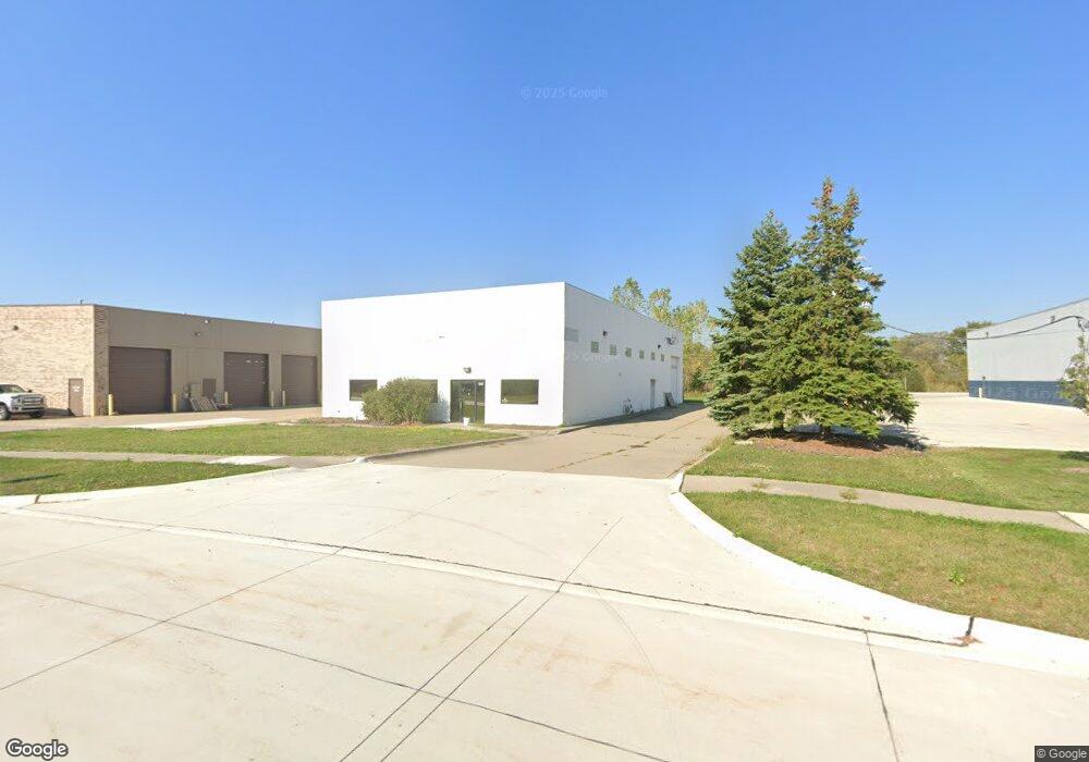
56305 Precision Dr Chesterfield, MI 48051
Estimated Value: $681,424
--
Bed
--
Bath
5,200
Sq Ft
$131/Sq Ft
Est. Value
About This Home
This home is located at 56305 Precision Dr, Chesterfield, MI 48051 and is currently estimated at $681,424, approximately $131 per square foot. 56305 Precision Dr is a home located in Macomb County with nearby schools including New Haven High School, Merritt Academy, and Austin Catholic Academy.
Ownership History
Date
Name
Owned For
Owner Type
Purchase Details
Closed on
Mar 5, 2022
Sold by
Khaled Abdul-Nour
Bought by
Precision Dr 56305 Llc
Current Estimated Value
Purchase Details
Closed on
Feb 11, 2022
Sold by
V & L Properties Llc
Bought by
Abdul-Nour Khaled and Kluck Robert
Purchase Details
Closed on
Feb 10, 2022
Sold by
V & L Properties Llc
Bought by
Abdul-Nour Khaled and Kluck Robert
Purchase Details
Closed on
Feb 4, 2022
Sold by
V & L Properties Llc
Bought by
Abdul-Nour Khaled and Kluck Robert
Purchase Details
Closed on
Aug 26, 2004
Sold by
Impastato Vincent J and Impastato Laura J
Bought by
V & L Properties Llc
Create a Home Valuation Report for This Property
The Home Valuation Report is an in-depth analysis detailing your home's value as well as a comparison with similar homes in the area
Home Values in the Area
Average Home Value in this Area
Purchase History
| Date | Buyer | Sale Price | Title Company |
|---|---|---|---|
| Precision Dr 56305 Llc | -- | None Listed On Document | |
| Abdul-Nour Khaled | -- | None Listed On Document | |
| Abdul-Nour Khaled | -- | None Listed On Document | |
| Abdul-Nour Khaled | $625,000 | Ata National Title | |
| Abdul-Nour Khaled | -- | None Listed On Document | |
| V & L Properties Llc | -- | -- |
Source: Public Records
Tax History Compared to Growth
Tax History
| Year | Tax Paid | Tax Assessment Tax Assessment Total Assessment is a certain percentage of the fair market value that is determined by local assessors to be the total taxable value of land and additions on the property. | Land | Improvement |
|---|---|---|---|---|
| 2025 | $9,844 | $184,400 | $0 | $0 |
| 2024 | $5,441 | $183,900 | $0 | $0 |
| 2023 | $5,258 | $178,300 | $0 | $0 |
| 2022 | $3,680 | $161,900 | $0 | $0 |
| 2021 | $6,475 | $156,500 | $0 | $0 |
| 2020 | $3,540 | $153,100 | $0 | $0 |
| 2019 | $5,700 | $145,700 | $0 | $0 |
| 2018 | $5,790 | $134,400 | $30,200 | $104,200 |
| 2017 | $5,724 | $128,550 | $30,150 | $98,400 |
| 2016 | $5,700 | $128,550 | $0 | $0 |
| 2015 | $2,655 | $116,100 | $0 | $0 |
| 2014 | $2,655 | $109,050 | $27,400 | $81,650 |
| 2012 | -- | $0 | $0 | $0 |
Source: Public Records
Map
Nearby Homes
- 30601 Victoria Ct
- 30608 Eleanor Ct Unit 72
- 00 Gratiot Ave
- Vacant Land 26 Mile Rd
- 30596 Sabrina Ct
- 28405 26 Mile Rd
- 53929 Bates Rd
- 53841 Bates Rd
- 53659 Bates Rd
- 53615 Bates Rd
- 53737 Bates Rd
- 27350 25 Mile Rd
- 58151 Kincaid St
- 30185 Carl St
- 58156 Kincaid St
- 58168 Kincaid St
- 58199 Kincaid St
- 57237 Place Rd
- 58180 Kincaid St
- The Ludington Plan at Pembrooke South
- 32550 26 Mile Rd
- 56308 N Bay Dr
- 30221 26 Mile Rd Unit 30445 26 Mile
- 30221 26 Mile Rd Unit 30221-30225-30445 26
- 30221 26 Mile Rd Unit 30221
- 30221 26 Mile Rd
- 29700 26 Mile Rd
- 30445 26 Mile Rd
- 29901 26 Mile Rd
- 30500 Commerce Blvd
- 30500 Commerce Blvd
- 30405 26 Mile Rd
- 30520 26 Mile Rd
- 30475 26 Mile Rd
- 57150 Rosell Rd
- 30622 26 Mile Rd
- 29470 26 Mile Rd
- 30650 26 Mile Rd
- 57250 Rosell Rd
- 29270 26 Mile Rd