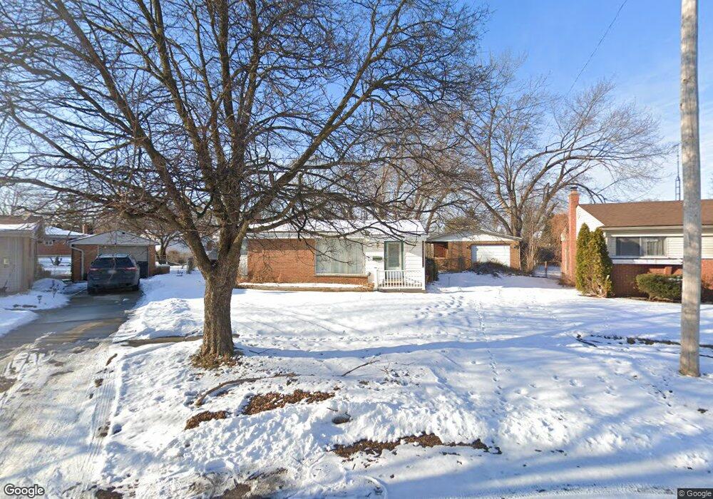
5633 Leslie Ct Flint, MI 48504
Bel-Aire Woods NeighborhoodEstimated Value: $53,989 - $67,000
3
Beds
2
Baths
994
Sq Ft
$62/Sq Ft
Est. Value
About This Home
This home is located at 5633 Leslie Ct, Flint, MI 48504 and is currently estimated at $61,997, approximately $62 per square foot. 5633 Leslie Ct is a home located in Genesee County with nearby schools including Brownell STEM Academy, The New Standard Academy, and Eagle's Nest Academy.
Ownership History
Date
Name
Owned For
Owner Type
Purchase Details
Closed on
Nov 25, 2024
Sold by
Kinzer Anthony
Bought by
Notoriety Property Management Llc
Current Estimated Value
Purchase Details
Closed on
Jun 2, 2024
Sold by
Kinzer Anthony Dwayne
Bought by
Davis Michael and Crowder Michael
Purchase Details
Closed on
Aug 28, 2017
Sold by
Riggs Jennife
Bought by
Kinzer Anthony Dwayne
Purchase Details
Closed on
Dec 20, 2016
Sold by
Cherry Deborah L
Bought by
Genesee County Land Bank
Purchase Details
Closed on
Aug 30, 2004
Sold by
Harting Richard
Bought by
Wynn Roderick and Wynn Jill
Create a Home Valuation Report for This Property
The Home Valuation Report is an in-depth analysis detailing your home's value as well as a comparison with similar homes in the area
Home Values in the Area
Average Home Value in this Area
Purchase History
| Date | Buyer | Sale Price | Title Company |
|---|---|---|---|
| Notoriety Property Management Llc | -- | None Listed On Document | |
| Davis Michael | $3,000 | None Listed On Document | |
| Kinzer Anthony Dwayne | -- | None Available | |
| Genesee County Land Bank | -- | None Available | |
| Wynn Roderick | $24,500 | -- |
Source: Public Records
Tax History Compared to Growth
Tax History
| Year | Tax Paid | Tax Assessment Tax Assessment Total Assessment is a certain percentage of the fair market value that is determined by local assessors to be the total taxable value of land and additions on the property. | Land | Improvement |
|---|---|---|---|---|
| 2025 | $963 | $16,900 | $0 | $0 |
| 2024 | $896 | $17,100 | $0 | $0 |
| 2023 | $879 | $14,200 | $0 | $0 |
| 2022 | $0 | $10,300 | $0 | $0 |
| 2021 | $889 | $10,400 | $0 | $0 |
| 2020 | $822 | $10,400 | $0 | $0 |
| 2019 | $807 | $8,300 | $0 | $0 |
| 2018 | $863 | $9,200 | $0 | $0 |
| 2017 | $221 | $0 | $0 | $0 |
| 2016 | $745 | $0 | $0 | $0 |
| 2015 | $0 | $0 | $0 | $0 |
| 2014 | -- | $0 | $0 | $0 |
| 2012 | -- | $14,100 | $0 | $0 |
Source: Public Records
Map
Nearby Homes
- 5616 Griggs Dr
- 5620 Marlowe Dr
- 5806 Marlowe Dr
- 1902 Marlowe Dr
- 1720 Marlowe Dr
- 1709 W Home Ave
- 1625 Barbara Dr
- 1605 Barbara Dr
- 2017 Chateau Dr
- 1621 Shamrock Ln
- 5106 Cloverlawn Dr
- 5302 Susan St
- 6414 Valorie Ln
- 1913 Cherrylawn Dr
- 5610 Baldwin Blvd
- 1816 Russet Place
- 5318 Baldwin Blvd
- 6814 Colonial Dr
- 5210 Dupont St
- 2118 Santa Barbara Dr