Estimated Value: $901,163
--
Bed
2
Baths
6,000
Sq Ft
$150/Sq Ft
Est. Value
About This Home
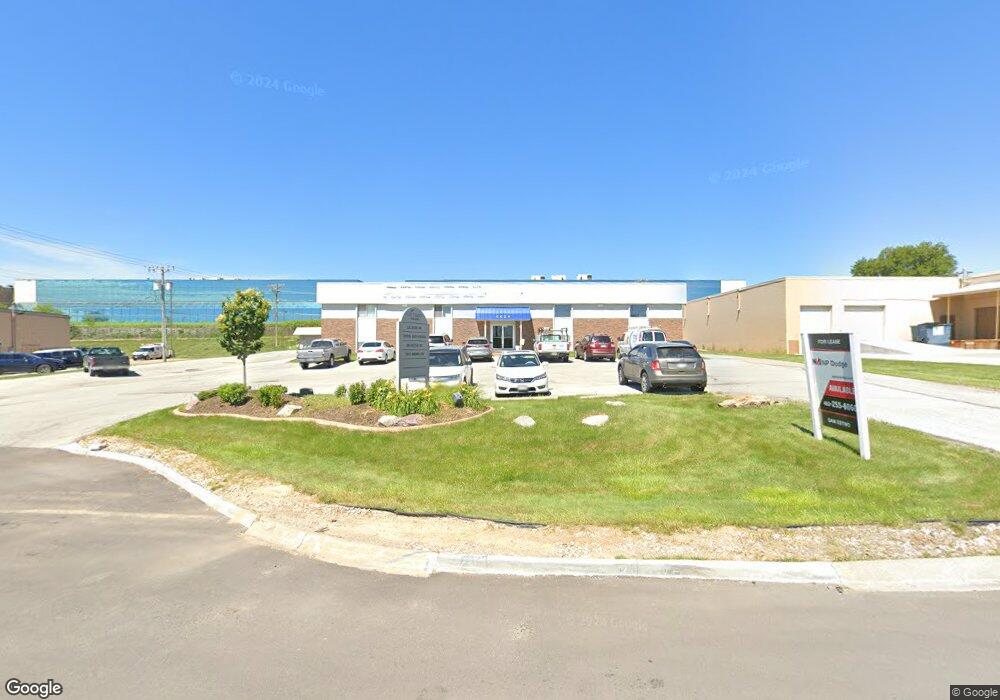
This home is located at 5634 S 85th Cir, Omaha, NE 68127 and is currently estimated at $901,163, approximately $150 per square foot. 5634 S 85th Cir is a home located in Douglas County with nearby schools including Meadows Elementary School and St Gerald School.
Ownership History
Date
Name
Owned For
Owner Type
Purchase Details
Closed on
May 25, 2023
Sold by
5634 South 85Th Circle Llc
Bought by
Otto Properties Llc
Current Estimated Value
Purchase Details
Closed on
Jul 14, 2022
Sold by
Brasel Realty Llc
Bought by
5712 Property Llc
Purchase Details
Closed on
Oct 28, 2014
Sold by
C & M Farms Llc
Bought by
5634 South 85Th Circle Llc
Purchase Details
Closed on
Jan 29, 2014
Sold by
Safe Harbour Eat Xxviii Llc
Bought by
C & M Farms Llc
Purchase Details
Closed on
Nov 20, 2013
Sold by
Schneider Charles J and Schneider Susan M
Bought by
Safe Harbour Eat Xxviii Llc
Home Financials for this Owner
Home Financials are based on the most recent Mortgage that was taken out on this home.
Original Mortgage
$430,000
Interest Rate
4.29%
Mortgage Type
Commercial
Create a Home Valuation Report for This Property
The Home Valuation Report is an in-depth analysis detailing your home's value as well as a comparison with similar homes in the area
Home Values in the Area
Average Home Value in this Area
Purchase History
| Date | Buyer | Sale Price | Title Company |
|---|---|---|---|
| Otto Properties Llc | $875,000 | Rts Title & Escrow | |
| 5712 Property Llc | $1,350,000 | Ambassador Title | |
| 5634 South 85Th Circle Llc | -- | None Available | |
| C & M Farms Llc | -- | Nebraska Title Co | |
| Safe Harbour Eat Xxviii Llc | $528,000 | Nebraska Title Company |
Source: Public Records
Mortgage History
| Date | Status | Borrower | Loan Amount |
|---|---|---|---|
| Previous Owner | Safe Harbour Eat Xxviii Llc | $430,000 |
Source: Public Records
Tax History Compared to Growth
Tax History
| Year | Tax Paid | Tax Assessment Tax Assessment Total Assessment is a certain percentage of the fair market value that is determined by local assessors to be the total taxable value of land and additions on the property. | Land | Improvement |
|---|---|---|---|---|
| 2025 | $12,694 | $723,600 | $171,100 | $552,500 |
| 2024 | $13,239 | $723,600 | $171,100 | $552,500 |
| 2023 | $13,239 | $655,400 | $171,100 | $484,300 |
| 2022 | $11,317 | $524,300 | $228,100 | $296,200 |
| 2021 | $10,770 | $524,300 | $228,100 | $296,200 |
| 2020 | $12,151 | $563,900 | $124,600 | $439,300 |
| 2019 | $12,142 | $563,900 | $124,600 | $439,300 |
| 2018 | $11,257 | $520,500 | $124,600 | $395,900 |
| 2017 | $11,230 | $520,500 | $124,600 | $395,900 |
| 2016 | $11,250 | $520,500 | $124,600 | $395,900 |
| 2015 | $11,525 | $520,500 | $124,600 | $395,900 |
| 2014 | $11,525 | $527,500 | $124,600 | $402,900 |
Source: Public Records
Map
Nearby Homes
- 8036 Maywood St
- 8000 Park Dr
- 6612 S 85th St
- 8106 Ralston Ave
- 8655 Monroe St
- 7765 Main St
- 8234 Ralston Ave
- 7757 Oakwood St
- 5027 S 82nd St
- 9121 Washington St
- 5121 S 79th Ave
- 7745 Oakwood St
- 7752 Highland St
- 9208 V Plaza
- 8464 Orchard Ave
- 7636 Serum Ave
- 7006 Wood Lane Dr
- 7007 Wood Lane Dr
- 5012 S 92nd St
- 9103 Polk St
- 5620 S 85th Cir
- 5712 S 85th Cir
- 5641 S 85th Cir
- 5639 S 86th Cir
- 5621 S 85th Cir
- 5631 S 85th Cir
- 5723 S 86th Cir
- 5610 S 85th Cir
- 8417 Park Dr
- 8401 Park Dr
- 5701 S 85th Cir
- 8517 Park Dr
- 5805 S 86th Cir
- 5720 S 86th Cir
- 8545 Park Dr
- 5636 S 86th Cir
- 5815 S 86th Cir
- 8406 Park Dr
- 5734 S 86th Cir
- 8340 Park Dr