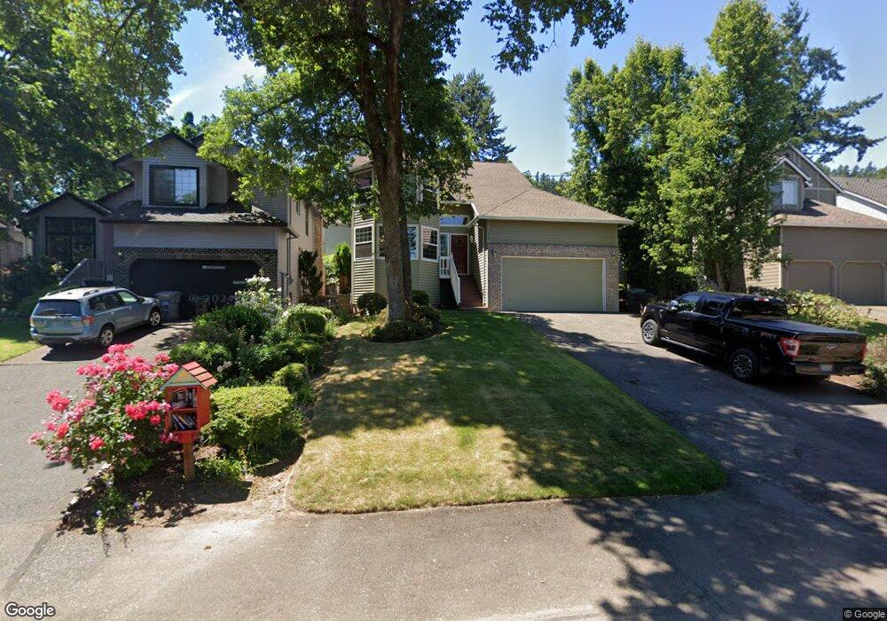
5638 Broadway St West Linn, OR 97068
Bolton NeighborhoodEstimated Value: $619,516 - $677,000
4
Beds
7
Baths
2,000
Sq Ft
$327/Sq Ft
Est. Value
About This Home
This home is located at 5638 Broadway St, West Linn, OR 97068 and is currently estimated at $654,129, approximately $327 per square foot. 5638 Broadway St is a home located in Clackamas County with nearby schools including Bolton Primary School, West Linn High School, and Clackamas Academy of Industrial Sciences (CAIS).
Ownership History
Date
Name
Owned For
Owner Type
Purchase Details
Closed on
Jul 18, 2003
Sold by
Tripp Janet
Bought by
Hoelle Bruce and Hoelle Andrea
Current Estimated Value
Purchase Details
Closed on
Feb 3, 2000
Sold by
Checketts Edith L
Bought by
Hoelle Bruce M and Hoelle Andrea Crosman
Home Financials for this Owner
Home Financials are based on the most recent Mortgage that was taken out on this home.
Original Mortgage
$172,000
Interest Rate
8.14%
Create a Home Valuation Report for This Property
The Home Valuation Report is an in-depth analysis detailing your home's value as well as a comparison with similar homes in the area
Home Values in the Area
Average Home Value in this Area
Purchase History
| Date | Buyer | Sale Price | Title Company |
|---|---|---|---|
| Hoelle Bruce | $1,000 | -- | |
| Hoelle Bruce M | $215,000 | Fidelity National Title Co |
Source: Public Records
Mortgage History
| Date | Status | Borrower | Loan Amount |
|---|---|---|---|
| Previous Owner | Hoelle Bruce M | $172,000 | |
| Closed | Hoelle Bruce M | $32,250 |
Source: Public Records
Tax History Compared to Growth
Tax History
| Year | Tax Paid | Tax Assessment Tax Assessment Total Assessment is a certain percentage of the fair market value that is determined by local assessors to be the total taxable value of land and additions on the property. | Land | Improvement |
|---|---|---|---|---|
| 2025 | $6,375 | $330,792 | -- | -- |
| 2024 | $6,136 | $321,158 | -- | -- |
| 2023 | $6,136 | $311,804 | $0 | $0 |
| 2022 | $5,792 | $302,723 | $0 | $0 |
| 2021 | $5,498 | $293,906 | $0 | $0 |
| 2020 | $5,535 | $285,346 | $0 | $0 |
| 2019 | $5,279 | $277,035 | $0 | $0 |
| 2018 | $5,016 | $268,966 | $0 | $0 |
| 2017 | $5,026 | $270,769 | $0 | $0 |
| 2016 | $4,803 | $262,883 | $0 | $0 |
| 2015 | $4,507 | $255,226 | $0 | $0 |
| 2014 | $4,265 | $247,792 | $0 | $0 |
Source: Public Records
Map
Nearby Homes
- 5910 W A St
- 5390 Grove St
- 5687 River St
- 1954 Buck St
- 5089 Territorial Dr
- 4711 Alder St
- 22691 Oregon City Loop
- 5128 Firwood Dr
- 22881 Oregon City Loop
- 4645 Pine St
- 5062 Prospect St
- 6345 Caufield St
- 1870 Hemlock St
- 4973 Summit St
- 6403 Tompkins Ct
- 2530 Cambridge St
- 5219 Summit St
- 4578 Norfolk St
- 4405 Grant St
- 2764 Ridge Ln
- 5642 Broadway St
- 5632 Broadway St
- 5650 Broadway St
- 5645 W A St
- 5622 Broadway St
- 5621 W A St
- 5673 W A St
- 5610 Broadway St
- 5617 W - A- St
- 5617 W A St
- 5645 Broadway St Unit F
- 5651 Broadway St Unit F
- 5678 Broadway St
- 5663 Broadway St
- 5675 Broadway St
- 5685 W A St
- 5682 Broadway St
- 5679 W A St
- 5681 Broadway St
- 5590 Broadway St